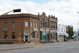
Yorkton is a city located in south-eastern Saskatchewan, Canada. It is about 450 kilometres north-west of Winnipeg and 300 kilometres south-east of Saskatoon and is the sixth largest in the province.

Sturgis is a town of 620 people in east central Saskatchewan, Canada. The Town of Sturgis is 95 km north of Yorkton on Highway 9. It is located in the Assiniboine river valley near the lakes and woods region of the province.

Reindeer Lake is a lake in Western Canada located on the border between northeastern Saskatchewan and northwestern Manitoba, with the majority in Saskatchewan. The name of the lake appears to be a translation of the Algonquian name. It is the second-largest lake in Saskatchewan and the ninth largest in Canada. 8% of the lake lies in Manitoba and 92% of lake in Saskatchewan.

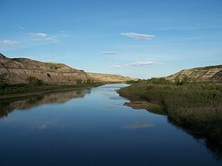
The Red Deer River is a river in Alberta and a small portion of Saskatchewan, Canada. It is a major tributary of the South Saskatchewan River and is part of the larger Saskatchewan-Nelson system that empties into Hudson Bay.

Lake Diefenbaker is a reservoir and bifurcation lake in Southern Saskatchewan, Canada. It was formed by the construction of Gardiner Dam and the Qu'Appelle River Dam across the South Saskatchewan and Qu'Appelle Rivers respectively. Construction began in 1959 and the lake was filled in 1967. The lake is 225 kilometres (140 mi) long with approximately 800 kilometres (500 mi) of shoreline. It has a maximum depth of 66 metres (217 ft), while the water levels regularly fluctuate 3–9 metres (9–27 feet) each year. Lake Diefenbaker provides water for domestic irrigation and town water supplies. The flow of the two rivers is now regulated with a considerable portion of the South Saskatchewan diverted into the Qu'Appelle. Prior to the dams' construction, high water levels in the South Saskatchewan would frequently cause dangerous ice conditions downstream in Saskatoon while the Qu'Appelle would frequently dry up in the summer months.

The Shellmouth Reservoir is a man-made reservoir on the Assiniboine River in Manitoba and Saskatchewan, Canada.

The North Saskatchewan River is a glacier-fed river that flows from the Canadian Rockies continental divide east to central Saskatchewan, where it joins with another major river to make up the Saskatchewan River. Its water flows eventually into the Hudson Bay.

The geography of Saskatchewan (suskăchuwun"), is unique among the provinces and territories of Canada in some respects. It is one of only two landlocked regions and it is the only region whose borders are not based on natural features like lakes, rivers or drainage divides. The borders of Saskatchewan, which make it very nearly a trapezoid, were determined in 1905 when it became a Canadian province. Saskatchewan has a total area of 651,036 square kilometres (251,366 sq mi) of which 591,670 km2 (228,450 sq mi) is land and 59,366 km2 (22,921 sq mi) is water.

Highway 5 is a major highway in the Canadian province of Saskatchewan. It begins in downtown Saskatoon and runs eastward to the Manitoba border near Togo, where it becomes Provincial Road 363. The highway is approximately 393 kilometres (244 mi) long. Between the early 1900s (decade) and 1976, Provincial Highway 5 was a trans-provincial highway travelling approximately 630 kilometres (390 mi) in length. At this time it started at the Alberta border in Lloydminster and traveled east to the Manitoba border.
Highway 9 is a provincial paved undivided highway in the Canadian province of Saskatchewan. It runs from North Dakota Highway 8 at the US border near Port of Northgate until it transitions into Provincial Road 283 at the Manitoba provincial boundary.
The Saskota Flyway is known as the International Road to Adventure, because it takes you from Hudson Bay, Saskatchewan, all the way south to Bismarck, North Dakota.

Rama is a village in the east-central region of Saskatchewan. It is located 44 km west of Canora and 60 km east of Wadena at the intersection of Highway 5 and Secondary Hwy 754.

Insinger, Saskatchewan is an unincorporated area in the rural municipality of Insinger No. 275, Saskatchewan, in the Canadian province of Saskatchewan. Insinger is located on Saskatchewan Highway 16, the Yellowhead in south eastern Saskatchewan. Lawrie post office first opened in 1898 at the legal land description of Sec.6, Twp.29, R.7, W2. It changed names in 1907 to Insinger and moved to Sec.21, Twp.29, R.8, W2. The population is smaller than a hamlet, and is counted within the Insinger No. 275, Saskatchewan, however it is still listed as a village at Geonames. Insinger is located between Yorkton and Foam Lake. Insinger is located within 14 kilometres (8.7 mi) of Whitesand Regional Park.

The Beaver Hills are a range of hills located in the Canadian province of Saskatchewan.

Mistusinne is a resort village in Maple Bush Rural Municipality No. 224, Saskatchewan, Canada. The population was 56 at the 2006 Census. The village's name is derived from the Plains Cree word mistasiniy which refers to a massive stone that resembled a sleeping bison that once rested in the Qu'Appelle Valley before Lake Diefenbaker was built. Douglas Provincial Park extends from the community to the Qu'Appelle River Dam and is 8 km south of the village of Elbow on highway 19. The community serves as a summer retreat that contains many cabins and a golf course, with a view of Lake Diefenbaker. Part of the golf course along the shore had to be rebuilt when waters of Lake Diefenbaker rose in 1998 and collapsed the shoreline.

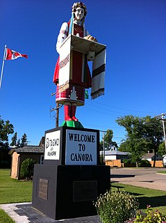
Good Lake No. 274 is a rural municipality in the Canadian province of Saskatchewan, located in Census Division 9. The seat of the municipality is located in the Town of Canora.
Daniel Zederayko "Dan" Daniels was an educator, merchant, farmer and political figure in Saskatchewan. He represented Pelly from 1944 to 1948 in the Legislative Assembly of Saskatchewan as a Co-operative Commonwealth Federation (CCF) member.

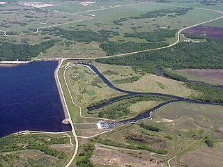
Spirit Creek is a creek located in the Assiniboine River watershed. It begins near Rama, Saskatchewan generally following a line to the east. 2 miles east of Rama is the Spirit Creek Reservoir, the creek continues east. At a point 2 miles west of Buchanan the creek turns to the South and crosses Highway 5 and the CN rail line. It continues south east from the rail line before crossing Highway 754 it then continues to Highway 47 2 miles south of Buchanan. From there the creek passes through Patterson Lake and finds its mouth at the northernmost end of Good Spirit Lake.

The Reindeer River is a river in northern Saskatchewan in the Canadian Shield. It flows south from Reindeer Lake to the Churchill River. The river's flow is regulated by the Whitesand Dam located between Marchand Lake and Fafard Lake.


