
Melksham is a town and civil parish on the River Avon in Wiltshire, England, about 4.5 miles (7 km) northeast of Trowbridge and 6 miles (10 km) south of Chippenham. At the 2011 census, the Melksham built-up area had a population of 19,357, making it Wiltshire's fifth-largest settlement after Swindon, Salisbury, Chippenham and Trowbridge.

Broughton Gifford is a village and civil parish about 1.5 miles (2.4 km) west of Melksham in Wiltshire, England. The parish includes the hamlets of Norrington Common and The Common.

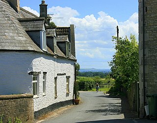
Melksham Without is a civil parish in the county of Wiltshire, England. It surrounds, but does not include, the town of Melksham and is the largest rural parish in Wiltshire, with a population of 7,230 and an area of 29 square kilometres.

Bromham is a village and civil parish in Wiltshire, England. The village is 3+1⁄2 miles (6 km) northwest of Devizes and the same distance east of Melksham.

Sherston is a village and civil parish about 5 miles (8 km) west of Malmesbury in Wiltshire, England. The parish is bounded to the north by the county boundary with Gloucestershire, and to the southeast by the Fosse Way, a Roman road. The parish includes the hamlets of Easton Town, immediately east of Sherston; Pinkney, further east along the Malmesbury road; and Willesley, to the north.

Grafton is a civil parish in Wiltshire, England, in the Vale of Pewsey about 7 miles (11 km) southeast of Marlborough. Its main settlement is the village of East Grafton, on the A338 Burbage - Hungerford road; the parish includes the village of Wilton and the hamlets of West Grafton, Marten and Wexcombe.

West Overton is a village and civil parish in the English county of Wiltshire, about 3.5 miles (5.6 km) west of Marlborough. The river Kennet runs immediately north of the village, separating it from the A4 road. The parish includes the village of Lockeridge, also near the river, further east (downstream).

Purton is a large village and civil parish in north Wiltshire, England, about 4 miles (6 km) northwest of the centre of Swindon. The parish includes the village of Purton Stoke and the hamlets of Bentham, Hayes Knoll, Purton Common, Restrop, The Fox and Widham.

Box is a large village and civil parish within the Cotswolds Area of Outstanding Natural Beauty in Wiltshire, England, about 3 miles (5 km) west of Corsham and 5 miles (8 km) northeast of Bath. Box also falls in the easternmost part of the Avon Green Belt. Besides the village of Box, the parish includes the villages of Ashley and Box Hill; Hazelbury manor; and the hamlets of Alcombe, Blue Vein, Chapel Plaister, Ditteridge, Henley, Kingsdown, Middlehill, and Wadswick. To the east the parish includes much of Rudloe, formerly a hamlet but now a housing estate, and the defence establishments and related businesses on the site of the former RAF Rudloe Manor.
Atworth is a village and civil parish in west Wiltshire, England. The village is on the A365 road between Melksham and Box, about 2.5 miles (4 km) northwest of Melksham and 4 miles (6 km) northeast of Bradford on Avon. The hamlet of Purlpit lies east of Atworth village, and in the south of the parish are the small village of Great Chalfield and the hamlet of Little Chalfield.

Bulkington is a village and civil parish in the county of Wiltshire, England. The village is about 4.5 miles (7.2 km) west of Devizes and a similar distance southeast of Melksham.

Beanacre is a small village in Wiltshire, England, about 1.5 miles (2.4 km) north of Melksham on the A350 towards Chippenham. It is in the civil parish of Melksham Without. The Bristol Avon passes to the east of the village where a stream from Sandridge joins it.

Worton is a village and civil parish about 3 miles (5 km) southwest of Devizes in Wiltshire. It is near the northern edge of Salisbury Plain in central southern England.

Great Hinton is a small village and civil parish about 3 miles (4.8 km) south of Melksham and 3.5 miles (5.6 km) north-east of Trowbridge in Wiltshire, England. The parish includes the hamlets of Bleet and Cold Harbour.

Seend is a village and civil parish about 3 miles (5 km) southeast of the market town of Melksham, Wiltshire, England. It lies about 3.5 miles (6 km) west of Devizes and 5.5 miles (9 km) northeast of the county town of Trowbridge. The parish includes the sub-village of Seend Cleeve and the hamlets of Inmarsh, Martinslade, Seend Head, Sells Green and The Stocks.
Shaw is a village in the civil parish of Melksham Without, Wiltshire, England. It is about 1.7 miles (2.7 km) northwest of Melksham on the A365 Melksham to Box road, where the B3353 diverges to Corsham.
South Wraxall is a village and a civil parish in Wiltshire, England, 2.5 miles (4.0 km) north of Bradford on Avon. The village is to the east of the B3109 road from Bradford on Avon to Corsham.
Holt is a village and civil parish in the west of Wiltshire, England, about 2.5 miles (4 km) north-east of Bradford-on-Avon and 3 miles (5 km) south-west of Melksham.

Lydiard Millicent is a village and civil parish in Wiltshire, England, about 3+1⁄2 miles (6 km) west of the centre of Swindon. The parish contains the hamlets of Lydiard Green, Lydiard Plain, Greatfield and Green Hill; in the northeast the parish extends to Common Platt, which is now contiguous with the Peatmoor area of Swindon.

Great Chalfield, also sometimes called by its Latin name of Chalfield Magna, formerly East Chalfield and anciently Much Chaldefield, is a small village and former civil parish in west Wiltshire, England, now part of Atworth parish. Its nearest towns are Melksham, about 3 miles (4.8 km) away to the northeast, and Bradford-on-Avon, at about the same distance to the southwest.

