Related Research Articles

Goodsprings is an unincorporated community in Clark County, Nevada, United States. The population was 229 at the 2010 census.
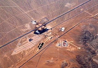
Jean is a small commercial town in Clark County, Nevada, United States, located approximately 12 mi (19 km) north of the Nevada–California state line along Interstate 15. Las Vegas is located about 30 mi (48 km) to the north. There are no residents of Jean, but many people in nearby communities such as Primm and Sandy Valley have Jean listed in their mailing address because it is the location of the main post office for the 89019 ZIP code. South Las Vegas Boulevard ends about 2 mi (3.2 km) south of Jean, and it contiguously runs northbound past Las Vegas, ending near the I-15–US 93 Junction.

The Old Spanish Trail is a historical trade route that connected the northern New Mexico settlements of Santa Fe, New Mexico with those of Los Angeles, California and southern California. Approximately 700 mi (1,100 km) long, the trail ran through areas of high mountains, arid deserts, and deep canyons. It is considered one of the most arduous of all trade routes ever established in the United States. Explored, in part, by Spanish explorers as early as the late 16th century, the trail saw extensive use by pack trains from about 1830 until the mid-1850s.

State Route 161 is a state highway in Clark County, Nevada. It is known as Goodsprings Road, connecting the town of Goodsprings to Interstate 15 at Jean. The route was part of State Route 53 prior to 1976.

Lanfair Valley is located in the Mojave Desert in southeastern California near the Nevada state line. It is bounded on the north by the New York Mountains and Castle Mountains, on the east by the Piute Range, and on the south by the Woods Mountains and Vontrigger Hills. Joshua Trees can be found in most of the valley. Elevation is 4,045 feet.

Nevada's 3rd congressional district is a congressional district occupying the area south of Las Vegas, including Henderson, Boulder City and much of unincorporated Clark County. The district was initially created after the 2000 census.

The Mojave Road, also known as Old Government Road, is a historic route and present day dirt road across what is now the Mojave National Preserve in the Mojave Desert in the United States. This rough road stretched 147 miles (237 km) from Beale's Crossing, to Fork of the Road location along the north bank of the Mojave River where the old Mojave Road split off from the route of the Old Spanish Trail/Mormon Road.

The Goodsprings Cemetery consists of 1.33 acres (0.54 ha) and is an old, continuing cemetery located southwest of Las Vegas, Nevada seven miles (11 km) from Jean and just before entering the town of Goodsprings.

Havilah is an unincorporated community in Kern County, California. It is located in the mountains between Walker Basin and the Kern River Valley, 5 miles (8.0 km) south-southwest of Bodfish at an elevation of 3,136 feet (956 m).

The Potosi mining district, or Potosi, was an area in Clark County of southern Nevada, U.S. It is listed on the National Register of Historic Places and includes three structures. The town was named after the famous silver-mining city of Potosi, Bolivia.

Mountain Springs Summit [el. 5,502 ft (1,677 m)] is a mountain pass in the Spring Mountains of Southern Nevada in the United States.
Jean Pass (north) is one of two passes on the west and northwest of the Jean Dry Lake basin, an endorheic basin bordering Jean, Nevada.
Shadow Valley is a north to northwest flowing drainage within the Mojave Desert of San Bernardino County, California. A section of Interstate 15 passes through the valley between Mountain Pass and Halloran Springs. The valley drains to the north from the west flank of the Mescal Range, the Ivanpah Mountains and Cima Dome within the Mojave National Preserve. North of I-15 the valley lies between Clark Mountains to the east and Shadow Mountain to the west. To the north of Shadow Mountain, Kingman Wash becomes the main drainage and turns to the west south of the Kingston Range. The Mesquite Mountains and the Mesquite Valley are to the northeast.
Elizabeth von Till Warren is an American historian and preservationist. She has expertise in the history of water development in the Mojave Desert and the Las Vegas Valley in particular. She also has expertise in the historical route of the Old Spanish Trail in Southern Nevada.
Potosi or Potosi Camp, was called Crystal City in the 1870s, a mining ghost town in Clark County, Nevada. It lies at an elevation of 5705 feet.
Bitter Spring is a spring within the Fort Irwin National Training Center in San Bernardino County, California. It lies at an elevation of 1355 feet and is located in a valley between the Soda Mountains to the east, the Tiefort Mountains to the northwest, Alvord Mountain to the southwest and Cronese Mountains to the south and southeast.
Impassable Pass is a gap in Alvord Mountain, in San Bernardino County, California. It is located just south and outside of the boundary fence of Fort Irwin National Training Center.
Red Pass is a gap in the Avawatz Mountains, in San Bernardino County, California. Red Pass, lies between the Silurian Valley and the valley drained by an as yet unnamed tributary of Salt Creek, which drains much of the area of Fort Irwin National Training Center, through Red Pass into the Silurian Valley and into the Amargosa River in Death Valley.
Goodsprings Valley is a basin in Clark County of southern Nevada. It lies at an elevation of 3,566 ft (1,087 m) between the Spring Mountains to the northwest and southwest and the Bird Spring Range to the northeast. Goodsprings Valley drains southeast into the Ivanpah Valley. The valley is the location of the town of Goodsprings, Nevada in the midst of the basin.
Mesquite Valley is a valley in Clark County, Nevada and Inyo County and San Bernardino County, California. Mesquite is an endorheic basin with Mesquite Lake at is lowest point at an elevation of 2,536 feet / 773 meters. This valley trends northwest and southeast with a head at 35°40′07″N115°29′09″W to the southeast near State Line Pass and another head at 35°53′50″N115°46′55″W at the southwestern end of Pahrump Valley, at an elevation of 2,808 feet / 856 meters, between the Kingston Range and Black Butte to the northwest. It is bounded on the northeast by the Spring Mountains, by the Mesquite Mountains to the southwest and the Clark Mountains to the southeast.
References
- ↑ U.S. Geological Survey Geographic Names Information System: Wilson Pass
- ↑ Keith Myhrer, William G. White, Stanton D. Rolf, ARCHAEOLOGY OF THE OLD SPANISH TRAlL/MORMON ROAD, From Las Vegas, Nevada to the California Border, TECHNICAL REPORT 17, BUREAU OF LAND MANAGEMENT, NEVADA, FEBRUARY 1990
Coordinates: 35°52′34″N115°30′38″W / 35.87611°N 115.51056°W
| This Clark County, Nevada state location article is a stub. You can help Wikipedia by expanding it. |