Winnifred, Alberta

Last updated

Winnifred is an unincorporated community in Alberta, Canada, within the County of Forty Mile No. 8. It is located approximately 50 km (31 mi) southwest of the City of Medicine Hat and 14 km (8.7 mi) east of the Town of Bow Island.

Alberta Province of Canada

Alberta is a western province of Canada. With an estimated population of 4,067,175 as of 2016 census, it is Canada's fourth most populous province and the most populous of Canada's three prairie provinces. Its area is about 660,000 square kilometres (250,000 sq mi). Alberta and its neighbour Saskatchewan were districts of the Northwest Territories until they were established as provinces on September 1, 1905. The premier is Jason Kenney as of April 30, 2019.

Canada Country in North America

Canada is a country in the northern part of North America. Its ten provinces and three territories extend from the Atlantic to the Pacific and northward into the Arctic Ocean, covering 9.98 million square kilometres, making it the world's second-largest country by total area. Canada's southern border with the United States, stretching some 8,891 kilometres (5,525 mi), is the world's longest bi-national land border. Its capital is Ottawa, and its three largest metropolitan areas are Toronto, Montreal, and Vancouver. As a whole, Canada is sparsely populated, the majority of its land area being dominated by forest and tundra. Consequently, its population is highly urbanized, with over 80 percent of its inhabitants concentrated in large and medium-sized cities, with 70% of citizens residing within 100 kilometres (62 mi) of the southern border. Canada's climate varies widely across its vast area, ranging from arctic weather in the north, to hot summers in the southern regions, with four distinct seasons.
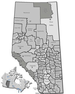
County of Forty Mile No. 8 Municipal district in Alberta, Canada

The County of Forty Mile No. 8 is a municipal district in south eastern Alberta, Canada.

Contents

The County of Forty Mile No. 8 considers the community to be a hamlet. [1] However, Alberta Municipal Affairs does not recognize it as a hamlet. [2]

Hamlet (place) small settlement in a rural area

A hamlet is a small human settlement. In different jurisdictions and geographies, hamlets may be the size of a town, village or parish, be considered a smaller settlement or subdivision or satellite entity to a larger settlement. The word and concept of a hamlet have roots in the Anglo-Norman settlement of England, where the old French hamlet came to apply to small human settlements. In British geography, a hamlet is considered smaller than a village and distinctly without a church.

Alberta Municipal Affairs is a ministry of the Executive Council of Alberta. Its major responsibilities include assisting municipalities in the provision of local government, administering the assessment of linear property in Alberta, administering a safety system for the construction and maintenance of buildings and equipment, and managing Alberta's network of municipal and library system boards.

History

Winnifred, originally a whistle stop at Mile 31 on the Dunmore Junction, also known as the Turkey Track, was upgraded to a siding in 1885 named after a daughter of J.R. Whitlaw, one of the charter members of the Turkey Track.

Dunmore, Alberta hamlet in Alberta

Dunmore is a hamlet in Alberta, Canada within Cypress County, located 2.6 kilometres (1.6 mi) southeast of Medicine Hat's city limits on Highway 1 and the Canadian Pacific Railway mainline. A portion of the hamlet is recognized as a designated place by Statistics Canada.

In 1903 the only buildings were the section house where William Savage lived, a dugout for the section hands, and a small two room building that housed the telegraph office. No more than ten people lived in the surroundings.

A railway section house is a building or house-like structure located near or next to a section of railroad used for housing railroad workers, or for the storing and maintenance of equipment for a section of railroad. Section houses were used mainly from the 1890s to the 1960s. By the 1970s, section houses were being slowly phased out. In Canada section houses were usually located right across from the railway station.

Four years later in 1907 the Alberta Government opened up the district between Grassy Lake and Winnifred for homesteading.

Grassy Lake, Alberta Hamlet in Alberta, Canada

Grassy Lake is a hamlet in Alberta, Canada within the Municipal District of Taber. It is located on the Crowsnest Highway (Highway 3), midway between the cities of Lethbridge to the west and Medicine Hat to the east. It is approximately 13 km (8.1 mi) west of Burdett and 34 km (21 mi) east of Taber. It has an elevation of 810 metres (2,660 ft).

Homesteading

Homesteading is a lifestyle of self-sufficiency. It is characterized by subsistence agriculture, home preservation of food, and may also involve the small scale production of textiles, clothing, and craftwork for household use or sale. Pursued in different ways around the world—and in different historical eras—homesteading is generally differentiated from rural village or commune living by isolation of the homestead. Use of the term in the United States dates back to the Homestead Act (1862) and before. In sub-Saharan Africa, particularly in nations formerly controlled by the British Empire, a homestead is the household compound for a single extended family. In the UK, the term 'smallholder' or 'crofts' is the rough equivalent of 'homesteader'.

Settlers from Eastern Canada and the mid-western states flooded the area, taking up almost every quarter section of land for miles, unaware of the drought-ridden nature of the region. With lack of water and wood, settlers relied on wells for water and small coal deposits in the area for heating.

Settler person who has migrated to an area and established permanent residence there

A settler is a person who has migrated to an area and established a permanent residence there, often to colonize the area. Settlers are generally from a sedentary culture, as opposed to nomads who share and rotate their settlements with little or no concept of individual land ownership. Settlements are often built on land already claimed or owned by another group. Many times settlers are backed by governments or large countries. They also sometimes leave in search of religious freedom.

Eastern Canada Region in Canada

Eastern Canada is generally considered to be the region of Canada east of Manitoba, consisting of the following provinces:

A quarter section, often shortened to quarter, is an area of one-fourth of a square mile, or 160 acres (0.65 km2). It was a common size of a tract under Homestead Acts in the United States and the Dominion Land Survey in Canada.

The first few businesses in Winnifred came in 1908 and the spring of 1909. P.J. Demarce opened a store on the south side of the tracks; William Hickmore imported lumber from Lethbridge for a hotel and eating house; and J.S Fisher, of Whitefish, Montana, opened the Fisher Mercantile.

In 1913, most of the businesses expanded and moved across the tracks, where they joined F.W. Brown's Hardware and Quong Chon's combination laundry and café. The Fritz Sick brewery of Lethbridge built an up-to-date hotel. The site of the Union Bank was diagonally across from the Fisher Mercantile building.

The boom years for Winnifred were 1915-1916, when heavy rains produced bumper crops. It was too good to be true, as in 1918 the Fisher Mercantile went bankrupt and the first of many homesteaders started moving away. The hotel went the same year and was moved to Brooks. The newspaper The Winnifred Record, [3] which started out so bravely to chronicle the development of the community, folded shortly after.

The 1920s were harsh years for the remaining settlers, with drought, clouds of grasshoppers and finally hordes of rabbits who ate everything that looked like grain. More settlers packed up and left, and with the help of the government moved to homesteads in central and Northern Alberta.

By the mid-1930s, dust storms completed the task and farm after farm was abandoned. It took thirty years for the determined homesteaders to appreciated that without irrigation the land was best suited for ranching.

Modernizations completed the process of decline as the consolidation of schools and re-routing Highway 3 drew even more of the population off to larger centres such as Lethbridge and Medicine Hat. The few remaining business such as the Turtle Café, operated by Wing Chong, closed in the early 60s, and Winnifred became a ghost town except for the grain elevators and their operators. Eventually they too ceased to exist and were torn down. Very little of Winnifred's rich history remains, just memories and photos.

Today young families are moving back into Winnifred, in a sense repopulating the town once again. [4] [5]

See also

Related Research Articles

Irvine, Alberta Hamlet in Alberta, Canada

Irvine is a hamlet in Alberta, Canada within Cypress County. It is located approximately 35 kilometres (22 mi) east of Medicine Hat on Highway 1 and has an elevation of 763 metres (2,503 ft). The hamlet is located in census division No. 1 and in the federal riding of Medicine Hat.

Bow Island Town in Alberta, Canada

Bow Island is a town in Alberta, Canada. It is located on Highway 3 in southern Alberta, approximately 100 km (62 mi) from the United States border and 320 km (200 mi) southeast of Calgary.

Barons, Alberta Village in Alberta, Canada

Barons is a village in southern Alberta, Canada in a region referred to as Palliser's Triangle. It is located 51 kilometres (32 mi) north of Lethbridge along Highway 23. Barons was a filming location for a scene in the 1978 film Superman.

Champion, Alberta Village in Alberta, Canada

Champion is a village in southern Alberta, Canada within Vulcan County. It is located on Highway 23, approximately 74 kilometres (46 mi) north of Lethbridge and 147 kilometres (91 mi) south of Calgary, Alberta.

New Sarepta Hamlet in Alberta, Canada

New Sarepta is a hamlet in central Alberta, Canada, within Leduc County. It is located approximately 23 km (14 mi) east of the City of Leduc along Highway 21.

Burdett, Alberta Hamlet in Alberta, Canada

Burdett is a hamlet in Alberta, Canada within the County of Forty Mile No. 8. It is located approximately 71 kilometres (44 mi) west of Medicine Hat and 97 kilometres (60 mi) east of Lethbridge on Highway 3. Also, Burdett is regarded as the site of Canada's first irrigation pivot.

Hays, Alberta

Hays is a hamlet in southern Alberta, Canada within the Municipal District of Taber. It is located at the intersection of Highway 524 and Highway 875 between Vauxhall and Redcliff. The Bow River is 3.3 kilometres (2.1 mi) to the north of the hamlet and the Oldman River is approximately 19 kilometres (12 mi) to the south. These two rivers converge to form the South Saskatchewan River approximately 20 kilometres (12 mi) to the southeast.

Turin, Alberta Hamlet in Alberta, Canada

Turin is a hamlet in Alberta, Canada within the Lethbridge County. It is located approximately 56 kilometres (35 mi) northeast of Lethbridge on Highway 25 and along a Canadian Pacific Railway line.

Cheadle, Alberta Hamlet in Alberta, Canada

Cheadle is a hamlet in Alberta, Canada, within Wheatland County. It is located on Highway 24, 2 kilometers (1.2 mi) south of the Highway 1 and approximately 35 kilometers (22 mi) east of the City of Calgary.

Etzikom Hamlet in Alberta, Canada

Etzikom is a hamlet in Alberta, Canada within the County of Forty Mile No. 8. It is approximately 20 kilometres (12 mi) east of Foremost on Highway 61.

Maybutt, Alberta Unincorporated community in Alberta, Canada

Maybutt, also known as "New Stirling" or "New Town", is a former locality in the County of Warner No. 5, Alberta, Canada. The community is situated 1 km north of the Village of Stirling just off the CANAMEX Corridor between Lethbridge and the Canada–US border. The community has become a bedroom community to Lethbridge, with many newer acreages being developed in the area. The footprint of Maybutt is defined by its historic boundary roads, Young St., Sunnyside Ave., Front St. & Lorne Ave, and Etzikom Ave. York St., First Ave. and Second Ave. are the only interior streets left of the original street grid of Maybutt. Two larger brick homes built in the 1910s, still remain on Second Ave. and the Alberta Wheat Pool residence remains at the corner of York St. & Lorne Ave. The 1922 Ellison grain elevator still stands opposite side of the tracks of Range Rd. 194B.

Nemiscam, Alberta Unincorporated community in Alberta, Canada

Nemiscam, also known as Nemiskam, and originally known as Bingham, is an unincorporated community within the County of Forty Mile No. 8 in southern Alberta, Canada. The community is about 5 km east of Foremost and west of Etzikom, Alberta on Highway 61 and is administered by the County of Forty Mile No. 8.

Manyberries Hamlet in Alberta, Canada

Manyberries is a hamlet in Alberta, Canada within the County of Forty Mile No. 8. It is located approximately 85 km (53 mi) south of Medicine Hat, at the eastern end of Highway 61.

Skiff, Alberta Hamlet in Alberta, Canada

Skiff is a hamlet in southern Alberta, Canada within the County of Forty Mile No. 8. It is located on Highway 61, also known as the historic Red Coat Trail, approximately 75 km (47 mi) southeast of Lethbridge.

Iron Springs, Alberta

Iron Springs is a hamlet in southern Alberta, Canada within the Lethbridge County. It is located on Highway 25, approximately 28 kilometres (17 mi) northeast of Lethbridge. It was founded in 1925 when the railroad arrived. The community was named after a spring of the same name near the original town site.

Spring Coulee

Spring Coulee is a hamlet in southern Alberta, Canada within Cardston County, located 2 kilometres (1.2 mi) east of Highway 5, approximately 42 kilometres (26 mi) southwest of Lethbridge.

St. Lina

St. Lina or Ste-Lina in French, is a hamlet in northern Alberta, Canada within the County of St. Paul No. 19. It is home of St. Lina Community Hall. It is located approximately 14 kilometres (8.7 mi) north of Highway 28 and 85 kilometres (53 mi) southwest of Cold Lake.

Travers, Alberta Hamlet in Alberta, Canada

Travers is a hamlet in southern Alberta, Canada within Vulcan County. It is located approximately 59 kilometres (37 mi) southwest of Highway 1 and 59 kilometres (37 mi) southwest of Brooks.

Fairview, Alberta (hamlet)

Fairview is a hamlet in southern Alberta, Canada, within Lethbridge County. It is adjacent to the eastern boundary of Lethbridge, approximately 0.3 kilometres (0.19 mi) south of Highway 3. More specifically, it is located on southeast corner of Highway 4 and Highway 512.

Whitla is an unincorporated community in Alberta, Canada within the County of Forty Mile No. 8. Located 20 miles south west of the city of Medicine Hat and one mile north of Highway 3.

References

  1. "Regular County/Municipal Committee Meeting" (PDF). County of Forty Mile No. 8. 2010-09-10. Retrieved 2011-04-14.
  2. "2011 Municipal Codes" (PDF). Alberta Municipal Affairs. 2011-01-05. Retrieved 2011-04-14.
  3. The Ghost Towns Journal - Book
  4. Lights on Project UFA Rural From the Roots Up
  5. Bow Island Commentator - Young Families Moving Into Winnifred

Coordinates: 49°54′16″N111°12′35″W / 49.90444°N 111.20972°W / 49.90444; -111.20972 (Winnifred)