Oxford is a city in England. It is the county town and only city of Oxfordshire. In 2017, its population was estimated at 152,450. It is 56 miles (90 km) northwest of London, 64 miles (103 km) southeast of Birmingham, and 61 miles (98 km) northeast of Bristol. The city is home to the University of Oxford, the oldest university in the English-speaking world, and has buildings in every style of English architecture from late Anglo-Saxon. Oxford's industries include motor manufacturing, education, publishing, information technology and science.
Cowley is a residential and industrial area in Oxford, England. Cowley's neighbours are Rose Hill and Blackbird Leys to the south, Headington to the north and the villages of Horspath and Garsington across fields to the east. Internationally, Cowley is best known for its automotive industry - historically it was the home of the car manufacturer Morris, which has now evolved into Mini.

Cowley Road is an arterial road in the city of Oxford, England, running southeast from near the city centre at The Plain near Magdalen Bridge, through the inner city area of East Oxford, and to the industrial suburb of Cowley. The central shopping is at 51.746°N 1.232°W
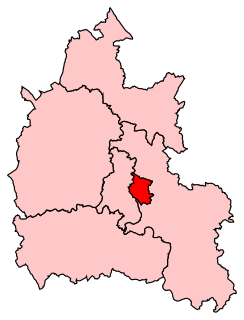
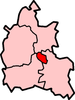
Oxford East is a constituency represented in the House of Commons of the UK Parliament by Anneliese Dodds of the Labour Party, who also serves as party chair.

Headington is an eastern suburb of Oxford, England. It is at the top of Headington Hill overlooking the city in the Thames valley below, and bordering Marston to the north-west, Cowley to the south, and Barton and Risinghurst to the east. The life of the large residential area is centred upon London Road, the main road between London and Oxford.
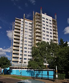
Risinghurst is an outlying residential area of Oxford, England, just outside the Eastern Bypass Road which forms part of the Oxford ring road. It is about 1 mile (1.6 km) east of the centre of Headington and 3 miles (4.8 km) east of Oxford city centre. It is part of the Risinghurst and Sandhills civil parish and is typical of housing estates built between the wars to house an increasingly prosperous working class who were moving into new urban centres—in this instance to take advantage of the burgeoning motor industry in Oxford.
Wheatley is a village and civil parish in Oxfordshire, about 5 miles (8 km) east of Oxford. The parish includes the hamlet of Littleworth, which is immediately to the west of Wheatley village. The 2011 census recorded the parish population as 3,913.
Cheney School is a secondary school and sixth form with academy status, located in Headington, Oxford, England. It serves the Headington and East Oxford area as a destination for students from primary schools across the city. Rupert Moreton, was appointed as head teacher in 2017, replacing Jolie Kirby who now heads the Community School Alliance Trust, the multi-academy trust that runs Cheney. He was replaced in 2020 by Rob Pavey.

New Marston is a suburb about 1.25 miles (2 km) northeast of the centre of Oxford, England.

Thames Transit was a bus and coach company which operated in the Oxford area. As well as running a number of local services, it also ran a regular service to London under the Oxford Tube brand. It was sold in July 1997 to Stagecoach, and traded as Stagecoach in Oxfordshire. As of 2022 it is part of Stagecoach West.
Mill Woods is a residential area in the city of Edmonton, Alberta, Canada. Located in southeast Edmonton, Mill Woods is bounded by Whitemud Drive (Highway 14) to the north, 91 Street to the west, 34 Street to the east, and Anthony Henday Drive to the south. Mill Woods is adjacent to three other residential areas including The Meadows to the east across 34 Street, and Southeast Edmonton and Ellerslie to the south and southwest respectively across Anthony Henday Drive.

St Clement's is a district in Oxford, England, on the east bank of the River Cherwell. "St Clement's" is usually taken to describe a small triangular area from The Plain bounded by the Cherwell in the West, Cowley Road in the East. to the foot of Headington Hill in the South. It also refers to the ecclesiastical parish of St Clement's which includes some neighbouring areas and is used in the names of local City and County electoral districts.
Rose Hill is a residential area, with some housing that has been council-owned, on the southern outskirts of Oxford, England. According to the 2001 Census, the population of Rose Hill and the adjoining village of Iffley was 4,667.

Clairlea is a neighbourhood of Scarborough, in the city of Toronto, Ontario, Canada. The neighbourhood is located in the western part of Scarborough just east of Victoria Park Avenue. To the north it is bounded by Eglinton Avenue and to the south by Taylor-Massey Creek and the railway tracks. The neighborhood is served by Warden station and the Don Valley Parkway. A large portion of Clairlea-Birchmount is taken up by shopping centres, the Eglinton Square Shopping Centre and other large retail developments along what was once Scarborough’s old Golden Mile of Industry on Eglinton Avenue.
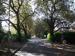
Jack Straw's Lane is a residential road in Oxford, England. It runs between the north end of Pullens Lane on Headington Hill and Marston Road.

Headington Quarry is a residential district of Oxford, England, located east of Headington and west of Risinghurst, just inside the Oxford ring road in the east of the city. To the south is Wood Farm. Today the district is also known colloquially as "Quarry". The area, now residential, is considerably uneven due to previous quarrying in the area.
St Clement's Church is an evangelical Church of England parish church situated just to the east of central Oxford, England.