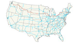
U.S. Route 51 is a major south-north United States highway that extends 1,277 miles (2,055 km) from the western suburbs of New Orleans, Louisiana, to within 150 feet (46 m) of the Wisconsin–Michigan state line. Much of the highway in Illinois and southern Wisconsin runs parallel to or overlaps Interstate 39 (I-39), and much of the route in several states also parallels the Illinois Central Railroad. The highway's northern terminus is between Hurley, Wisconsin, and Ironwood, Michigan, where it ends with a T interchange at US 2. Its southern terminus is Laplace, Louisiana, ending at US 61.

The Robert Kingery Expressway, formerly called the Tri-State Highway, is a three-mile-long, eight-lane freeway in northeastern Illinois. It carries Interstates 80 and 94 from the Illinois/Indiana border at the Borman Expressway west to Illinois Route 394, Interstate 294, and the southern end of the Bishop Ford Freeway. It also carries U.S. Route 6 west from the Indiana state line to the U.S. 6 exit with Illinois Route 83.
Illinois Route 5 is a four-lane road that runs from U.S. Route 67 in Rock Island to the interchange of Interstate 80 and the toll-free portion of Interstate 88, a distance of 15.78 miles (25.40 km). Illinois Route 92 also continues eastbound on Interstate 88.
Illinois Route 394, also known as the Calumet Expressway, is a 14.63-mile (23.54 km) long four-lane state highway that travels north from a junction with Illinois Route 1 south of Crete to an interchange in South Holland with Interstate 294/Interstate 94/Interstate 80 ; this route is an extension of, but not part of the latter freeway). Although not an Interstate highway, Illinois 394 is an Interstate standard highway from its junction with Sauk Trail at Sauk Village to its northern terminus at the Interstate 294/Interstate 94/Interstate 80 interchange in South Holland. IL 394 functions as a bypass of IL 1 to the west, which it was formerly part of, and provides access to southern suburbs of Chicago.
Illinois Route 251 is a north–south state road that runs on the former alignment of U.S. Route 51 before Interstate 39 was built in central Illinois. It runs from U.S. 51 at the border with Wisconsin to I-39 and U.S. 51 south of Kappa. Illinois 251 is 135.32 miles (217.78 km) long.
Interstate 88 (I-88) is an Interstate Highway in the US state of Illinois that runs from an interchange with I-80 near Silvis and Moline to an interchange with I-290 and I-294 in Hillside, near Chicago. I-88 is 140.60 miles (226.27 km) long. This route is not contiguous with I-88 in New York. Since 2010, all of I-88 has been part of the Chicago–Kansas City Expressway. The highway also runs through the cities of Aurora, Naperville, DeKalb, and Dixon. East of Rock Falls, the route is a part of the Illinois Tollway system.
Illinois Route 23 is a north–south state highway in northern Illinois. It runs from Illinois Route 116 in Pontiac north to U.S. Route 14 south of Harvard. This is a distance of 126.17 miles (203.05 km).
Illinois Route 1 is a state highway in the U.S. state of Illinois. Running parallel to the Indiana border, it is also the longest state road, starting on the south side of Chicago as Halsted Street at an intersection with Interstate 57, south to a free ferry crossing to Kentucky at Cave-in-Rock on the Ohio River. This is a distance of 325.59 miles (523.99 km).
Illinois Route 173 is an east–west state road that runs from Illinois Route 251 in the Rockford suburb of Machesney Park east to Illinois Route 137 in Zion near the Illinois-Wisconsin border; this is a distance of 66.20 miles (106.54 km). Illinois Route 173 is also one of the northernmost east-west state highways in Illinois. On Interstate 94 traveling south from Wisconsin, it is the second road seen which has an interchange at that location. Similarly, when traveling south/east from Wisconsin on Interstate 39/90, Illinois Route 173 is only the third exit into Illinois. In 2008, the entirety of Illinois 173 has been designated the 173rd Airborne Brigade Highway
The Lee Roy Selmon Expressway, originally known as the Southern Crosstown Expressway is a 14.168-mile (22.801 km) all-electronic, limited access toll road in Hillsborough County, Florida, It connects the South Tampa neighborhood near MacDill Air Force Base with Downtown Tampa and the bedroom community of Brandon. The expressway was built in stages, opening between 1976 and 1987.
The Crosstown Expressway, was a proposed highway route in Chicago, Illinois. It was originally proposed through the 1960s and 1970s.
U.S. Route 20 in the U.S. state of Illinois is a major arterial highway that runs from the Iowa state line at East Dubuque at the northwestern tip of Illinois, to the Indiana state line at Chicago south of the Chicago Skyway, a distance of 233.93 miles (376.47 km). For its entire length, US 20 is designated as the General Ulysses S. Grant Highway, often abbreviated the U.S. Grant Memorial Highway. However, this name is only commonly used west of Elgin. From Elgin to Melrose Park, US 20 follows Lake Street. It then follows Mannheim Road, and further south La Grange Road. US 20 also follows 95th Street as it turns east through Chicago's southwestern suburbs. It ultimately leaves Illinois on Indianapolis Boulevard.

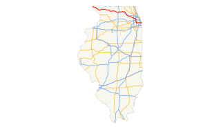
U.S. Route 51 (US 51) in the U.S. state of Illinois, is a main north–south artery that runs from the Ohio River north to the Wisconsin border, a distance of 415.95 miles (669.41 km).
Interstate 80 (I-80) is a part of the Interstate Highway System that runs from San Francisco, California, to Teaneck, New Jersey. I-80 enters Illinois from Iowa in the west, southwest of Rapids City and runs generally eastward through East Moline, LaSalle and Joliet, before entering Indiana in Lansing. The interstate runs for approximately 163.41 miles (262.98 km) through the state.
Interstate 94 (I-94) generally runs north–south through the northeastern portion of the U.S. state of Illinois, in Lake and Cook counties. It is marked east–west in Illinois in accordance with its general alignment across the country. I-94 in Illinois is 78.00 miles (125.53 km) long.
Interstate 90 (I-90) in the U.S. state of Illinois runs roughly northwest-to-southeast through the northern part of the state. From the Wisconsin state line at South Beloit, it heads south to Rockford before heading east-southeast to the Indiana state line at Chicago. I-90 traverses 108 miles (174 km) through a variety of settings, from farmland west of the Fox River Valley through the medium-density suburbs west of O'Hare International Airport, through downtown Chicago, and through the heart of the industrial southeast side of Chicago before entering Indiana.
Interstate 55 (I-55) is a major north–south Interstate Highway in the U.S. state of Illinois that connects the St. Louis, Missouri, and Chicago metropolitan areas. It enters the state from Missouri on the Poplar Street Bridge near East St. Louis and runs to U.S. Route 41 near downtown Chicago where the highway ends, a distance of 294.38 miles (473.76 km). The Road also runs through the cities of Springfield, Bloomington, and Joliet. The section in DuPage County is officially named Joliet Freeway or Will Rogers Freeway and in Cook County is officially named the Stevenson Expressway.
Cicero Avenue, also known as Skokie Boulevard from Skokie, is a major north-south street in Chicago and its suburbs. It carries Illinois Route 50 from its south end to Skokie, and U.S. Route 41 from Skokie to its north end. It runs north from the Governors Highway in University Park, next to Governors State University, crossing major highways such as Interstate 294, Interstate 55, Interstate 290 and Interstate 94, to Interstate 94 in Wilmette. Cicero Avenue is located 6 miles west of State Street.
There have been plans in Florida for expressways, but some were never constructed due to financial problems, community opposition and environmental issues.