
Kelmė District Municipality is one of 60 municipalities in Lithuania, located in western part of Lithuania.

Brushford is a village and civil parish in the Mid Devon district of Devon in England. According to the 2001 census it had a population of 59. The village is situated on the River Taw, and is about 12 miles north-east of Okehampton.

Fredriksskans is a stadium in Kalmar, Sweden that is Kalmar SK:s home arena.
The Canton of Rue is a canton situated in the department of the Somme and in the Hauts-de-France region of northern France.
Yelverton Pass is a mountain pass on northern Ellesmere Island, Nunavut, Canada.
Zadębce is a village in the administrative district of Gmina Trzeszczany, within Hrubieszów County, Lublin Voivodeship, in eastern Poland.
Danówek is a village in the administrative district of Gmina Grajewo, within Grajewo County, Podlaskie Voivodeship, in north-eastern Poland.
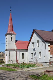
Nawojowa Góra is a village in the administrative district of Gmina Krzeszowice, within Kraków County, Lesser Poland Voivodeship, in southern Poland.

Perespa-Kolonia is a village in the administrative district of Gmina Tyszowce, within Tomaszów Lubelski County, Lublin Voivodeship, in eastern Poland. It lies approximately 8 kilometres (5 mi) north-west of Tyszowce, 29 km (18 mi) north-east of Tomaszów Lubelski, and 99 km (62 mi) south-east of the regional capital Lublin.
Grabowiec is a village in the administrative district of Gmina Chmielnik, within Kielce County, Świętokrzyskie Voivodeship, in south-central Poland. It lies approximately 10 kilometres (6 mi) north-west of Chmielnik and 24 km (15 mi) south of the regional capital Kielce.
Piotrkowice is a village in the administrative district of Gmina Chmielnik, within Kielce County, Świętokrzyskie Voivodeship, in south-central Poland. It lies approximately 9 kilometres (6 mi) north-west of Chmielnik and 25 km (16 mi) south of the regional capital Kielce.
Jakubowice is a village in the administrative district of Gmina Ożarów, within Opatów County, Świętokrzyskie Voivodeship, in south-central Poland. It lies approximately 9 kilometres (6 mi) south of Ożarów, 18 km (11 mi) east of Opatów, and 75 km (47 mi) east of the regional capital Kielce.
Romanów is an unincorporated village in the administrative district of Gmina Kamienica Polska, within Częstochowa County, Silesian Voivodeship, in southern Poland. It lies approximately 15 kilometres (9 mi) south of Częstochowa and 48 km (30 mi) north of the regional capital Katowice.
Dzbańce is a village in the administrative district of Gmina Branice, within Głubczyce County, Opole Voivodeship, in south-western Poland, close to the Czech border. It lies approximately 7 kilometres (4 mi) north-east of Branice, 13 km (8 mi) south of Głubczyce, and 65 km (40 mi) south of the regional capital Opole.

Nowe Prusy is a village in the administrative district of Gmina Czersk, within Chojnice County, Pomeranian Voivodeship, in northern Poland. It lies approximately 8 kilometres (5 mi) north-east of Czersk, 35 km (22 mi) north-east of Chojnice, and 70 km (43 mi) south-west of the regional capital Gdańsk.
Sadlinki is a village in Kwidzyn County, Pomeranian Voivodeship, in northern Poland. It is the seat of the gmina called Gmina Sadlinki. It lies approximately 9 kilometres (6 mi) south-west of Kwidzyn and 80 km (50 mi) south of the regional capital Gdańsk.

Hóa Tiến is a commune (xã) and village in Minh Hóa District, Quảng Bình Province, in Vietnam.
Viesati parish is an administrative unit of the Tukums District, Latvia.

Schloss Drachenburg is a private villa in palace style constructed in the late 19th century. It was completed in only two years (1882–84) on the Drachenfels hill in Königswinter, a German town on the Rhine near the city of Bonn. Baron Stephan von Sarter (1833–1902), a broker and banker, planned to live there, but never did.
Enivere is a village in Lääne-Nigula Parish, Lääne County, in western Estonia.


