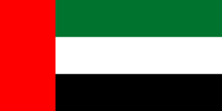
The national flag of the United Arab Emirates contains the Pan-Arab colors red, green, white, and black. It was designed in 1971 by Abdullah Mohammed Al Maainah, who was 19 years old at that time, and was adopted on 2 December 1971. The main theme of the flag's four colors is the unity of Arab nations. In 2008, there was a minor change to the Emblem.

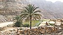
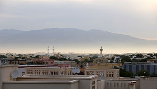
Khatt is a mountainous village south-east of the city of Ras Al Khaimah, United Arab Emirates. Famous for its hot springs, and latterly home to a spa hotel, there is evidence that Khatt has been a site of constant human settlement since the stone age – a record of over 5,000 years of occupation.
Jabal Al-Mebraḥ, also commonly mistakenly referred to by the name of the nearby peak Jabal Yibir, is a 1,505 m (4,938 ft) tall mountain in the United Arab Emirates (UAE).
The Bani Kaab is an Arab tribe in Oman and the United Arab Emirates, also evident in other Gulf countries.
The Tunaij, also spelled as Tanaij, is an Arab tribe in the United Arab Emirates (UAE). The Tunaij have mostly settled in Dhaid, the inland oasis town of Sharjah, and the Ras Al Khaimah town of Rams. A small number of Tunaij also settled at Hamriyah.
The Shihuh is an Arab tribe living in the United Arab Emirates (UAE) and Oman. In the singular, the name is Al Shehhi, a common family name in the UAE and Oman today. Inhabiting the northern part of the Hajar Mountain range, specifically in the Ruus Al Jibal, the tribe has long been influential in the affairs of both the east and west coast settlements of the northern UAE and Oman and has fiercely maintained both its identity and independence.
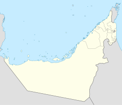
Masfout is a village that forms part of the eponymous exclave of Masfout in Ajman, one of the seven emirates forming the United Arab Emirates. It is surrounded by Ras Al Khaimah, the Dubai exclave of Hatta and Oman. It is only accessible from Ajman itself by crossing territories of Sharjah, Ras Al Khaimah, and Oman.
Bani Shatair is a tribal name, originating in Ras Al Khaimah, in the United Arab Emirates (UAE) and in areas of Northern Oman.
Sheikh Rashid bin Ahmad Al Mualla was the Ruler of Umm Al Quwain from 1904–1922, one of the Trucial States and today one of the seven emirates forming the United Arab Emirates (UAE). He gained influence over the tribes of the interior at the expense of the pre-eminent Trucial Ruler of the time, Sheikh Zayed bin Khalifa Al Nahyan.
The Bani Qitab is a tribe of the United Arab Emirates (UAE). The singular form of the name, Al Ketbi, is a common family name in the Northern UAE today. Consisting of a settled southern section and a nomadic northern section, the tribe was long influential in the conduct of affairs in the interior of the Trucial States. The Northern branch mostly settled in the inland towns of Dhaid and Al Falayah.
The Na'im is an Arab tribe in the United Arab Emirates. The tribe is also present in other gulf countries.
Bani Hadiyah is a tribal name, originating in Ras Al Khaimah, in the United Arab Emirates (UAE) and in areas of Northern Oman.

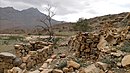
Bithnah Fort is a traditional double story rock, coral and mudbrick fortification located in the Wadi Ham, near the village of Bithnah in Fujairah, United Arab Emirates. The fort has played a significant role in the history of the Emirates, particularly in the emergence of Fujairah as an independent emirate in the early 20th century. With a controlling position overlooking the Wadi Ham, the fort replaced an Iron Age fortification.

Jabal ar Raḩraḩ is a peak in the Al Hajar Mountains, northeast of the United Arab Emirates, in the Emirate of Ras al Khaimah.
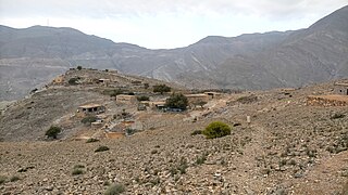
Musaibat is a small agricultural and livestock village, located in the northeast of the United Arab Emirates (UAE), in the Al Hajar Mountains, Emirate of Ras al Khaimah.
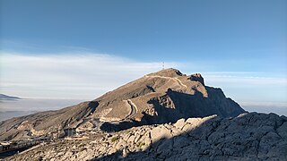
Jabal Raḩabah is a peak in the Al Hajar Mountains, northeast of the United Arab Emirates, in the Emirate of Ras Al Khaimah. At 1,543 m, it is one of the highest peaks in the UAE, located entirely within the territory of the Emirates

Ras Ash is a small agricultural and livestock village, located at 1,450 m altitude, northeast of the United Arab Emirates (UAE), in the Al Hajar Mountains, Emirate of Ras al Khaimah.

The Wadi Jib is a valley or dry river, with intermittent flow, which flows almost exclusively during the rainy season, belonging to the river basin of Wadi Bih, north-east of the United Arab Emirates (UAE), in the Emirate of Ras al Khaimah.
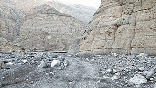
The Wadi Litibah is a valley or dry river, with intermittent flow, flowing almost exclusively during the rainy season, located northeast of the United Arab Emirates, in the Emirate of Ras al Khaimah.