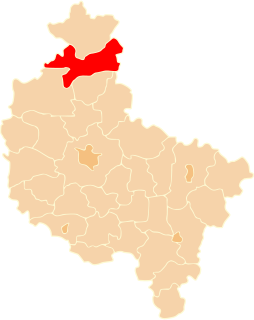
Biegodzin is a settlement in the administrative district of Gmina Łobżenica, within Piła County, Greater Poland Voivodeship, in west-central Poland. It lies approximately 10 kilometres (6 mi) north-east of Łobżenica, 46 km (29 mi) north-east of Piła, and 108 km (67 mi) north of the regional capital Poznań.
Dziegciarnia is a village in the administrative district of Gmina Łobżenica, within Piła County, Greater Poland Voivodeship, in west-central Poland. It lies approximately 12 kilometres (7 mi) east of Łobżenica, 48 km (30 mi) east of Piła, and 104 km (65 mi) north of the regional capital Poznań.
Dziunin is a settlement in the administrative district of Gmina Łobżenica, within Piła County, Greater Poland Voivodeship, in west-central Poland. It lies approximately 11 kilometres (7 mi) east of Łobżenica, 46 km (29 mi) east of Piła, and 99 km (62 mi) north of the regional capital Poznań.
Fanianowo is a village in the administrative district of Gmina Łobżenica, within Piła County, Greater Poland Voivodeship, in west-central Poland. It lies approximately 9 kilometres (6 mi) south-east of Łobżenica, 44 km (27 mi) east of Piła, and 98 km (61 mi) north of the regional capital Poznań.
Ferdynandowo German: Ferdinandshof) is a village in the administrative district of Gmina Łobżenica, within Piła County, Greater Poland Voivodeship, in west-central Poland. It lies approximately 8 kilometres (5 mi) east of Łobżenica, 44 km (27 mi) east of Piła, and 101 km (63 mi) north of the regional capital Poznań.
Izdebki German: Eichenrode, Kreis Wirsitz) is a village in the administrative district of Gmina Łobżenica, within Piła County, Greater Poland Voivodeship, in west-central Poland. It lies approximately 6 kilometres (4 mi) east of Łobżenica, 43 km (27 mi) east of Piła, and 102 km (63 mi) north of the regional capital Poznań.
Kościerzyn Mały is a village in the administrative district of Gmina Łobżenica, within Piła County, Greater Poland Voivodeship, in west-central Poland. It lies approximately 4 kilometres (2 mi) south of Łobżenica, 37 km (23 mi) east of Piła, and 96 km (60 mi) north of the regional capital Poznań.
Kruszki is a village in the administrative district of Gmina Łobżenica, within Piła County, Greater Poland Voivodeship, in west-central Poland. It lies approximately 6 kilometres (4 mi) south-west of Łobżenica, 32 km (20 mi) east of Piła, and 95 km (59 mi) north of the regional capital Poznań.
Kunowo is a village in the administrative district of Gmina Łobżenica, within Piła County, Greater Poland Voivodeship, in west-central Poland. It lies approximately 6 kilometres (4 mi) west of Łobżenica, 32 km (20 mi) north-east of Piła, and 98 km (61 mi) north of the regional capital Poznań.
Liszkowo is a village in the administrative district of Gmina Łobżenica, within Piła County, Greater Poland Voivodeship, in west-central Poland. It lies approximately 7 kilometres (4 mi) south-east of Łobżenica, 40 km (25 mi) east of Piła, and 96 km (60 mi) north of the regional capital Poznań.
Łobżonka is a settlement in the administrative district of Gmina Łobżenica, within Piła County, Greater Poland Voivodeship, in west-central Poland. It lies approximately 5 kilometres (3 mi) north-east of Łobżenica, 41 km (25 mi) north-east of Piła, and 104 km (65 mi) north of the regional capital Poznań.
Luchowo is a village in the administrative district of Gmina Łobżenica, within Piła County, Greater Poland Voivodeship, in west-central Poland. It lies approximately 2 kilometres (1 mi) east of Łobżenica, 39 km (24 mi) east of Piła, and 99 km (62 mi) north of the regional capital Poznań.
Nowina is a settlement in the administrative district of Gmina Łobżenica, within Piła County, Greater Poland Voivodeship, in west-central Poland. It lies approximately 8 kilometres (5 mi) east of Łobżenica, 43 km (27 mi) east of Piła, and 99 km (62 mi) north of the regional capital Poznań.
Puszczka is a village in the administrative district of Gmina Łobżenica, within Piła County, Greater Poland Voivodeship, in west-central Poland. It lies approximately 11 kilometres (7 mi) east of Łobżenica, 47 km (29 mi) east of Piła, and 101 km (63 mi) north of the regional capital Poznań.
Szczerbin is a village in the administrative district of Gmina Łobżenica, within Piła County, Greater Poland Voivodeship, in west-central Poland. It lies approximately 4 kilometres (2 mi) south of Łobżenica, 36 km (22 mi) east of Piła, and 96 km (60 mi) north of the regional capital Poznań.
Topola is a village in the administrative district of Gmina Łobżenica, within Piła County, Greater Poland Voivodeship, in west-central Poland. It lies approximately 8 kilometres (5 mi) east of Łobżenica, 45 km (28 mi) east of Piła, and 103 km (64 mi) north of the regional capital Poznań.
Trzeboń is a village in the administrative district of Gmina Łobżenica, within Piła County, Greater Poland Voivodeship, in west-central Poland. It lies approximately 4 kilometres (2 mi) south-east of Łobżenica, 40 km (25 mi) east of Piła, and 98 km (61 mi) north of the regional capital Poznań.
Wiktorówko is a village in the administrative district of Gmina Łobżenica, within Piła County, Greater Poland Voivodeship, in west-central Poland. It lies approximately 4 kilometres (2 mi) west of Łobżenica, 34 km (21 mi) north-east of Piła, and 99 km (62 mi) north of the regional capital Poznań.
Witrogoszcz is a village in the administrative district of Gmina Łobżenica, within Piła County, Greater Poland Voivodeship, in west-central Poland. It lies approximately 6 kilometres (4 mi) north-east of Łobżenica, 42 km (26 mi) north-east of Piła, and 104 km (65 mi) north of the regional capital Poznań.
Zawada is a settlement in the administrative district of Gmina Łobżenica, within Piła County, Greater Poland Voivodeship, in west-central Poland. It lies approximately 7 kilometres (4 mi) east of Łobżenica, 44 km (27 mi) east of Piła, and 102 km (63 mi) north of the regional capital Poznań.