Buxton railway station (Norfolk)

Last updated

Buxton Station on the Bure Valley Railway Buxton Station on the Bure Valley Railway - geograph.org.uk - 159336.jpg
Buxton Station on the Bure Valley Railway

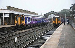
Buxton railway station serves the village of Buxton in Norfolk and is served by the Bure Valley Railway.

Buxton, Norfolk village in Norfolk, United Kingdom

Buxton is a village in Norfolk, located between Norwich and Aylsham. The village is mentioned in the Domesday Book of 1085. Buxton is adjacent to the village of Lamas. The two villages are separated by the River Bure at Buxton Mill but are otherwise indistinguishable. Together they form the civil parish of Buxton with Lamas.

Norfolk County of England

Norfolk is a county in East Anglia in England. It borders Lincolnshire to the northwest, Cambridgeshire to the west and southwest, and Suffolk to the south. Its northern and eastern boundaries are the North Sea and to the north-west, The Wash. The county town is Norwich. With an area of 2,074 square miles (5,370 km2) and a population of 859,400, Norfolk is a largely rural county with a population density of 401 per square mile. Of the county's population, 40% live in four major built up areas: Norwich (213,000), Great Yarmouth (63,000), King's Lynn (46,000) and Thetford (25,000).

Bure Valley Railway 15 inch gauge railway in Norfolk, England

The Bure Valley Railway is a 15 in minimum gauge heritage railway in Norfolk, within The Broads National Park. The railway runs from Wroxham to Aylsham and is Norfolk's longest railway of less than standard gauge. It uses both steam and diesel locomotives. There are intermediate halts at Brampton, Buxton and Coltishall. There are 17 bridges, including a 105 ft (32 m) long girder bridge over the River Bure in Buxton with Lammas as well as Aylsham Bypass Tunnel under the A140 at Aylsham.

Preceding station HR icon.svg   Heritage railways Following station
Brampton   Bure Valley Railway   Coltishall

Coordinates: 52°45′27″N1°18′25″E / 52.75760°N 1.30702°E / 52.75760; 1.30702

Geographic coordinate system Coordinate system

A geographic coordinate system is a coordinate system that enables every location on Earth to be specified by a set of numbers, letters or symbols. The coordinates are often chosen such that one of the numbers represents a vertical position and two or three of the numbers represent a horizontal position; alternatively, a geographic position may be expressed in a combined three-dimensional Cartesian vector. A common choice of coordinates is latitude, longitude and elevation. To specify a location on a plane requires a map projection.

Related Research Articles

River Bure river in Norfolk, United Kingdom

The River Bure is a river in the county of Norfolk, England, most of it in the Broads. The Bure rises near Melton Constable, 11 miles (18 km) upstream of Aylsham, which was the original head of navigation. Nowadays, the head of navigation is 10 miles (16 km) downstream at Coltishall Bridge. After Aylsham Lock and Burgh Bridge, the Bure passes through Buxton Lammas, Coltishall, Belaugh, Wroxham, Horning, Ludham Bridge, past St. Benet's Abbey, through Oby, Acle, Stokesby, along the northern border of the Halvergate Marshes, through Runham and Great Yarmouth where it meets Breydon Water and flows into the sea at Gorleston.

The Bure Valley Path is a 9-mile (14 km) long walking trail and cycling trail in Norfolk, England. It runs alongside the Bure Valley Railway, a heritage railway from Wroxham to Aylsham.

Manchester, Buxton, Matlock and Midland Junction Railway

The Manchester, Buxton, Matlock and Midland Junction Railway ran from a junction with the Midland Railway at Ambergate to Rowsley north of Matlock and thence to Buxton.

Chinley railway station

Chinley railway station serves the village of Chinley in Derbyshire, England. The station is 17 12 miles (28.2 km) south east of Manchester Piccadilly, on the Hope Valley Line from Sheffield to Manchester. It is unstaffed, and is managed by Northern.

Buxton railway station

Buxton railway station serves the town of Buxton in Derbyshire, England. It is managed and served by Northern. The station is 25 34 miles (41.4 km) south east of Manchester Piccadilly and is the terminus of the Buxton Line.

Dove Holes railway station

Dove Holes railway station serves the village of Dove Holes, Derbyshire, England. The station is on the Manchester Piccadilly to Buxton line 22 34 miles (36.6 km) south east of Piccadilly. It is managed and served by Northern.

Whaley Bridge railway station

Whaley Bridge railway station serves the town of Whaley Bridge in Derbyshire, England. The station is on the Manchester-Buxton Line 16 14 miles (26.2 km) south east of Manchester Piccadilly.

Middlewood railway station railway station on the Stockport to Buxton line in England

Middlewood railway station serves the Middlewood and Higher Poynton districts of Poynton, Cheshire, England.

Hazel Grove railway station

Hazel Grove railway station is on the Stockport to Buxton / Sheffield line, serving the village of Hazel Grove, Greater Manchester, England. It was built for the Stockport, Disley and Whaley Bridge Railway by the London and North Western Railway and opened on 9 June 1857. From 1923 until 1948 it was owned by the London Midland and Scottish Railway and following nationalisation it was operated by the London Midland Region of British Railways.

Davenport railway station (England) railway station in Stockport, England

Davenport railway station serves the Davenport suburb of Stockport, Greater Manchester, England.

Millers Dale railway station

Millers Dale railway station was situated in Millers Dale in the Peak District. It was built in 1863 by the Midland Railway on its extension of the Manchester, Buxton, Matlock and Midlands Junction Railway from Rowsley.

Hulme End human settlement in United Kingdom

Hulme End is a small hamlet in Staffordshire, England. It is located in the Peak District National Park about 10 miles north of Ashbourne. A natural gateway to the Manifold valley, the settlement is located beside the river Manifold where it crosses the road from Hartington to Warslow.

The Ashbourne line was a 33 12 mi (53.9 km) railway from Buxton via Ashbourne to Uttoxeter. It was built by the London and North Western Railway using a section of the Cromford and High Peak Railway (C&HPR) and it joined the North Staffordshire Railway at Ashbourne, proceeding to Uttoxeter with a junction onto the main line at Rocester.

Higher Buxton railway station

Higher Buxton railway station was opened in 1894 to the south east of Buxton, Derbyshire, on the LNWR line to Ashbourne and the south.

Norbury and Ellaston railway station was opened in 1852 by the North Staffordshire Railway at Norbury north of Ashbourne, Derbyshire.

Buxton Lamas railway station

Buxton Lamas was a railway station in Buxton with Lamas, Norfolk. It was located near the Bure Valley Railway's present Buxton station.

Buxton Heath

Buxton Heath is a 67.3-hectare (166-acre) biological Site of Special Scientific Interest north of Norwich in Norfolk. It is a Nature Conservation Review site, Grade 2, and part of the North Valley Fens Special Area of Conservation.

Hatton Park was a cricket ground in Wellingborough, Northamptonshire. The first recorded match on the ground was in 1873, when Wellingborough played a United North of England Eleven. It was a United North of England Eleven that played a United South of England Eleven in the grounds only first-class match. The final recorded match held on the ground came in 1884 when Northamptonshire played Essex.

Buxton railway station (Midland Railway)

Buxton (Midland) railway station served the town of Buxton, Derbyshire, England between 1863 and 1967.