
Wola Mieczysławska is a village in the administrative district of Gmina Lubartów, within Lubartów County, Lublin Voivodeship, in eastern Poland. It lies approximately 6 kilometres (4 mi) north-west of Lubartów and 29 km (18 mi) north of the regional capital Lublin.

Gmina Niedźwiada is a rural gmina in Lubartów County, Lublin Voivodeship, in eastern Poland. Its seat is the village of Niedźwiada, which lies approximately 10 kilometres (6 mi) north-east of Lubartów and 34 km (21 mi) north of the regional capital Lublin.
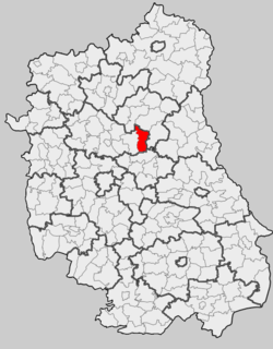
Gmina Serniki is a rural gmina in Lubartów County, Lublin Voivodeship, in eastern Poland. Its seat is the village of Serniki, which lies approximately 6 kilometres (4 mi) south-east of Lubartów and 22 km (14 mi) north of the regional capital Lublin.
Gmina Uścimów is a rural gmina in Lubartów County, Lublin Voivodeship, in eastern Poland. Its seat is the village of Uścimów, which lies approximately 24 kilometres (15 mi) east of Lubartów and 36 km (22 mi) north-east of the regional capital Lublin.
Ostrów Lubelski is a town in Gmina Ostrów Lubelski in Lubartów County, Lublin Voivodeship in Poland.
Trójnia is a village in the administrative district of Gmina Lubartów, within Lubartów County, Lublin Voivodeship, in eastern Poland. It lies approximately 8 kilometres (5 mi) north of Lubartów and 32 km (20 mi) north of the regional capital Lublin.
Gmina Spiczyn is a rural gmina in Łęczna County, Lublin Voivodeship, in eastern Poland. Its seat is the village of Spiczyn, which lies approximately 10 kilometres (6 mi) north-west of Łęczna and 18 km (11 mi) north-east of the regional capital Lublin.

Łęczna Lake District Landscape Park or Łęczna Lakeland Scenic Park is a protected area in eastern Poland, established in 1990, covering an area of 118.16 square kilometres (45.62 sq mi) in the geographic region called the Łęczna-Włodawa Lakeland or the Łęczna-Włodawa Plain.
Majdan Sobolewski is a village in the administrative district of Gmina Firlej, within Lubartów County, Lublin Voivodeship, in eastern Poland. It lies approximately 6 kilometres (4 mi) south-west of Firlej, 14 km (9 mi) north-west of Lubartów, and 34 km (21 mi) north of the regional capital Lublin.
Ostrów is a village in the administrative district of Gmina Michów, within Lubartów County, Lublin Voivodeship, in eastern Poland. It lies approximately 24 kilometres (15 mi) north-west of Lubartów and 42 km (26 mi) north-west of the regional capital Lublin.
Podlodówek is a village in the administrative district of Gmina Michów, within Lubartów County, Lublin Voivodeship, in eastern Poland. It lies approximately 17 kilometres (11 mi) north-west of Lubartów and 35 km (22 mi) north of the regional capital Lublin.
Zofianówka is a village in the administrative district of Gmina Michów, within Lubartów County, Lublin Voivodeship, in eastern Poland. It lies approximately 19 kilometres (12 mi) north-west of Lubartów and 36 km (22 mi) north-west of the regional capital Lublin.
Kaznów is a village in the administrative district of Gmina Ostrów Lubelski, within Lubartów County, Lublin Voivodeship, in eastern Poland.
Kolechowice-Folwark is a village in the administrative district of Gmina Ostrów Lubelski, within Lubartów County, Lublin Voivodeship, in eastern Poland.
Rozkopaczew is a village in the administrative district of Gmina Ostrów Lubelski, within Lubartów County, Lublin Voivodeship, in eastern Poland. It lies approximately 9 kilometres (6 mi) south of Ostrów Lubelski, 19 km (12 mi) east of Lubartów, and 27 km (17 mi) north-east of the regional capital Lublin.
Rudka Kijańska is a village in the administrative district of Gmina Ostrów Lubelski, within Lubartów County, Lublin Voivodeship, in eastern Poland. It lies approximately 7 kilometres (4 mi) south of Ostrów Lubelski, 19 km (12 mi) east of Lubartów, and 30 km (19 mi) north-east of the regional capital Lublin.
Tarkawica is a village in the administrative district of Gmina Ostrówek, within Lubartów County, Lublin Voivodeship, in eastern Poland. It lies approximately 20 kilometres (12 mi) north of Lubartów and 43 km (27 mi) north of the regional capital Lublin.
Telatyn is a village in Tomaszów Lubelski County, Lublin Voivodeship, in eastern Poland. It is the seat of the gmina called Gmina Telatyn. It lies approximately 33 kilometres (21 mi) east of Tomaszów Lubelski and 120 km (75 mi) south-east of the regional capital Lublin.


