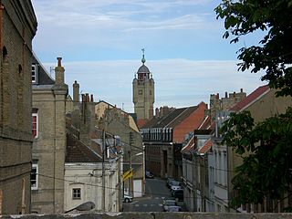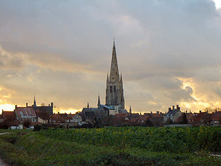
Antwerp Province is the northernmost province both of the Flemish Region, also called Flanders, and of Belgium. It borders on North Brabant province of the Netherlands and the Belgian provinces of Limburg, Flemish Brabant and East Flanders. Its capital is Antwerp which comprises the Port of Antwerp. It has an area of 2,867 km2 (1,107 sq mi) and with 1.8 million inhabitants it is the country's most populous province. The province consists of 3 arrondissements: Antwerp, Mechelen and Turnhout. The eastern part of the province comprises the main part of the Campine region.
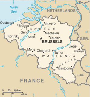
Belgium is a federal state located in Western Europe, bordering the North Sea. Belgium shares borders with France (556 km), Germany (133 km), Luxembourg (130 km) and the Netherlands (478 km). Belgium comprises the regions of Flanders, Wallonia and Brussels.

The Battle of Hondschoote took place during the Flanders Campaign of the Campaign of 1793 in the French Revolutionary Wars. It was fought during operations surrounding the Siege of Dunkirk between 6 and 8 September 1793 at Hondschoote, Nord, France, and resulted in a French victory under General Jean Nicolas Houchard and General Jean-Baptiste Jourdan against the command of Marshal Freytag, part of the Anglo-Hanoverian corps of the Duke of York.
RTBF is a public-service broadcasting organization delivering radio and television services to the French-speaking Community of Belgium, in Wallonia and Brussels. Its counterpart in the Flemish Community is the Dutch-language VRT, and in the German-speaking Community it is BRF.
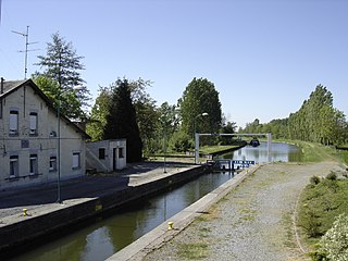
The Canal de laSambre à l'Oise is a canal in northern France. It forms a connection between the canalised river Sambre at Landrecies and the Oise at La Fère. The canal is 71 kilometres (44 mi) long, and has 38 locks. The junction made at La Fère is with a branch of the Canal de Saint-Quentin, while the Canal latéral à l'Oise is joined 10.5 km further downstream at Chauny. It was used by the standard Freycinet-gauge péniches, 38.50 metres (126.3 ft) long, and 5.05 metres (16.6 ft) in beam, carrying up to 250 tonnes. The canal, also a popular waterway for boats heading south from the Netherlands and Belgium to the central French waterways, had to be closed in 2006 when two aqueducts were found to be in danger of failing. Funding has been put in place by the owner, Voies Navigables de France, and the local authorities, with support from the State, and it is expected to reopen the canal throughout in 2020.

The A25 is a 62.2 kilometres (38.6 mi) long motorway in northern France. It is also part of European Route E42.

Westhoek or Maritime Flanders is a region in Belgium and France and includes the following areas:
- Belgian Westhoek including the West Flanders arrondissements of Diksmuide, Ypres, and Veurne including the cities of Veurne, Poperinge, Wervik, Ypres, De Panne, Langemark-Poelkapelle, Diksmuide and Koekelare. However, the three Belgian coast municipalities of De Panne, Koksijde, and Nieuwpoort are frequently considered a separate region known as the Belgian or Flemish West Coast (Westkust).
- French Westhoek, roughly the arrondissement of Dunkirk, including the cities of Dunkirk, Gravelines, and Hazebrouck, itself part of a larger area known as French Flanders.
Television in Belgium was introduced in 1953 and began with one channel each in Dutch and French.
Coppenaxfort is a hamlet in the Nord department in northern France. It is located on the territory of three communes : Brouckerque, Craywick and Bourbourg.
The Communauté de communes des Hauts de Flandre is a communauté de communes in the Nord département and in the Hauts-de-France région of France. It was formed on 1 January 2014 by the merger of the former Communauté de communes de la Colme, Communauté de communes du canton de Bergues, Communauté de communes de Flandre and the Communauté de communes de l'Yser. Its seat is in Bergues.
The Canal de Bergues is one of the oldest canals in Flanders, its course being shown on a map dating from the 9th century, connecting Bergues to the port of Dunkerque, in northern France. The town itself, heavily fortified by Vauban in the late 17th century, is the main attraction for boats, which moor in a dramatic location just outside the fortified walls. Commercial traffic ceased in the 1970s. The site acquired worldwide fame in 2008 as the location for the cult film Bienvenue chez les Ch’tis. The local dialect and out-of-tune belfry chimes contributed to making the town a destination for tourists. The canal formerly connected with the Canal de la Basse-Colme heading west to Veurne via the Bergenvaart, and the Canal de la Haute-Colme west to the Canal Dunkerque-Escaut at Lynck. Restoration of these canals would greatly increase the tourism potential of Bergues, but there is opposition from the authority managing the local drainage canals. Bergues remains a there-and-back excursion for visiting boats.
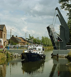
The Canal de Roubaix is a canal in northern France. It joins the Canal de la Deûle near Marquette-lez-Lille to the Canal de l’Espierres in Belgium at Leers, just east of the former textile manufacturing town Roubaix. It is 20 km long with 12 locks. The Belgian canal continues 8.4 km and three locks beyond the border to the junction with the river Escaut (Scheldt).

The Canal de la Somme is a canal in northern France. Its total length is 156.4 km with 25 locks, from the English Channel at Saint-Valéry-sur-Somme to the Canal de Saint-Quentin at Saint-Simon.

The Canal Dunkerque-Escaut is a 189 km long series of historic canals, and the canalised river Escaut (Scheldt) that were substantially rebuilt from the mid-1950s up to ca. 1980, with some new sections, from Dunkerque to the Belgian border at Mortagne-du-Nord. Existing canals were straightened and widened; and new locks (écluses) were built, also on the river Escaut, from the junction at Bouchain to the border.The route is also known as the Liaison 'à grand gabarit'Dunkerque-Escaut. Some authors have separated the waterway into the canal proper and the canalised river Escaut, but current practice is to use the simple name throughout. The Liaison was designed for large commercial vessels up to 85m long by 11.50m wide. The entire route is being further upgraded to offer European Class Vb dimensions, for push-tows 185m by 11.50m, and motor barges up to 125m long, as part of the current EU-funded Seine-Escaut-Rhine waterway corridor investments, including the new Seine-Nord Europe Canal.

The Canal de la Haute Colme is a canal in northern France. The haute Colme corresponds to the western segment of the Canal de la Colme. The channel connects Aa River at Watten to Canal de Bergues and Canal de la Basse Colme at Bergues. Between Watten and Cappelle-Brouck, it is part of the Canal Dunkerque-Escaut.

The Canal de la Deûle is one of the oldest canals in northern France, originally connecting the river Scarpe near Douai with the river Lys at Deûlémont near the Belgian border. Roughly half of its original length has been absorbed in the high-capacity Dunkerque-Escaut waterway, as shown on the map, and the remaining length through the port of Lille is often considered as a branch of the main route, hence the alternative names Liaison or Antenne Bauvin-Lys. This official name was never adopted by the local population, which refers simply to the Deûle, evoking its original state as a natural river, although it has the size and the appearance of a built canal. It is 34.8 km long with 3 locks.

The Nieuwpoort-Dunkirk Canal is a canal which links the Belgian coastal town of Nieuwpoort with the French port Dunkirk. The Nieuwpoort-Dunkirk Canal forms an extension of the Plassendale-Nieuwpoort Canal, and runs for 32 kilometres (20 mi) pretty much parallel to the coast line, within two to four kilometers from the sea.

Hauts-de-France, is a region of France created by the territorial reform of French Regions in 2014, from a merger of Nord-Pas-de-Calais and Picardy. Its capital is Lille. The new region came into existence on 1 January 2016, after the regional elections in December 2015. France's Conseil d'État approved Hauts-de-France as the name of the region on 28 September 2016, effective 30 September 2016.

