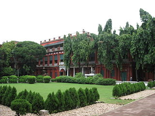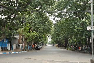
Jorasanko is a neighbourhood of North Kolkata, in Kolkata district, West Bengal, India. It is so called because of the two (jora) wooden or bamboo bridges (sanko) that spanned a small stream at this point.

Rashbehari Avenue is one of the most prestigious and important east–west avenues of Kolkata, India. A major portion of this road is often commonly referred to as Gariahat, the prime shopping and aristocratic residential neighbourhood of south Kolkata. Rashbehari Avenue falls in the posh residential neighbourhood of Ballygunge. The road is named after Sir Rash Behari Ghosh who was an Indian politician, lawyer, social worker and philanthropist.

Bagbazar is a neighbourhood of North Kolkata, in Kolkata district in the Indian state of West Bengal. The area, under Shyampukur police station of Kolkata Police, has been, along with neighbouring Shyambazar, the citadel of the Bengali aristocracy. Bagbazar has played an active role in growth and development of Kolkata.

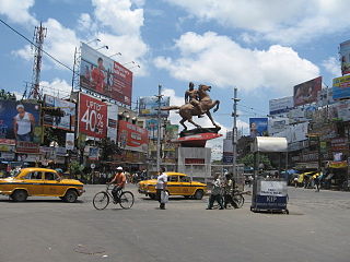
Shyambazar is a neighbourhood of North Kolkata, in Kolkata district in the Indian state of West Bengal. The area, under Shyampukur police station of Kolkata Police, has been, along with neighbouring Bagbazar, the citadel of the Bengali aristocracy, in a part of what was earlier known as Sutanuti. and the popularity of shyambazer five point crossing is for The Statue of Netaji Subhas Chandra Bose.

Bowbazar is a neighbourhood of Central Kolkata, in Kolkata district in the Indian state of West Bengal.

Mahatma Gandhi Road or M.G. Road, formerly known as Harrison Road, is a principal East-West thoroughfare in Kolkata, the capital of the Indian state of West Bengal. M.G. Road makes the boundary of North and Central Kolkata. In 1889 this was the first street of the city to be lit by electricity.

Vivekananda Road is a major east–west thoroughfare in the Indian city of Kolkata and connects Maniktala with Jorasanko. West of Maniktala Police Station, Maniktala Main Road becomes Vivekananda Road. It becomes Kali Krishna Tagore Street after crossing Rabindra Sarani. This road's name is a tribute for Swami Vivekananda's Ancestral House which is some meters away from Bidhan Sarani Crossing.
Ward No. 25, Kolkata Municipal Corporation is an administrative division of Kolkata Municipal Corporation in Borough No. 4, covering parts of Rambagan, Girish Park, Jorasanko and Simla neighbourhoods in North Kolkata, in the Indian state of West Bengal.
Ward No. 26, Kolkata Municipal Corporation is an administrative division of Kolkata Municipal Corporation in Borough No. 4, covering parts of Ramdulal Sarkar Street and Hedua Park neighbourhoods in North Kolkata, in the Indian state of West Bengal.
Ward No. 39, Kolkata Municipal Corporation is an administrative division of Kolkata Municipal Corporation in Borough No. 5, covering parts of Marcus Square, College Street and Simla neighbourhoods in North Kolkata, in the Indian state of West Bengal.
Ward No. 41, Kolkata Municipal Corporation is an administrative division of Kolkata Municipal Corporation in Borough No. 5, covering parts of Jorasanko neighbourhood in North Kolkata, in the Indian state of West Bengal.
Ward No. 42, Kolkata Municipal Corporation is an administrative division of Kolkata Municipal Corporation in Borough No. 5, covering parts of Burrabazar neighbourhood in North Kolkata, in the Indian state of West Bengal.
Ward No. 43, Kolkata Municipal Corporation is an administrative division of Kolkata Municipal Corporation in Borough No. 5, covering parts of Burrabazar (Mechhua) and Kolutola neighbourhoods in north-central Kolkata, in the Indian state of West Bengal.
Ward No. 44, Kolkata Municipal Corporation is an administrative division of Kolkata Municipal Corporation in Borough No. 5, covering parts of Burrabazar (Mechhua), Tiretta Bazaar, Kolutola(Colootola Street) and College Street neighbourhoods in north-central Kolkata, in the Indian state of West Bengal.
Ward No. 45, Kolkata Municipal Corporation is an administrative division of Kolkata Municipal Corporation in Borough No. 5, covering parts of Esplanade West, Eden Gardens, Babughat, Millennium Park, B.B.D. Bagh, Lalbazar and Burrabazar neighbourhoods in central Kolkata, in the Indian state of West Bengal.
Ward No. 46, Kolkata Municipal Corporation is an administrative division of Kolkata Municipal Corporation in Borough No. 6, covering parts of Chowringhee, Esplanade East, Dharmatala, Janbazar, Lalbazar, Bowbazar and Maidan neighbourhoods in central Kolkata, in the Indian state of West Bengal.
Ward No. 47, Kolkata Municipal Corporation is an administrative division of Kolkata Municipal Corporation in Borough No. 6, covering parts of Bowbazar and Dharmatala neighbourhoods in central Kolkata, in the Indian state of West Bengal.
Ward No. 63, Kolkata Municipal Corporation is an administrative division of Kolkata Municipal Corporation in Borough No. 7, covering parts of Chowringhee, Taltala, Park Street, Shakespeare Sarani, Maidan, The 42 and Hastings neighbourhoods in central Kolkata, in the Indian state of West Bengal.

Girish Park is a neighbourhood of North Kolkata in Kolkata district in the Indian state of West Bengal. it is named after famous Bengali Theatre personnel Girish Chandra Ghosh.

Hare Street is a road in the Indian city of Kolkata, in Kolkata district, West Bengal, India. It connects the junction of Council House Street and Netaji Subhas Road in B.B.D. Bagh to Millennium Park on Strand Road.


