Division No. 1, Subdivision A is an unorganized subdivision on the Avalon Peninsula in Newfoundland and Labrador, Canada. It is in Division No. 1, and lies between Trinity Bay and Placentia Bay.

Upper Island Cove, Newfoundland and Labrador is a town in Newfoundland and Labrador. It is located in Division 1, Newfoundland and Labrador census division. It is north east of Bay Roberts. The Way office was established in 1864. The population was 942 in 1940; 1,346 in 1951, 1,563 in 1956, and 1762 in 1966. As of 2001, the population is 1,774.
The Bay de Verde Peninsula is the largest peninsula that makes up part of the Avalon Peninsula, of the province of Newfoundland and Labrador, Canada. The peninsula separates both Trinity and Conception Bay.
The Burin Peninsula is a peninsula located on the south coast of the island of Newfoundland in the province of Newfoundland and Labrador.
Tickle Cove is a settlement in Newfoundland and Labrador, located north west of Catalina. The first postmaster was John Maloney. The population was 115 in 1951. The movie, The Grand Seduction, is set here.
Route 235, commonly called the Bonavista Bay Highway, branches off from Route 230 at Southern Bay. Both Route 230 and Route 235 head towards Bonavista, Route 230 crossing the peninsula at this point to service towns on the Trinity Bay side of the Bonavista Peninsula whilst Route 235 stays on the Bonavista Bay side of the Peninsula.
The Bonavista Peninsula is a large peninsula on the east coast of the island of Newfoundland in the Canadian province of Newfoundland and Labrador.
Newfoundland and Labrador Route 350, commonly known as The Botwood Highway is a side highway in Central Newfoundland that leads from the Trans-Canada Highway in Bishop's Falls to Botwood, Point Leamington and Leading Tickles. It is approximately 70 km in length and contains several side roads to communities located off the route, such as Peterview, and Route 352 that leads to Point of Bay and the Cottrells Cove-Fortune Harbour area. Route 350-17 branches off in Point Leamington and connects the small community of Pleasantview to the main route. Route 350 continues on from Point Leamington for another 25 km north to Leading Tickles where the road officially ends. Along the way a short road connect Glover's Harbour to the main route as well.
New Perlican is a town in the Canadian province of Newfoundland and Labrador. The town had a population of 188 in the Canada 2006 Census.
South River is a town in the Canadian province of Newfoundland and Labrador, located at the junction of Cupids, Roaches Line, Makinsons and Clarke's Beach at the head of Bay de Grave. The town had a population of 647 in the 2016 Canadian Census. South River is the site of the western terminus of Newfoundland and Labrador Route 60, also known as the Conception Bay Highway, which proceeds eastward to downtown St. John's. The river is located on Taylor's road, which is off of Springfield.
Winterton is a town in the Canadian province of Newfoundland and Labrador. It was originally named Sille Cove or Scilly Cove. In 1912 the town was named Winterton for Sir James Spearman Winter, former Prime Minister of Newfoundland.

Copper Cove Subdivision is an unincorporated community in Calaveras County, California. It lies at an elevation of 1070 feet.

Birchy Cove was a settlement in Newfoundland and Labrador.
The English River Dene Nation is a Dene First Nation band government in Patuanak, Saskatchewan, Canada. Their reserve is in the northern section of this Canadian province. Its territories are in the boreal forest of the Canadian Shield. This First Nation is a member of the Meadow Lake Tribal Council (MLTC).
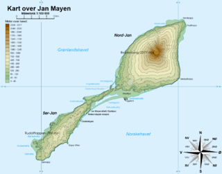
Båtvika is a cove at the southern part of the island of Jan Mayen. It is located at the southeastern side of the island, in the southwestern part of Rekvedbukta, northeast of Kapp Traill. The settlement Olonkinbyen is located on the plain northeast of the cove, and Båtvika is the settlement's nearest harbour.

Division No. 1, Subdivision G is an unorganized subdivision on the Avalon Peninsula in Newfoundland and Labrador, Canada. It is in Division 1 and contains the unincorporated communities of Baccalieu Island, Besom Cove, Bradley's Cove, Burnt Point, Caplin Cove, Daniel's Cove, Grates Cove, Gull Island, Job's Cove, Kingston, Long Beach, Lower Island Cove, Low Point, Northern Bay, Ochre Pit Cove, Red Head Cove, Riverhead, Smooth Cove and Western Bay.
Division No. 1, Subdivision L is an unorganized subdivision on the Avalon Peninsula in Newfoundland and Labrador, Canada. It is in Division 1 and contains the unincorporated communities of Bareneed, Black Duck Pond, Blow Me Down, Coley's Point South, Hibb's Cove, Pick Eyes, Port de Grave, Ship Cove and The Dock

