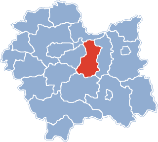
Baczków is a village in the administrative district of Gmina Bochnia, within Bochnia County, Lesser Poland Voivodeship, in southern Poland. It lies approximately 4 kilometres (2 mi) north of Bochnia and 36 km (22 mi) east of the regional capital Kraków.

Bogucice is a village in the administrative district of Gmina Bochnia, within Bochnia County, Lesser Poland Voivodeship, in southern Poland. It lies approximately 9 kilometres (6 mi) north-east of Bochnia and 39 km (24 mi) east of the regional capital Kraków.
Gawłów is a village in the administrative district of Gmina Bochnia, within Bochnia County, Lesser Poland Voivodeship, in southern Poland. It lies approximately 4 kilometres (2 mi) north of Bochnia and 37 km (23 mi) east of the regional capital Kraków.
Krzyżanowice is a village in the administrative district of Gmina Bochnia, within Bochnia County, Lesser Poland Voivodeship, in southern Poland. It lies approximately 2 kilometres (1 mi) north of Bochnia and 37 km (23 mi) east of the regional capital Kraków.
Majkowice is a village in the administrative district of Gmina Bochnia, within Bochnia County, Lesser Poland Voivodeship, in southern Poland. It lies approximately 7 kilometres (4 mi) north-east of Bochnia and 38 km (24 mi) east of the regional capital Kraków.
Słomka is a village in the administrative district of Gmina Bochnia, within Bochnia County, Lesser Poland Voivodeship, in southern Poland. It lies approximately 4 kilometres (2 mi) north of Bochnia and 37 km (23 mi) east of the regional capital Kraków.
Zatoka is a village in the administrative district of Gmina Bochnia, within Bochnia County, Lesser Poland Voivodeship, in southern Poland. It lies approximately 9 kilometres (6 mi) north-east of Bochnia and 42 km (26 mi) east of the regional capital Kraków.
Gawłówek is a village in the administrative district of Gmina Drwinia, within Bochnia County, Lesser Poland Voivodeship, in southern Poland. It lies approximately 6 kilometres (4 mi) south of Drwinia, 8 km (5 mi) north of Bochnia, and 37 km (23 mi) east of the regional capital Kraków.
Mikluszowice is a village in the administrative district of Gmina Drwinia, within Bochnia County, Lesser Poland Voivodeship, in southern Poland. It lies approximately 6 kilometres (4 mi) south of Drwinia, 8 km (5 mi) north of Bochnia, and 37 km (23 mi) east of the regional capital Kraków.
Borek is a village in the administrative district of Gmina Rzezawa, within Bochnia County, Lesser Poland Voivodeship, in southern Poland. It lies approximately 4 kilometres (2 mi) north of Rzezawa, 8 km (5 mi) north-east of Bochnia, and 42 km (26 mi) east of the regional capital Kraków.
Bratucice is a village in the administrative district of Gmina Rzezawa, within Bochnia County, Lesser Poland Voivodeship, in southern Poland. It lies approximately 10 kilometres (6 mi) north of Rzezawa, 12 km (7 mi) north-east of Bochnia, and 43 km (27 mi) east of the regional capital Kraków.
Buczków is a village in the administrative district of Gmina Rzezawa, within Bochnia County, Lesser Poland Voivodeship, in southern Poland. It lies approximately 9 kilometres (6 mi) north-east of Rzezawa, 13 km (8 mi) north-east of Bochnia, and 45 km (28 mi) east of the regional capital Kraków.
Dębina is a village in the administrative district of Gmina Rzezawa, within Bochnia County, Lesser Poland Voivodeship, in southern Poland. It lies approximately 8 kilometres (5 mi) north of Rzezawa, 11 km (7 mi) north-east of Bochnia, and 43 km (27 mi) east of the regional capital Kraków.
Jodłówka is a village in the administrative district of Gmina Rzezawa, within Bochnia County, Lesser Poland Voivodeship, in southern Poland. It lies approximately 3 kilometres (2 mi) east of Rzezawa, 9 km (6 mi) east of Bochnia, and 45 km (28 mi) east of the regional capital Kraków.
Krzeczów is a village in the administrative district of Gmina Rzezawa, within Bochnia County, Lesser Poland Voivodeship, in southern Poland. It lies approximately 3 kilometres (2 mi) west of Rzezawa, 4 km (2 mi) east of Bochnia, and 40 km (25 mi) east of the regional capital Kraków.
Łazy is a village in the administrative district of Gmina Rzezawa, within Bochnia County, Lesser Poland Voivodeship, in southern Poland. It lies approximately 3 kilometres (2 mi) south-west of Rzezawa, 6 km (4 mi) east of Bochnia, and 42 km (26 mi) east of the regional capital Kraków.
Okulice is a village in the administrative district of Gmina Rzezawa, within Bochnia County, Lesser Poland Voivodeship, in southern Poland. It lies approximately 10 kilometres (6 mi) north of Rzezawa, 12 km (7 mi) north-east of Bochnia, and 43 km (27 mi) east of the regional capital Kraków.
Ostrów Królewski is a village in the administrative district of Gmina Rzezawa, within Bochnia County, Lesser Poland Voivodeship, in southern Poland. It lies approximately 5 kilometres (3 mi) north-west of Rzezawa, 6 km (4 mi) north-east of Bochnia, and 40 km (25 mi) east of the regional capital Kraków.
Rzezawa is a village in Bochnia County, Lesser Poland Voivodeship, in southern Poland. It is the seat of the gmina called Gmina Rzezawa. It lies approximately 6 kilometres (4 mi) east of Bochnia and 43 km (27 mi) east of the regional capital Kraków.