Gmina Krzeszów

Last updated
Gmina Krzeszów
Krzeszów Commune
Gmina

Krzeszow - Urzad Gminy (01) - dsc06932 v1.jpg

Gmina Krzeszów Office
POL Krzeszow COA.svg
Coat of arms
Coordinates(Krzeszów): 50°24′14″N22°20′28″E / 50.40389°N 22.34111°E / 50.40389; 22.34111 Coordinates: 50°24′14″N22°20′28″E / 50.40389°N 22.34111°E / 50.40389; 22.34111
CountryFlag of Poland.svg  Poland
Voivodeship Subcarpathian
County Nisko
Seat Krzeszów
Area
  Total 62.38 km2 (24.09 sq mi)
Population (2013 [1] )
  Total 4,289
  Density 69/km2 (180/sq mi)
Website http://www.krzeszow.pl

Gmina Krzeszów is a rural gmina (administrative district) in Nisko County, Subcarpathian Voivodeship, in south-eastern Poland. Its seat is the village of Krzeszów, which lies approximately 21 kilometres (13 mi) south-east of Nisko and 48 km (30 mi) north-east of the regional capital Rzeszów.

Gmina administrative division of Poland

The gmina is the principal unit of the administrative division of Poland, similar to a municipality. As of 2010 there were 2,478 gminy throughout the country. The word gmina derives from the German word Gemeinde, meaning "community".

Nisko County County in Subcarpathian, Poland

Nisko County is a unit of territorial administration and local government (powiat) in Subcarpathian Voivodeship, south-eastern Poland. It came into being on January 1, 1999, as a result of the Polish local government reforms passed in 1998. Its administrative seat and largest town is Nisko, which lies 57 kilometres (35 mi) north of the regional capital Rzeszów. The county also contains the towns of Rudnik nad Sanem, lying 13 km (8 mi) south-east of Nisko, and Ulanów, 11 km (7 mi) east of Nisko.

Poland Republic in Central Europe

Poland, officially the Republic of Poland, is a country located in Central Europe. It is divided into 16 administrative subdivisions, covering an area of 312,696 square kilometres (120,733 sq mi), and has a largely temperate seasonal climate. With a population of approximately 38.5 million people, Poland is the sixth most populous member state of the European Union. Poland's capital and largest metropolis is Warsaw. Other major cities include Kraków, Łódź, Wrocław, Poznań, Gdańsk, and Szczecin.

Contents

The gmina covers an area of 62.38 square kilometres (24.1 sq mi), and as of 2006 its total population is 4,227 (4,289 in 2013).

Villages

Gmina Krzeszów contains the villages and settlements of Bystre, Kamionka, Koziarnia, Krzeszów, Krzeszów Dolny, Kustrawa, Łazów, Podolszynka Ordynacka, Podolszynka Plebańska and Sigiełki.

Bystre, Nisko County Village in Subcarpathian, Poland

Bystre is a village in the administrative district of Gmina Krzeszów, within Nisko County, Subcarpathian Voivodeship, in south-eastern Poland.

Kamionka, Nisko County Village in Subcarpathian, Poland

Kamionka is a village in the administrative district of Gmina Krzeszów, within Nisko County, Subcarpathian Voivodeship, in south-eastern Poland. It lies approximately 3 kilometres (2 mi) north of Krzeszów, 19 km (12 mi) south-east of Nisko, and 50 km (31 mi) north-east of the regional capital Rzeszów.

Koziarnia Village in Subcarpathian, Poland

Koziarnia is a village in the administrative district of Gmina Krzeszów, within Nisko County, Subcarpathian Voivodeship, in south-eastern Poland. It lies approximately 4 kilometres (2 mi) south of Krzeszów, 23 km (14 mi) south-east of Nisko, and 45 km (28 mi) north-east of the regional capital Rzeszów.

Neighbouring gminas

Gmina Krzeszów is bordered by the gminas of Harasiuki, Kuryłówka, Leżajsk, Nowa Sarzyna, Potok Górny, Rudnik nad Sanem and Ulanów.

Gmina Harasiuki is a rural gmina in Nisko County, Subcarpathian Voivodeship, in south-eastern Poland. Its seat is the village of Harasiuki, which lies approximately 26 kilometres (16 mi) east of Nisko and 61 km (38 mi) north-east of the regional capital Rzeszów.

Gmina Kuryłówka is a rural gmina in Leżajsk County, Subcarpathian Voivodeship, in south-eastern Poland. Its seat is the village of Kuryłówka, which lies approximately 5 kilometres (3 mi) northeast of Leżajsk and 44 km (27 mi) north-east of the regional capital Rzeszów.

Gmina Leżajsk is a rural gmina in Leżajsk County, Subcarpathian Voivodeship, in south-eastern Poland. Its seat is the town of Leżajsk, although the town is not part of the territory of the gmina.

Related Research Articles

Krzeszów, Podkarpackie Voivodeship Village in Subcarpathian, Poland

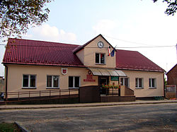
Krzeszów is a village in Nisko County, Subcarpathian Voivodeship, in south-eastern Poland. It is the seat of the gmina called Gmina Krzeszów. It lies on the San River, approximately 21 kilometres (13 mi) south-east of Nisko and 48 km (30 mi) north-east of the regional capital Rzeszów.

Gmina Stryszawa is a rural gmina in Sucha County, Lesser Poland Voivodeship, in southern Poland. Its seat is the village of Stryszawa, which lies approximately 7 kilometres (4 mi) west of Sucha Beskidzka and 50 km (31 mi) south-west of the regional capital Kraków.

Gmina Nowa Sarzyna is an urban-rural gmina in Leżajsk County, Subcarpathian Voivodeship, in south-eastern Poland. Its seat is the town of Nowa Sarzyna, which lies approximately 11 kilometres (7 mi) north-west of Leżajsk and 40 km (25 mi) north-east of the regional capital Rzeszów.

Gmina Nisko is an urban-rural gmina in Nisko County, Subcarpathian Voivodeship, in south-eastern Poland. Its seat is the town of Nisko, which lies approximately 57 kilometres (35 mi) north of the regional capital Rzeszów.

Gmina Jarocin, Podkarpackie Voivodeship Gmina in Subcarpathian, Poland

Gmina Jarocin is a rural gmina in Nisko County, Subcarpathian Voivodeship, in south-eastern Poland. Its seat is the village of Jarocin, which lies approximately 14 kilometres (9 mi) east of Nisko and 64 km (40 mi) north of the regional capital Rzeszów.

Gmina Jeżowe Gmina in Subcarpathian, Poland

Gmina Jeżowe is a rural gmina in Nisko County, Subcarpathian Voivodeship, in south-eastern Poland. Its seat is the village of Jeżowe, which lies approximately 18 kilometres (11 mi) south of Nisko and 40 km (25 mi) north of the regional capital Rzeszów.

Gmina Rudnik nad Sanem is an urban-rural gmina in Nisko County, Subcarpathian Voivodeship, in south-eastern Poland. Its seat is the town of Rudnik nad Sanem, which lies approximately 13 kilometres (8 mi) south-east of Nisko and 49 km (30 mi) north of the regional capital Rzeszów.

Gmina Ulanów is an urban-rural gmina in Nisko County, Subcarpathian Voivodeship, in south-eastern Poland. Its seat is the town of Ulanów, which lies approximately 11 kilometres (7 mi) east of Nisko and 55 km (34 mi) north of the regional capital Rzeszów.

Gmina Pysznica is a rural gmina in Stalowa Wola County, Subcarpathian Voivodeship, in south-eastern Poland. Its seat is the village of Pysznica, which lies approximately 6 kilometres (4 mi) east of Stalowa Wola and 61 km (38 mi) north of the regional capital Rzeszów.

Krzeszów Górny Village in Subcarpathian, Poland

Krzeszów Górny is a village in the administrative district of Gmina Harasiuki, within Nisko County, Subcarpathian Voivodeship, in south-eastern Poland. It lies approximately 10 kilometres (6 mi) south-west of Harasiuki, 23 km (14 mi) south-east of Nisko, and 51 km (32 mi) north-east of the regional capital Rzeszów.

Krzeszów Dolny Village in Subcarpathian, Poland

Krzeszów Dolny is a village in the administrative district of Gmina Krzeszów, within Nisko County, Subcarpathian Voivodeship, in south-eastern Poland. It lies approximately 2 kilometres (1 mi) east of Krzeszów, 23 km (14 mi) south-east of Nisko, and 49 km (30 mi) north-east of the regional capital Rzeszów.

Kustrawa Village in Subcarpathian, Poland

Kustrawa is a village in the administrative district of Gmina Krzeszów, within Nisko County, Subcarpathian Voivodeship, in south-eastern Poland. It lies approximately 4 kilometres (2 mi) south-east of Krzeszów, 25 km (16 mi) south-east of Nisko, and 48 km (30 mi) north-east of the regional capital Rzeszów.

Łazów, Podkarpackie Voivodeship Village in Subcarpathian, Poland

Łazów is a village in the administrative district of Gmina Krzeszów, within Nisko County, Subcarpathian Voivodeship, in south-eastern Poland. It lies approximately 9 kilometres (6 mi) south-east of Krzeszów, 30 km (19 mi) south-east of Nisko, and 47 km (29 mi) north-east of the regional capital Rzeszów.

Podolszynka Ordynacka Village in Subcarpathian, Poland

Podolszynka Ordynacka is a village in the administrative district of Gmina Krzeszów, within Nisko County, Subcarpathian Voivodeship, in south-eastern Poland. It lies approximately 2 kilometres (1 mi) north-east of Krzeszów, 21 km (13 mi) south-east of Nisko, and 50 km (31 mi) north-east of the regional capital Rzeszów.

Podolszynka Plebańska Village in Subcarpathian, Poland

Podolszynka Plebańska is a village in the administrative district of Gmina Krzeszów, within Nisko County, Subcarpathian Voivodeship, in south-eastern Poland. It lies approximately 4 kilometres (2 mi) north-east of Krzeszów, 22 km (14 mi) south-east of Nisko, and 51 km (32 mi) north-east of the regional capital Rzeszów.

References