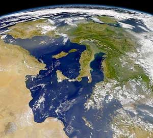
Italy is located in southern Europe and comprises the long, boot-shaped Italian Peninsula, the southern side of Alps, the large plain of the Po Valley and some islands including Sicily and Sardinia. Corsica, although belonging to the Italian geographical region, has been a part of France since 1769. Italy is part of the Northern Hemisphere.

The geography of France consists of a terrain that is mostly flat plains or gently rolling hills in the north and west and mountainous in the south and the east.

Sehore District is a district of Madhya Pradesh state in central India. The town of Sehore is the district headquarters. The district is part of Bhopal Division.

Kemzeke is a village in the Belgian municipality of Stekene in the province of East-Flanders. Until 1976, it was an independent municipality. It is between the Dutch border and Sint-Niklaas.
German submarine U-772 was a Type VIIC U-boat of Nazi Germany's Kriegsmarine during World War II.

Ciocănești is a commune in Călărași County, Romania. It is composed of a single village, Ciocănești. The island Ostrovul Ciocănești lies In the proximity of Ciocănești on the Danube.

Przesieczany is a village in the administrative district of Gmina Zgorzelec, within Zgorzelec County, Lower Silesian Voivodeship, in south-western Poland, close to the German border.
Voat Kor is a khum (commune) of Battambang District in Battambang Province in north-western Cambodia. It is the birthplace of Nuon Chea, one of the leaders of the Khmer Rouge.

Djelida is a town in northern Algeria.

Finsterwolde is a village in the Dutch province of Groningen, about 7 km northeast of the city of Winschoten. Finsterwolde was a separate municipality until 1990, when it was merged with Beerta into Reiderland. In 2010 Reiderland merged into the municipality Oldambt. The old municipality of Finsterwolde included six small nearby or connecting settlements. These are also taken into account in the population estimate of 2008, without which the actual population, purely based on the centre and new developments, would be 1250.
Opożdżew is a village in the administrative district of Gmina Warka, within Grójec County, Masovian Voivodeship, in east-central Poland. It lies approximately 9 kilometres (6 mi) south-west of Warka, 20 km (12 mi) south-east of Grójec, and 53 km (33 mi) south of Warsaw.
Hieronimów is a village in the administrative district of Gmina Sienno, within Lipsko County, Masovian Voivodeship, in east-central Poland. It lies approximately 6 kilometres (4 mi) east of Sienno, 12 km (7 mi) south-west of Lipsko, and 132 km (82 mi) south of Warsaw.
Piasków is a village in the administrative district of Gmina Sienno, within Lipsko County, Masovian Voivodeship, in east-central Poland. It lies approximately 6 kilometres (4 mi) east of Sienno, 12 km (7 mi) south-west of Lipsko, and 132 km (82 mi) south of Warsaw.
Czachówek is a village in the administrative district of Gmina Góra Kalwaria, within Piaseczno County, Masovian Voivodeship, in east-central Poland. It lies approximately 10 kilometres (6 mi) west of Góra Kalwaria, 12 km (7 mi) south of Piaseczno, and 29 km (18 mi) south of Warsaw.
Lipniak is a village in the administrative district of Gmina Wiśniew, within Siedlce County, Masovian Voivodeship, in east-central Poland. It lies approximately 7 kilometres (4 mi) west of Wiśniew, 11 km (7 mi) south-west of Siedlce, and 84 km (52 mi) east of Warsaw.
Paruszowice is a village in the administrative district of Gmina Byczyna, within Kluczbork County, Opole Voivodeship, in south-western Poland. It lies approximately 5 kilometres (3 mi) south-east of Byczyna, 12 km (7 mi) north of Kluczbork, and 52 km (32 mi) north-east of the regional capital Opole.
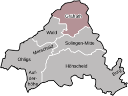
The Forstlicher Versuchsgarten Grafrath is an arboretum in Grafrath, Bavaria, Germany.
Tade is a village in Kose Parish, Harju County in northern Estonia.
Mount McLennan is a mountain 4 nautical miles (7 km) south of the Howard Hills in the northeast part of the Scott Mountains, Enderby Land, Antarctica. It was plotted from air photos taken from Australian National Antarctic Research Expeditions aircraft in 1956 and was named by the Antarctic Names Committee of Australia for K. McLennan, a member of the crew of the Discovery during the British Australian New Zealand Antarctic Research Expedition of 1929–31.