This page is based on this
Wikipedia article Text is available under the
CC BY-SA 4.0 license; additional terms may apply.
Images, videos and audio are available under their respective licenses.
The Ashton Canal is a canal in Greater Manchester, England.
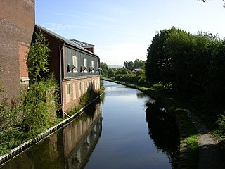
The Hollinwood Branch Canal was a canal near Hollinwood, in Oldham, England. It left the main line of the Ashton Canal at Fairfield Junction immediately above lock 18. It was just over 4.5 miles (7.2 km) long and went through Droylsden and Waterhouses to terminate at Hollinwood Basin. It rose through four locks at Waterhouses (19–22) and another four at Hollinwood (23–26). Immediately above lock 22 at Waterhouses was Fairbottom Junction where the Fairbottom Branch Canal started. Beyond Hollinwood Basin there was a lock free private branch, known as the Werneth Branch Canal, to Old Lane Colliery, which opened in 1797. It is a biological Site of Special Scientific Interest and a Local Nature Reserve.

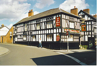
Hollinwood is an area and electoral ward of the Metropolitan Borough of Oldham, Greater Manchester, England. The population at the 2011 census was 10,920.

Coton is a village in Shropshire. It lies near the road from Whitchurch to Wem, about one mile southeast of Hollinwood.

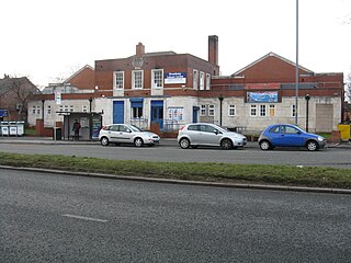
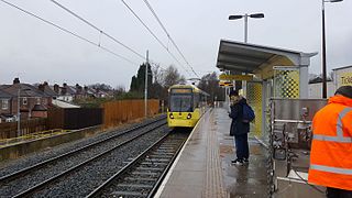
Hollinwood tram stop is a tram stop on the Oldham and Rochdale Line (ORL) in Hollinwood, Greater Manchester, England. It was formerly a railway station before its conversion to Metrolink in 2012.

Failsworth tram stop is a Manchester Metrolink tram stop on the Oldham and Rochdale Line (ORL) in Failsworth, Greater Manchester. It was formerly a railway station before its conversion to Metrolink in 2012.
One third of Oldham Metropolitan Borough Council in Greater Manchester, England is elected each year, followed by one year without election. Since the last boundary changes in 2004, 60 councillors have been elected from 20 wards.

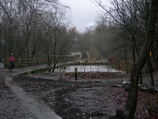
Daisy Nook is a country park in Failsworth, Greater Manchester, England. The park runs through the Medlock Valley in an area once called Waterhouses. Waterhouses was one of three 'houses' in the Failsworth area, the other two being Millhouses and Woodhouses.

Stotts Tours (Oldham) is a bus company based in Oldham.
Droylsden railway station served the town of Droylsden, Lancashire, England.
Hollinwood may refer to two places in England:
New Moston is a district within the City of Manchester, in North West England.
Abraham Moss is a Manchester Metrolink tram stop on the Bury Line. The station gained funding approval in 2010 and replaced nearby Woodlands Road stop. It is close to the local library and college campus. The planning application for the station was lodged June 2010. Construction began on 18 October 2010 and the station became operational on 18 April 2011.

Ace Mill is a cotton spinning mill in Chadderton in the Metropolitan Borough of Oldham, Greater Manchester. It was built as Gorse No. 2 Mill, in 1914 and cotton was first spun in 1919 by the Ace Mill Ltd, who renamed the mill. It was taken over by the Lancashire Cotton Corporation in the 1930s and passed to Courtaulds in 1964. Production finished in 1967.

Fox Mill, Hollinwood is a cotton spinning mill in Hollinwood, Oldham, Greater Manchester. It was taken over by the Lancashire Cotton Corporation in the 1930s and passed to Courtaulds in 1964.

Newton Heath and Moston is a Manchester Metrolink tram stop on the Oldham and Rochdale Line (ORL), in the Newton Heath area of Manchester, England.

Butler Green is a locality in the town of Chadderton in the Metropolitan Borough of Oldham, Greater Manchester. The area is also known as Washbrook.
Limeside, also known as Limehurst Village, is a large housing estate in the town of Oldham, Greater Manchester. Lying 2 miles south of Oldham town centre, it is contiguous with Hollinwood, Failsworth, Hollins and Garden Suburb. The Daisy Nook countryside park lies to the south of the estate. Limeside lies within the Hollinwood ward district.