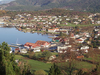
Fitjar is a municipality in Hordaland county, Norway. The municipality is located in the traditional district of Sunnhordland. Fitjar municipality includes the northern part of the island of Stord and the hundreds of surrounding islands, mostly to the northwest of the main island. The administrative centre of the municipality is the village of Fitjar.

The Hardangerfjord is the fourth longest fjord in the world, and the second longest fjord in Norway. It is located in Hordaland county in the Hardanger region. The fjord stretches 179 kilometres (111 mi) from the Atlantic Ocean into the mountainous interior of Norway along the Hardangervidda plateau. The innermost point of the fjord reaches the town of Odda.
Vigdarvatnet is a lake in the municipality of Sveio in Hordaland county, Norway. A small arm off the main lake juts to the south and runs along the municipal-county border between Sveio in Hordaland county and the town of Haugesund in Rogaland county. The 10-kilometre (6.2 mi) long lake forms a U-shape. It is fed by the nearby lake Stakkastadvatnet to the south, and it empties into the Ålfjorden, a small fjord arm off the main Hardangerfjorden. The village of Sveio lies on the northwestern shore of the lake.
Langevåg is a village in Bømlo municipality in Hordaland county, Norway. It is located on the southern tip of the island of Bømlo, along the Bømlafjorden. It lies in the far southern part of the municipality, about 12 kilometres (7.5 mi) south of the village of Lykling. The 1.15-square-kilometre (280-acre) village has a population (2013) of 796, giving the village a population density of 692 inhabitants per square kilometre (1,790/sq mi). This makes it the fourth largest village in the municipality.

Sagvåg is a village in Stord municipality in Hordaland county, Norway. The village is located on the southwest coast of the island of Stord, about 5 kilometres (3.1 mi) west of the town of Leirvik. The Stord Airport, Sørstokken lies about 2 kilometres (1.2 mi) northwest of Sagvåg. Nysæter Church was built here in 1991 to serve the population of the village. The small mining village of Litlabø lies just northeast of Sagvåg.

The Stjørnfjord or Stjørnfjorden is an arm of Trondheimsfjorden that flows through the municipalities of Bjugn, Ørland, and Indre Fosen in Trøndelag county, Norway. The 20-kilometre (12 mi) long fjord stretches southwest from the mouth of the Nordelva river near the village of Råkvåg to the Trondheimsfjord near Brekstad and Austrått. The inner part of the fjord splits into two smaller arms, the Nordfjord and Sørfjord. The Bjugnfjorden lies about 6 kilometres (3.7 mi) north of the fjord.

Sørfjorden is a 38-kilometre (24 mi) long fjord that is one of the innermost branches of the main Hardangerfjorden in Hordaland county, Norway. It is the longest arm that branches off of the Hardangerfjord. Sørfjorden stretches from just north of the village of Kinsarvik straight south to the industrial town of Odda. The Folgefonna glacier and Folgefonna National Park are located just to the west of the fjord and the Hardangervidda mountain plateau lies to its east.

Austfjorden is a fjord in Hordaland county, Norway. The 20-kilometre (12 mi) long fjord runs along the border between the municipalities of Lindås and Masfjorden. It starts in Lindås and extends to the northwest. The Masfjorden joins the Austfjorden from the north, and then the Austfjorden empties into the Fensfjorden before reaching the open sea near Fedje. The Austfjorden is the innermost arm of the Fensfjorden. The village of Knarrviki and the Mongstad industrial area lie on the western shore of the Austfjorden. The village of Myking lies on the western shore of the fjord, near the innermost part of the fjord.

Bømlo is an island in Hordaland county, Norway. At 171 square kilometres (66 sq mi), it is the largest island in the island municipality Bømlo lying just off the western coast of Norway. The island sits at the northern entrance to the vast Hardangerfjorden, west of the Stokksundet strait, south of the Selbjørnsfjorden, and east of the North Sea. In the 1800s, the Kulleseid Canal was built across a small isthmus in the central part of the island, giving a shortcut from the eastern side of the island to the western side of the island.
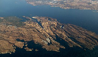
Spissøy or Spyssøya is an island in Bømlo municipality in Hordaland county, Norway. The 1.5-square-kilometre (0.58 sq mi) island lies at the confluence of the Stokksundet strait and the Hardangerfjorden. The island of Bømlo lies to the northwest, the island of Moster lies to the southwest, the island of Otterøya lies to the southeast, and the island of Nautøya lies to the northeast. Spyssøya is connected to the island of Bømlo by the Spissøy Bridge and to the island of Nautøya via the Bømla Bridge. Permanent inhabitants on the small island were few until the bridges were built. Since that time, the island's population has been increasing.
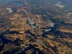
Stokksundet is a sound between the islands of Stord and Bømlo in Hordaland county, Norway. It is about 15 kilometres (9.3 mi) long and it runs from the village of Koløyhamn in the north to the islands of Føyno, Nautøya, and Spyssøya in the south. The Digernessundet is a small strait on the south end that connects the Stokksundet to the vast Hardangerfjorden. On the southern end of the strait, the Stord Bridge and Bømla Bridge cross the sound, connecting the islands of Stord and Bømlo to the Bømlafjord Tunnel as part of the Triangle Link which connects both islands to the mainland.

Bjørnafjorden is a fjord in Hordaland county, Norway. It runs through the municipalities of Austevoll, Fusa, Os, and Tysnes. The large island of Tysnesøya lie along the south side of the Bjørnafjorden and the Bergen Peninsula and the mainland lie along the north and east sides of the fjord. The Fusafjorden split off from the main fjord on the north side by the village of Osøyro. The 30-kilometre (19 mi) fjord is about 10 kilometres (6.2 mi) wide and its maximum depth is 583 metres (1,913 ft) below sea level.

Selbjørnsfjorden is a fjord in Hordaland county, Norway. The 20-kilometre (12 mi) long fjord flows east-west between the municipalities of Austevoll, Fitjar, and Bømlo. It is a wide fjord that starts at the Slåtterøy Lighthouse at the North Sea in the west and flows to the strait of Langenuen in the east. The central part of the fjord reaches about 8 kilometres (5.0 mi) wide. The fjord is named after the nearby island of Selbjørn.
Svortland or Bremnes is the administrative centre of Bømlo municipality in Hordaland county, Norway. The village is located in the north-central part of the island of Bømlo, about 6 kilometres (3.7 mi) west of the village of Rubbestadneset. The village surrounds the lake Storavatnet. The Norwegian County Road 542 runs through the village.
Fedjefjorden is a fjord in Hordaland county, Norway. It is located in the municipalities of Fedje, Austrheim, and Øygarden. The fjord has a width of about 5 kilometres (3.1 mi) and extends about 20 kilometres (12 mi) from Holmengrå Lighthouse to the island of Seløy where it joins the Hjeltefjorden which flows further south towards Bergen.

Norwegian National Road 7 is a national road in Norway which runs from the town of Hønefoss in Buskerud county to the village of Granvin in Hordaland county. The route is 387.6 kilometres (240.8 mi) long and runs east–west through Buskerud and Hordaland counties over the vast Hardangervidda plateau.
Valevåg is a village in Sveio municipality in Hordaland county, Norway. The village is located on the northern end of the Sveio peninsula, along the southern shore of the Hardangerfjorden. Historically, Valevåg was the administrative centre of the old municipality of Valestrand until it was merged into Sveio in 1964. Valen Chapel is in the village of Valevåg, and just outside the village to the south is the much larger Valestrand Church.

Etnefjorden is a fjord on the border between Hordaland and Rogaland counties in Norway. The majority of the fjord lies in the municipality of Etne, but a small part of it also lies in the neighboring municipality of Vindafjord in Rogaland county. The 8.5-kilometre (5.3 mi) long fjord flows from the village of Etnesjøen to the west into the Skånevikfjorden/Hardangerfjorden. The fjord is fed by the Etneelva river which empties into the fjord at the village of Etnesjøen. The European route E134 highway runs along the inner part of the fjord.