Irvine New Town Trail

Last updated

The Irvine New Town Trail is a recreational cycleway and footpath around Irvine, North Ayrshire, Scotland. The route is 19 kilometres (12 mi) long. The trail is used by many dog walkers and cyclists in the area.

Irvine, North Ayrshire town in North Ayrshire, Scotland

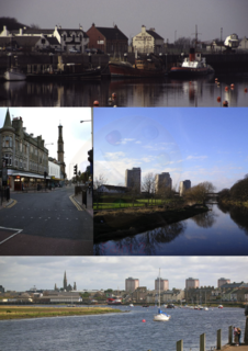
Irvine is an ancient settlement, in medieval times a royal burgh, and now a new town on the coast of the Firth of Clyde in North Ayrshire, Scotland. The 2011 Census recorded the town's population at 33,698 inhabitants, making it the largest settlement in North Ayrshire.

North Ayrshire Council area of Scotland

North Ayrshire is one of 32 council areas in Scotland. It has a population of roughly 135,800 people. It is located in the southwest of Scotland, and borders the areas of Inverclyde to the north, Renfrewshire to the northeast and East Ayrshire and South Ayrshire to the east and south respectively. North Ayrshire Council is a hung Council. North Ayrshire also forms part of the east coast of the Firth of Clyde.

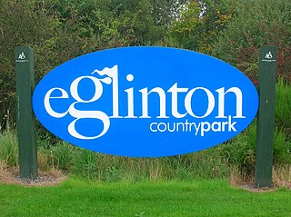
The route forms a ring with no specific start and end points. Taken in a clockwise direction from the town's main Rivergate Centre, the trail runs beside the River Irvine through Irvine's Low Green, continues north beside the railway line past the Towns Moor and the Garnock Floods wildlife reserve, then goes along beside the River Garnock towards Kilwinning's Woodwynd and Blacklands area. At this point, it diverges from the Ayrshire Coastal Path, crossing the river along the route of the former Doura colliery branch line of the Ardrossan Railway before following the Lugton Water eastwards through Eglinton Country Park: a very popular area for recreational activities, with historical interest at Eglinton Castle.

River Irvine river in the United Kingdom

The River Irvine is a river that flows through southwest Scotland. Its watershed is on the Lanarkshire border of Ayrshire at an altitude of 810 feet (250 m) above sea-level, near Loudoun Hill, Drumclog, and 7 miles (11 km) SW by W of Strathaven. It flows 29½ miles westward, dividing the old district of Cunninghame from that of Kyle, until it reaches the sea via Irvine Harbour in the form of the Firth of Clyde, and flows into Irvine Bay by the town of Irvine. It has many tributaries, some of which form parish, district and other boundaries.

River Garnock river in the United Kingdom

The River Garnock, the smallest of Ayrshire's six principal rivers, has its source on the southerly side of the Hill of Stake in the heart of the Clyde Muirshiel Regional Park. About a mile and a half south of this starting point the untested stream tumbles over the Spout of Garnock, the highest waterfall in Ayrshire, once thought to be the river's origin. The river then continues, for a total length of 20 miles (32 km) or so, through the towns of Kilbirnie, Glengarnock, Dalry and Kilwinning to its confluence with the River Irvine at Irvine Harbour.

Kilwinning town in North Ayrshire, Scotland

Kilwinning is a town in North Ayrshire, Scotland. It is on the River Garnock, north of Irvine, about 21 miles (34 km) south of Glasgow. It is known as "The Crossroads of Ayrshire". Kilwinning was also a Civil Parish. The 2001 Census recorded the town as having a population of 15,908. At the 2011 Census, Kilwinning had a population of 21,456.

The trail rejoins the disused Ardrossan Railway line at Sourlie Wood nature reserve, and follows the old track south through Girdle Toll in a cutting which formerly led to the Perceton colliery. The trail then runs beside the Annick Water, initially southwards through parkland and countryside to the east of Bourtreehill. It follows the river west in parkland between Broomlands and Dreghorn, using the disused Glasgow, Paisley, Kilmarnock and Ayr Railway trackbed past the site of the former Dreghorn railway station, then rejoins the River Irvine riverbank heading north back to the Rivergate shopping mall.

Girdle Toll village in the United Kingdom

Girdle Toll is an area of Irvine, North Ayrshire.

Perceton is a medieval settlement and old country estate in North Ayrshire, Scotland, near the town of Irvine. The ruined church in Perceton is one of the oldest buildings in the Irvine district. The earliest legible gravestone dates from 1698, though older stone coffins will certainly still rest deep within the small hillock on which the chapel and graveyard sit.

Annick Water river in the United Kingdom

The Annick Water is the largest tributary of the River Irvine. The river runs from Long Loch, just inside East Renfrewshire, in a generally south-western direction through North Ayrshire and East Ayrshire, to confluence with its parent river at Irvine, North Ayrshire on the west coast of Scotland. The name may derive from the Gaelic for 'overflowing' and Strathannick is very much prone to flooding as recorded by SEPA.

The route forms part of the national cycle network with routes 7 and 73 forming part of the route.

Coordinates: 55°38′40″N4°39′47″W / 55.64444°N 4.66306°W / 55.64444; -4.66306

Geographic coordinate system Coordinate system

A geographic coordinate system is a coordinate system that enables every location on Earth to be specified by a set of numbers, letters or symbols. The coordinates are often chosen such that one of the numbers represents a vertical position and two or three of the numbers represent a horizontal position; alternatively, a geographic position may be expressed in a combined three-dimensional Cartesian vector. A common choice of coordinates is latitude, longitude and elevation. To specify a location on a plane requires a map projection.


Related Research Articles

Glasgow, Paisley and Johnstone Canal

The Glasgow, Paisley and Ardrossan Canal, later known as the Glasgow, Paisley and Johnstone Canal, was a canal in the west of Scotland, running between Glasgow, Paisley and Johnstone which later became a railway. Despite the name, the canal was never completed down to Ardrossan, the termini being Port Eglinton in Glasgow and Thorn Brae in Johnstone. Within months of opening, the canal was the scene of a major disaster.

Cunninghame is a former comital district of Scotland and also a district of the Strathclyde Region from 1975–1996.

Dreghorn village in United Kingdom

Dreghorn is a village in North Ayrshire, Scotland, 3.5 kilometres (2.2 mi) to the east of Irvine town centre, on the old main road from Irvine to Kilmarnock. It is sited on a ridge between two rivers. As archaeological excavations near the village centre have found a significant neolithic settlement provisionally dated to around 3500BC, as well as medieval structures, scholars have suggested that Dreghorn could be Britain's oldest continuously inhabited village. Both Irvine and Dreghorn have grown in size and they are now separated by the Annick Valley Park, which incorporates a footpath and National Cycle Route 73 on the route of the disused Irvine to Busby railway line.

Fullarton

Fullarton is a small area in Irvine, North Ayrshire. It is situated close to Irvine Bay and is next to several industrial estates, large supermarkets and retail stores and the town centre itself. Stagecoach Western buses operate the local bus services in the area. Fullarton is only 8 miles from Prestwick Airport and 25 miles from the city of Glasgow.

The Lanarkshire and Ayrshire Railway (L&AR) was an independent railway company built to provide the Caledonian Railway with a shorter route for mineral traffic from the coalfields of Lanarkshire to Ardrossan Harbour, in Scotland.

Kilwinning Abbey

Kilwinning Abbey is a ruined abbey located in the centre of the town of Kilwinning, North Ayrshire.

Glasgow, Paisley, Kilmarnock and Ayr Railway railway in Scotland

The Glasgow, Paisley, Kilmarnock and Ayr Railway (GPK&AR) was a railway in Scotland that provided train services between Glasgow, Kilmarnock and Ayr. It opened its first line, between Glasgow and Ayr, in stages from 1839 to 1840. The section between Glasgow and Paisley was made jointly with the Glasgow, Paisley and Greenock Railway. Later it built a line from Dalry via Kilmarnock to Cumnock, linking there with the Glasgow, Dumfries and Carlisle Railway, and together forming a through route from Glasgow to Carlisle. The two companies merged to form the Glasgow and South Western Railway.

Ardrossan Railway railway that ran services between Kilwinning and Ardrossan in Scotland

The Ardrossan Railway was a railway company in Scotland built in the mid-19th century that primarily ran services between Kilwinning and Ardrossan, as well as freight services to and from collieries between Kilwinning and Perceton. The line was later merged with the Glasgow and South Western Railway, and is today part of the Ayrshire Coast Line.

A78 road road in Scotland

The A78 is an A road in Scotland. It connects Greenock and Prestwick on a route which follows the northern section of the Ayrshire coast.

The Largs Branch is a railway line in Scotland, serving communities on the north Ayrshire Coast, as well as the deep water ocean terminal at Hunterston. It branches from the Glasgow to Ayr line at Kilwinning.

Eglinton Country Park

Eglinton Country Park is located in the grounds of the old Eglinton Castle estate, Kilwinning, North Ayrshire, Scotland. Eglinton Park is situated in the parish of Kilwinning, part of the former district of Cunninghame, and covers an area of 400 hectares. The central iconic feature of the country park is the ruined Eglinton Castle, once home to the Eglinton family and later the Montgomeries, Earls of Eglinton and chiefs of the Clan Montgomery. Eglinton Country Park is managed and maintained by North Ayrshire Council and its Ranger Service.

Fergushill village in the United Kingdom

Fergushill is a small community in North Ayrshire, Parish of Kilwinning, Scotland. The Barony of Fergushill was held by the Fergushill family of that Ilk and the area has a complex history.

Industry and the Eglinton Castle estate village in United Kingdom

The Eglinton Castle estate was situated at Irvine, on the outskirts of Kilwinning, North Ayrshire, Scotland in the former district of Cunninghame. Eglinton Castle, was once home to the Montgomeries, Earls of Eglinton and chiefs of the Clan Montgomery. Eglinton Country Park now occupies part of the site.