
Islington was a civil parish and metropolitan borough in London, England. It was an ancient parish within the county of Middlesex, and formed part of The Metropolis from 1855. The parish was transferred to the County of London in 1889 and became a metropolitan borough in 1900. It was amalgamated with the Metropolitan Borough of Finsbury to form the London Borough of Islington in Greater London in 1965.

Farringdon Road is a road in Clerkenwell, London.

Gainsborough Pictures was a British film studio based on the south bank of the Regent's Canal, in Poole Street, Hoxton in the former Metropolitan Borough of Shoreditch, north London. Gainsborough Studios was active between 1924 and 1951. The company was initially based at Islington Studios, which were built as a power station for the Great Northern & City Railway and later converted to studios.

The EC postcode area, also known as the London EC postal area, is a group of postcode districts in central London, England. It includes almost all of the City of London and parts of the London Boroughs of Islington, Camden, Hackney, Tower Hamlets and Westminster. The area covered is of very high density development. Deliveries for the EC postcode area are made from Mount Pleasant Mail Centre.
The WC postcode area, also known as the London WC postcode area, is a group of postcode districts in central London, England. The area covered is of high density development, and includes parts of the City of Westminster and the London Boroughs of Camden and Islington, plus a very small part of the City of London.

The Metropolitan Cattle Market, just off the Caledonian Road in the parish of Islington was built by the City of London Corporation and was opened in June 1855 by Prince Albert. The market was supplementary to the meat market at Smithfield and was established to remove the difficulty of managing live cattle at that latter site.

The London Borough of Islington is short of large parks and open spaces, given its status in recent decades as a desirable place of residence. In fact, Islington has the lowest ratio of open space to built-up areas of any London borough. The largest continuous open space in the borough, at 11.75 hectares, is Highbury Fields.
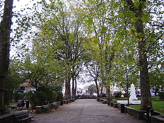
Islington Green is a small triangle of open land at the convergence of Upper Street and Essex Road in the London Borough of Islington. It roughly marks the northern boundary between the modern district of Angel and Islington proper.

The O2 Academy Islington, formerly known as the Carling Academy Islington, is an indoor music venue situated in the N1 Shopping Centre accessible via Upper Street and Liverpool Road, in the London Borough of Islington. It is run by the Academy Music Group. The main venue has a capacity of 800, and the adjacent O2 Academy 2 holds 250.

Charterhouse Street is a street in Smithfield, on the northern boundary of the City of London, forming the boundary with both the London Borough of Camden and the London Borough of Islington.

Camden Passage is a picturesque car-free London street minutes from the Angel tube station off Upper Street in the London Borough of Islington. The passage is known for its antique shops, markets and its array of independent shops, cafes and restaurants.

The Mount Pleasant Mail Centre is a mail centre operated by Royal Mail in London, England. The site has previously operated as one of the largest sorting offices in the world. It is located in the London Borough of Islington, on the boundary with the London Borough of Camden.

Barnsbury Wood is a Local Nature Reserve and Site of Borough Importance for Nature Conservation, Grade I, in Barnsbury in the London Borough of Islington. With an area of only 0.35 hectares, it is the smallest Local Nature Reserve in London It is owned and managed by Islington Council.

Gillespie Park is a 3.4 hectare Local Nature Reserve and Site of Metropolitan Importance for Nature Conservation in Highbury in the London Borough of Islington. It also hosts the Islington Ecology Centre, which provides environmental education for schools and organises walks and talks for adults. It is owned and managed by Islington Council. The site is protected by Fields in Trust through a legal "Deed of Dedication" safeguarding the future of the space as public recreation land for future generations to enjoy.

The Slug and Lettuce is a Grade II listed public house at 330 Upper Street and Islington Green, Islington, London.
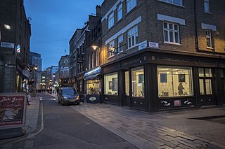
Whitecross Street is a short street in Islington, in Inner London. It features an eponymous street market and a large housing estate.

Islington Assembly Hall is a Grade II listed live music venue and events space on Upper Street, Islington, London. It has a capacity of up to 800 for live events, including seating for 200 in its balcony Events other than music shows, such as public meetings, also take place there.

Angel Recording Studios Limited is a British recording studio based in the eponymous recording and mixing complex in Islington, London. The company was incorporated by James Warren Sylvester de Wolfe on 5 December 1978.


