Richmondtown is a neighborhood in the Mid-Island section of Staten Island, New York City. It is bounded by Arthur Kill Road on the northwest, Richmond Road on the north, Amboy Road on the east and southeast, and the United Hebrew and Ocean View cemeteries on the southwest.

Richmond Creek is a major stream in Staten Island, a borough of New York City in the United States. Its upper drainage basin includes the remote forested hills in the center of the island. It empties into the Fresh Kills.
Historic Richmond Town is an authentic town and farm museum complex in the neighborhood of Richmondtown, Staten Island, in New York City. It is located near the geographical center of the island, at the junction of Richmond Road and Arthur Kill Road. Staten Island Historical Society and Historic Richmond Town are two different names for the same organization, reflecting its long history and evolution.

The term North Shore is frequently applied to a series of neighborhoods within the New York City borough of Staten Island.

Richmond Valley is the name of a neighborhood located on the South Shore of Staten Island, one of the five boroughs of New York City, the largest city in the United States. Richmond Valley is bordered on the north by Pleasant Plains, to the south by Tottenville, to the west by the Arthur Kill, and to the east by the Lower New York Bay.
Graniteville is the name of a neighborhood in Staten Island, one of the five boroughs of New York City, USA.
Lighthouse Hill is the name of a hill, and the neighborhood situated thereon, in the New York City borough of Staten Island. Lighthouse Hill is situated to the north of Richmondtown, south of Todt Hill, and west of Grant City.

The Abraham Manee House, also known as the Manee-Seguine Homestead, is a three-part Colonial Dutch dwelling on Staten Island in New York. It was designated a New York City landmark in 1984. Located on Purdy Place adjacent to Lemon Creek, on the South Shore of Staten Island, the oldest section is a one-room structure built by Paulus Regrenier in 1670, a French Huguenot fleeing religious persecution in Europe. The building is similar to the Billiou-Stillwell-Perine House in Old Town.

The Christopher House is an outstanding example of a provincial pre-Revolutionary War vernacular farmhouse of stone masonry. It is associated with two of the oldest Staten Island families. It was also used as a meeting place during the American Revolution, while being the residence of Joseph Christopher, a member of the Richmond County Committee of Safety from 1775-1776. It was moved to Historic Richmond Town the Autumn of 1969 and restored for museum presentation from 1975-1977.

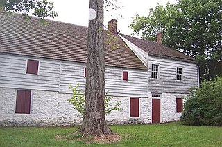
The Britton Cottage, formerly known as the Cubberly House, is a house in the Historic Richmond Town museum complex in the neighborhood of Richmondtown, Staten Island, in New York City. The oldest section of the cottage dates to 1671, with additions in the mid-18th century. It is constructed of stone and timberframe components. The house was originally located at the intersection of New Dorp Lane and Cedar Grove Avenue in the New Dorp Beach section of Staten Island, but was moved to its current location in 1967 when it was threatened with demolition.

The Boehm House is an historic house at 75 Arthur Kill Road in the Richmondtown section of the borough of Staten Island in New York City. This 1750 house, relocated from Greenridge as a part of Historic Richmondtown, was typical of rural New York during the American Revolution. Also on view in the house: an exhibit of early building techniques and restorations. It was designated a New York City landmark in 1969 as the "Boehm-Frost House".
The Treasure House is a historic building located in Staten Island, New York City, New York, US. Samuel Grasset, a tanner and leather worker, built the original construction in approximately 1700. Additions were made in 1740, 1790 and 1860. Subsequent owners of the house in subsequent centuries include a cord wainer (shoemaker), innkeeper, stonemason, and coach trimmer. A number of local businesses have also occupied the structure. The house was named after a legend that a cache of American Revolutionary War era gold coins was discovered during renovation in about 1860.

Old Town is a neighborhood in the New York City borough of Staten Island, located on its East Shore. Old Town was established in August 1661 as part of New Netherland, and was the first permanent European settlement on Staten Island. Originally described as "Oude Dorpe", much of its original territory makes up what is present-day South Beach, with parts of Midland Beach and Dongan Hills. The area was settled by a group of Dutch, Walloon and French Protestants (Huguenots) led by Walloon Pierre Billiou.
The Staten Island Cricket Club (SICC) is a cricket club on Staten Island, New York that was incorporated as the Staten Island Cricket and Base Ball Club on March 22, 1872. It became the first tennis venue in the United States.

The Church of St. Patrick is a parish church under the authority of the Roman Catholic Archdiocese of New York, located in the Richmondtown area of Staten Island, New York City.

Southfield was a Town in Richmond County, New York. It was located in the southeastern part of Staten Island, along Lower New York Bay prior to the incorporation of Staten Island into New York City in 1898, bounded on the west roughly by Richmond Road, Giffords Lane, Amboy Road, and Arden Avenue.
Middletown was a town in Richmond County, New York. It was incorporated in 1860 from parts of Southfield and Castleton. At the time, it included the most populous part of the village of Edgewater and the hilly ridges of the interior, Grymes Hill and Todt Hill among others.
Westfield was a town in Richmond County, New York. It was incorporated in 1788 as one of the four original towns of Staten Island. It was dissolved in 1898 upon consolidation into the City of New York.
Northfield was a town in Richmond County, New York. It was incorporated in 1788 as one of the four original towns of Staten Island. It was dissolved in 1898 upon consolidation into the City of New York.