Krasnoyarsk Krai is a federal subject of Russia, with its administrative center in the city of Krasnoyarsk—the third-largest city in Siberia. Comprising half of the Siberian Federal District, Krasnoyarsk Krai is the largest krai in the Russian Federation, the second largest federal subject and the third largest subnational governing body by area in the world, after Sakha and the Australian state of Western Australia. The krai covers an area of 2,339,700 square kilometers (903,400 sq mi), which is nearly one quarter the size of the entire country of Canada, constituting roughly 13% of the Russian Federation's total area and containing a population of 2,828,187, or just under 2% of its population, per the 2010 Census.

Khabarovsk Krai is a federal subject of Russia. It is geographically located in the Far East region of the country and is a part of the Far Eastern Federal District. The administrative centre of the krai is the city of Khabarovsk, which is home to roughly half of the krai's population and the second largest city in the Russian Far East. Khabarovsk Krai is the fourth-largest federal subject by area, with a population of 1,343,869 as of the.

Primorsky Krai (Russian: Примо́рский край, tr. Primorsky kray, IPA: [prʲɪˈmorskʲɪj kraj] is a federal subject of Russia, located in the Far East region of the country and is a part of the Far Eastern Federal District. The city of Vladivostok is the administrative center of the krai, as well as the largest city in the Russian Far East. The krai has the largest economy among the federal subjects in the Russian Far East, and a population of 1,956,497 as of the 2010 Census.

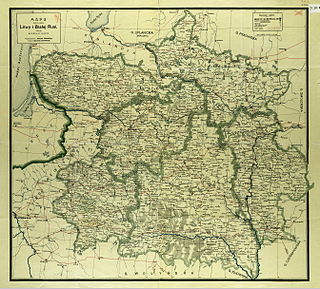
The Russian Far East comprises the Russian part of the Far East, the eastermost territory of Russia, between Lake Baikal in Eastern Siberia and the Pacific Ocean.

Stavropol Krai is a federal subject of Russia. It is geographically located in the North Caucasus region in Southern Russia, and is administratively part of the North Caucasian Federal District. Stavropol Krai has a population of 2,786,281 (2010).

Stavropol is a city and the administrative center of Stavropol Krai, Russia. As of the 2010 Census, its population was 398,539.

Altai Krai is a federal subject of Russia. It borders with the regions of, clockwise from the west, Kazakhstan, Novosibirsk and Kemerovo Oblasts, and the Altai Republic. The krai's administrative center is the city of Barnaul. As of the 2010 Census, the population of the krai was 2,419,755.
Barnaul is a city and the administrative center of Altai Krai, Russia, located at the confluence of the Barnaulka and Ob Rivers in the West Siberian Plain. As of the 2010 Census, its population was 612,401.

Krasnodar Krai is a federal subject of Russia, located in the North Caucasus region in Southern Russia and administratively a part of the Southern Federal District. Its administrative center is the city of Krasnodar. The third most-populous federal subject, the krai had a population of 5,226,647 as of the 2010 Census.

The North Caucasus or Ciscaucasia is the northern part of the Caucasus region between the Sea of Azov and Black Sea on the west and the Caspian Sea on the east, in Russia. Geographically, the Northern Caucasus includes the Russian republics and krais of the North Caucasus. As part of the Russian Federation, the Northern Caucasus region is included in the North Caucasian and Southern Federal Districts and consists of Krasnodar Krai, Stavropol Krai, and the constituent republics, approximately from west to east: the Republic of Adygea, Karachay–Cherkessia, Kabardino-Balkaria, North Ossetia–Alania, Ingushetia, Chechnya, and the Republic of Dagestan.

A krai is a type of federal subject of Russia. The country is divided into 85 federal subjects, of which nine are krais. Oblasts, another type of federal subject, are legally identical to krais and the difference between a political entity with the name "krai" or "oblast" is purely traditional, similar to the commonwealths in the United States; both are constituent entities equivalent in legal status in Russia with representation in the Federation Council. During the Soviet era, the autonomous oblasts could be subordinated to republics or krais, but not to oblasts.

Russia is divided into twelve economic regions —groups of federal subjects sharing the following characteristics:

Perm Krai is a federal subject of Russia that came into existence on December 1, 2005 as a result of the 2004 referendum on the merger of Perm Oblast and Komi-Permyak Autonomous Okrug. The city of Perm is the administrative center. Population: 2,635,276.

Kamchatka Krai is a federal subject of Russia. It is geographically located in the Far East region of the country, and it is administratively part of the Far Eastern Federal District. Kamchatka Krai has a population of 322,079 (2010).
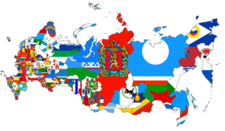
This gallery of flags of federal subjects of Russia shows the flags of the 85 federal subjects of Russia.

Zabaykalsky Krai is a federal subject of Russia that was created on March 1, 2008 as a result of a merger of Chita Oblast and Agin-Buryat Autonomous Okrug, after a referendum held on the issue on March 11, 2007. Formerly part of the Siberian Federal District, the Krai is now part of the Russian Far East as of November 2018 in accordance with a decree issued by Russian President Vladimir Putin. The administrative center of the krai is located in the city of Chita. As of the 2010 Census, the population was 1,107,107.
Russia has international borders with 16 sovereign states, including two with maritime boundaries, as well as with the partially recognized states of South Ossetia and Abkhazia. With a land border running 20,241 kilometres (12,577 mi) in total, Russia has, the second-longest land border of any country.
Taymyrsky Dolgano-Nenetsky District is an administrative and municipal district (raion), one of the forty-three in Krasnoyarsk Krai, Russia. It is located in the north of the krai above the Arctic Circle on the Taymyr Peninsula and borders with Laptev and Kara Seas in the north, the Sakha Republic in the east, Evenkiysky and Turukhansky Districts in the south, and with Yamalo-Nenets Autonomous Okrug in the west. The area of the district is 879,900 square kilometers (339,700 sq mi). Its administrative center is the town of Dudinka. Population: 34,432 (2010 Census); 39,786 ; 55,111 (1989 Census). The population of Dudinka accounts for 64.4% of the district's total population.