This article may be expanded with text translated from the corresponding article in German. (February 2010)Click [show] for important translation instructions.
|
| La Bélgica | |
|---|---|
| Town | |
| Country | |
| Time zone | BST (UTC-4) |
La Bélgica is a small town in Bolivia.
This article may be expanded with text translated from the corresponding article in German. (February 2010)Click [show] for important translation instructions.
|
| La Bélgica | |
|---|---|
| Town | |
| Country | |
| Time zone | BST (UTC-4) |
La Bélgica is a small town in Bolivia.

The Arctic Archipelago, also known as the Canadian Arctic Archipelago, is a group of islands north of the Canadian mainland.

The Usarp Mountains is a major Antarctic mountain range, lying westward of the Rennick Glacier and trending N-S for about 190 kilometres (118 mi). The feature is bounded to the north by Pryor Glacier and the Wilson Hills. Its important constituent parts include Welcome Mountain, Mount Van der Hoeven, Mount Weihaupt, Mount Stuart, Mount Lorius, Smith Bench, Mount Roberts, Pomerantz Tableland, Daniels Range, Emlen Peaks, Helliwell Hills and Morozumi Range.

The Mexican Riviera refers collectively to twenty cities and lagoons lying on the western coast of Mexico. Although there are long distances between these cities, they are often collectively referred to as the Mexican Riviera because of their many oceanfront resorts and their popularity among tourists. Cruise ships often visit three or four of these destinations on their longer cruises. In a 2005 interview Stanley McDonald, the founder of Princess Cruises, mentioned:
The call of the "Mexican Riviera" was coined by Princess Cruise Line. Now everyone refers to it as the Mexican Riviera. I believe that it really spoke to the quality and beauty of what people would see down there. We all know the French Riviera -- the Mexican Riviera was something we had in the western hemisphere.

Athos Range is the northernmost range in the Prince Charles Mountains of Mac. Robertson Land, Antarctica. The range consists of a large number of individual mountains and nunataks that trend east-west for 40 miles (60 km) along the north side of Scylla Glacier.
Attlee Glacier is a glacier 8 miles (13 km) long, which flows east-southeast from the plateau escarpment on the east side of Graham Land to the head of Cabinet Inlet to the north of Bevin Glacier.

Guerrero is a municipality located in the Mexican state of Tamaulipas.
The Boeing T60 was a family of small turboshaft/turboprop engines produced by Boeing, based on Boeing's earlier Model 500 gas generator and Model 502 (T50) turboshaft engines.

The Continental CAE T51 was a small turboshaft engine produced by Continental Aviation and Engineering (CAE) under license from Turbomeca. A development of the Artouste, it was followed by three additional turboshaft engines, the T72, the T65, and the T67. However, none of these engines, including the T51, entered full production. CAE abandoned turboshaft development in 1967 after the XT67 lost to the Pratt & Whitney Canada PT6T (T400) to power the Bell UH-1N Twin Huey.
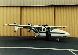
The Basler Turbo 37/Spectrum SA-550 is a twin-boom single engined aircraft converted from a Reims/Cessna FTB337G Skymaster by Basler Turbo Conversions and Spectrum Aircraft Corporation. The aircraft first flew on 1 February 1983.
Mount Dockery is a mountain, 1,095 m (3,590 ft) high, standing 6 km (4 mi) west of Mount Matthias in the western part of the Everett Range in the Concord Mountains of northern Victoria Land, Antarctica. It stands on the Pennell Coast, between Cape Williams and Cape Adare.
Fidase Peak is a distinctive peak 9 nautical miles (17 km) east of Mount Jacquinot, rising to 915 metres (3,000 ft) at the west end of Mott Snowfield, Trinity Peninsula. The name represents the initial letters of the Falkland Islands and Dependencies Aerial Survey Expedition (FIDASE) (1955–57) led by P.G. Mott.

Hale Glacier is a glacier about 6 nautical miles (11 km) long, located just east of Mount Simpson on Thurston Island, Antarctica, and flowing southwest to the Abbot Ice Shelf in Peacock Sound. It was delineated from air photos taken by U.S. Navy Squadron VX-6 in January 1960, and was named by the Advisory Committee on Antarctic Names (US-ACAN) for Lieutenant Bill J. Hale, U.S. Navy, a helicopter pilot aboard USS Burton Island who made exploratory flights to Thurston Island in February 1960.
Hansen Spur is a spur, 8 nautical miles (15 km) long, descending from the northwest side of Nilsen Plateau, in the Queen Maud Mountains of Antarctica, and terminating at the edge of Amundsen Glacier just east of the Olsen Crags. It was mapped by the United States Geological Survey from surveys and U.S. Navy air photos, 1960–64, and was named by the Advisory Committee on Antarctic Names for Ludvig Hansen, a member of the sea party aboard the Fram on Amundsen's Norwegian expedition of 1910–12. This naming preserves the spirit of Amundsen's 1911 commemoration of "Mount L. Hansen," a name applied for an unidentified mountain in the general area. The Blackwall Glacier flows northwest along the northeast side of Hansen Spur to join Amundsen Glacier.
View Point is 150m long eastern tip of a promontory, on Antarctica, forming the west side of the entrance to Duse Bay on the south coast of Trinity Peninsula, on the northern portion of the Antarctic Peninsula. Situated 6.79 km east of Skomlya Hill and 6.45 km southeast of Boil Point. Discovered by a party under J. Gunnar Andersson of the Swedish Antarctic Expedition, 1901-04. So named by the Falkland Islands Dependencies Survey (FIDS) following their survey of the area in 1945 because from this promontory, good panoramic photographs were obtained.
Mount Bailey is a mountain, 1,445 metres (4,740 ft) high, which stands south of Anthony Glacier and 6 nautical miles (11 km) west-southwest of Lewis Point, on the east coast of Palmer Land, Antarctica. It was charted in 1936–37 by a British Graham Land Expedition sledge party under John Riddoch Rymill, and was recharted in 1947 by a joint sledge party consisting of members of the Ronne Antarctic Research Expedition (RARE), and the Falkland Islands Dependencies Survey. It was named by Finn Ronne for Commander Clay W. Bailey, U.S. Navy, a member of the Byrd Antarctic Expedition, 1933–35, and the West Base party of the U.S. Antarctic Service, 1939–41, who assisted in outlining the RARE radio requirements.

The Mercedes-Benz S-Class (C217) is a full-size luxury car/grand tourer manufactured by Mercedes-Benz since 2014.
German submarine U-767 was a Type VIIC U-boat built for Nazi Germany's Kriegsmarine for service during World War II. She was laid down on 5 April 1941 by Kriegsmarinewerft Wilhelmshaven as yard number 150, launched on 10 July 1943 and commissioned on 11 September 1943 under Oberleutnant zur See Walter Dankleff.

German submarine U-955 was a Type VIIC U-boat of Nazi Germany's Kriegsmarine during World War II.
Coordinates: 17°33′S63°13′W / 17.550°S 63.217°W

A geographic coordinate system is a coordinate system that enables every location on Earth to be specified by a set of numbers, letters or symbols. The coordinates are often chosen such that one of the numbers represents a vertical position and two or three of the numbers represent a horizontal position; alternatively, a geographic position may be expressed in a combined three-dimensional Cartesian vector. A common choice of coordinates is latitude, longitude and elevation. To specify a location on a plane requires a map projection.
| This Santa Cruz Department location article is a stub. You can help Wikipedia by expanding it. |