This page is based on this
Wikipedia article Text is available under the
CC BY-SA 4.0 license; additional terms may apply.
Images, videos and audio are available under their respective licenses.

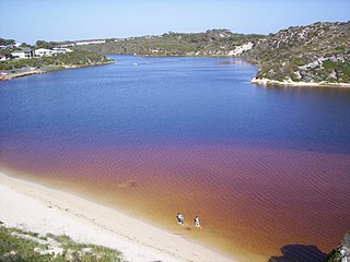
Watheroo National Park is a national park in Western Australia, 187 km north of Perth. It contains Jingemia Cave.

Yagan was an Indigenous Australian warrior from the Noongar people. He played a key part in early resistance to British colonial settlement and rule in the area surrounding what is now Perth, Western Australia. Yagan was pursued by the local authorities after he killed Erin Entwhistle, a servant of farmer Archibald Butler. It was an act of retaliation after Thomas Smedley, another of Butler's servants, shot at a group of Noongar people stealing potatoes and fowls, killing one of them. The government offered a bounty for Yagan's capture, dead or alive, and a young settler, William Keats, subsequently shot and killed him. Yagan's execution figures in Australian history as a symbol of the unjust and sometimes brutal treatment of the indigenous peoples of Australia by colonial settlers. He is considered a hero by the Noongar.

Western Port, commonly but unofficially known as Western Port Bay, is a large tidal bay in southern Victoria, Australia, opening into Bass Strait. It is the second largest bay in the state. Geographically, it is dominated by the two large islands; French Island and Phillip Island. Contrary to its name, it lies to the east of the larger Port Phillip, and is separated from it by the Mornington Peninsula. It is visited by Australian fur seals, whales and dolphins, as well as many migratory waders and seabirds. It is listed under the Ramsar Convention as a wetland of international significance.
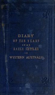
The diary of George Fletcher Moore is an important record of early colonial life in Western Australia, because it is one of a few records that were written from the point of view of an ordinary colonist, as opposed to the official correspondence of a salaried public official. Tom Stannage describes the diary as "an immensely valuable social document" and "the best published guide we have to life in Swan River colony between 1830 and 1840."

George Fletcher Moore was a prominent early settler in colonial Western Australia, and "one [of] the key figures in early Western Australia's ruling elite". He conducted a number of exploring expeditions; was responsible for one of the earliest published records of the language of the Australian Aborigines of the Perth area; and was the author of Diary of Ten Years Eventful Life of an Early Settler in Western Australia.

The convict era of Western Australia was the period during which Western Australia was a penal colony of the British Empire. Although it received small numbers of juvenile offenders from 1842, it was not formally constituted as a penal colony until 1849. Between 1850 and 1868, 9,721 convicts were transported to Western Australia on 43 convict ship voyages. Transportation ceased in 1868, and it was many years until the colony ceased to have any convicts in its care.

Jerramungup is a Western Australian town located in the Great Southern agricultural region, 454 kilometres (282 mi) southeast of Perth 6 kilometres (4 mi) west of the Gairdner River.

The Moore River Native Settlement was the name of the now defunct Aboriginal settlement and internment camp located 135 kilometres (84 mi) north of Perth and 11 kilometres (6.8 mi) west of Mogumber in Western Australia, near the headwaters of the Moore River.
Thomas Bather Moore was a pioneer explorer of Western and South West, Tasmania, Australia.
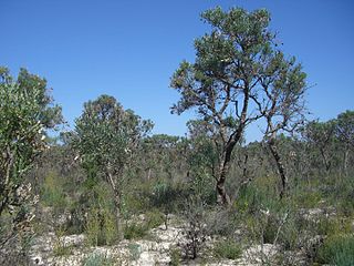
The history of the Aboriginal inhabitants of Western Australia has been dated as existing for 50-70 thousand years before European contact. This article only deals with documented history from non indigenous sources since European settlement in Perth.

Woodridge is a town and rural residential estate located 75 kilometres (47 mi) north of the Perth central business district, the capital city of Western Australia, on the western side of Wanneroo Road near the Moore River. It is separated from Perth's residential area by a 13-kilometre (8.1 mi) wide area of State Forest at Wilbinga. In the 2011 census, it had a population of 584, up from 565 at the 2006 Census, and 541 and 485 at the 2001 and 1996 censuses respectively.

Bendemeer is a village of 485 people on the Macdonald River in the New England region of New South Wales, Australia. It is situated at the junction of the New England and Oxley Highways.
Prince Regent National Park is a protected area in the Kimberley region of Western Australia. In 1978 the area was nominated as a UNESCO World Biosphere Reserve.

The Acheron River, a minor inland perennial river of the Goulburn Broken catchment, part of the Murray-Darling basin, is located in the lower South Eastern Highlands bioregion and Northern Country/North Central regions of the Australian state of Victoria. The headwaters of the Acheron River rise on the north–western slopes of the Yarra Ranges, below The Knobs and descend to flow into the Goulburn River near Alexandra.

The Steavenson River, sometimes incorrectly referred to as Steavensons River, a minor inland perennial river of the Goulburn Broken catchment, part of the Murray-Darling basin, is located in the lower South Eastern Highlands bioregion and Northern Country/North Central regions of the Australian state of Victoria. The headwaters of the Steavenson River rise on the north–western slopes of the Yarra Ranges, below Mount Edgar and descend to flow into the Acheron River near Buxton.
Worsley River is a river in the South West region of Western Australia. The river rises in the Darling Range 2 km south of the old timber town of Worsley then flows east and south discharging into the Collie River in Wellington Reservoir.
The Nyamal are an Indigenous Australian people of the Pilbara area of north-western Australia.