This page is based on this
Wikipedia article Text is available under the
CC BY-SA 4.0 license; additional terms may apply.
Images, videos and audio are available under their respective licenses.

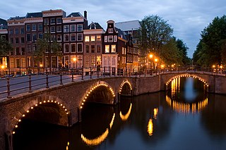
Amstelveen is a municipality in the province of North Holland, Netherlands with a population of 89,918 (2017). It is a suburban part of the metropolitan area of Amsterdam.

Naarden is a city and former municipality in the Gooi region in the province of North Holland, Netherlands. It has been part of the new municipality of Gooise Meren since 2016.

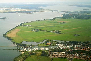
Weesp is a city and municipality in the province of North Holland, Netherlands. It had a population of 18,988 in 2017. It lies on the river Vecht and next to the Amsterdam–Rhine Canal in an area called the Vechtstreek. Weesp is part of the Amsterdam metropolitan area even if the city is surrounded by open grassland and lakes.

IJmuiden is a port city in the Dutch province of North Holland and is the main town in the municipality of Velsen. It is located at the mouth of the North Sea Canal to Amsterdam, and lies approximately 17 kilometres (11 mi) north of Haarlem.
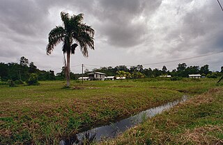
Commewijne is a district of Suriname, located on the right bank of the Suriname River. Commewijne's capital city is Nieuw Amsterdam. Tamanredjo is another major town.

Bronkhorst is a village in the municipality of Bronckhorst, Gelderland, the Netherlands. Technically, it is a city and with only 157 inhabitants (2010), it is one of the smallest cities in the Netherlands.

The Vecht is a Rhine branch in the Dutch province of Utrecht. It is sometimes called Utrechtse Vecht to avoid confusion with its Overijssel counterpart. The area along the river is called the Vechtstreek.

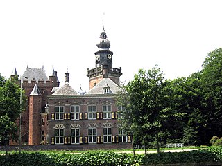
Muiden Castle is a castle in the Netherlands, located at the mouth of the Vecht river, some 15 kilometers southeast of Amsterdam, in Muiden, where it flows into what used to be the Zuiderzee. It is one of the better known castles in the Netherlands and featured in many television shows set in the Middle Ages.

Fortaleza do Monte is a fort in Santo António in Macau SAR, China. It is the historical military centre of Macau. The Fortaleza forms part of the "Historic Centre of Macau" and is a UNESCO World Heritage Site.
The Dutch Water Line was a series of water-based defences conceived by Maurice of Nassau in the early 17th century, and realised by his half brother Frederick Henry. Combined with natural bodies of water, the Water Line could be used to transform Holland almost into an island. In the 19th century, the Line was extended to include Utrecht.

Zeeburg is a former borough of Amsterdam. It had 52,701 residents and an area of 19.31 km². The construction of new islands to the east called IJburg made it the most rapidly growing borough of Amsterdam. On 1 May 2010 Zeeburg merged with the borough of Amsterdam-Oost.
The Vechtstreek is a region in the Dutch provinces of Utrecht and North Holland along the Vecht River between the towns of Utrecht and Amsterdam. Located in the economic heartland of the Netherlands, it is known for its natural environment, castles, parks and stately homes.

The Utrecht University Botanic Gardens have consisted of two locations since 1987: the main garden at Fort Hoofddijk (52.0883°N 5.1725°E) in Uithof and the Von Gimborn Arboretum (52.0325°N 5.3093°E) in Doorn.
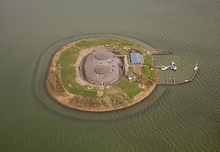
Pampus is an artificial island and late 19th-century sea fort located in the IJmeer near Amsterdam. Pampus now belongs to the municipality of Gooise Meren and is open to visitors.
Abraham ben Samson ha-Kohen Onderwijzer was a Dutch rabbi. He was chief rabbi of North Holland and founder of the Jewish labor union Betsalel.
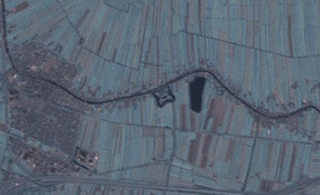
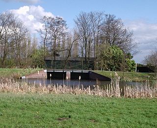
The Wierickerschans Fort is a part of the Old Dutch Waterline or "Oude Hollandse Waterlinie". This was a defence system that allowed large parts of the country (Holland) to be flooded (inundated). Thus protecting the main towns and city in the West against invading forces from the East. It was in use right up to the 19th century. The Fort was built on the site where in 1672 Stadtholder Willem III had his headquarters during the war against the French. The Fort is centrally located within the Old Dutch Waterline that stretched from Muiden down to the Biesbosch.
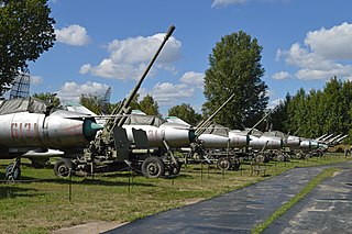
The Museum of Polish Military Technology is a military museum in the Mokotów district of Warsaw, Poland. It is a branch of the Polish Army Museum. It is located in former Fort IX of the Warsaw Fortress.

Suriname-Rivier is a lightvessel permanently berthed in a wet dock in the Fort Nieuw-Amsterdam Open-Air Museum in Nieuw-Amsterdam, Commewijne, Suriname.