Pullalur

Last updated
Pullalur
village
CountryFlag of India.svg  India
State Tamil Nadu
District Kanchipuram
Population (2001)
  Total 2,690
Languages
  Official Tamil
Time zone IST (UTC+5:30)

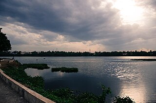
Pullalur or Pollilur is a village in the Kanchipuram taluk of Kanchipuram district in Tamil Nadu, India. The village has been the site of three historic battles - the Battle of Pullalur fought between the Chalukya king Pulakesin II and the Pallava king Mahendravarman I in 611-12, the Battle of Pollilur (1780) and Battle of Pollilur (1781) of the Second Anglo-Mysore War between Hyder Ali and the East India Company.

Kancheepuram taluk is a taluk of Kancheepuram district of the Indian state of Tamil Nadu. The headquarters of the taluk is the town of Kanchipuram

Kanchipuram district District in Tamil Nadu, India

Kancheepuram district is one of the districts in the northeast of the state of Tamil Nadu in India. The area comprising the present day Kancheepuram district was earlier a part of Chengalpattu district. The original Chengalpattu district was split in the year 1997 to form the present day Kancheepuram and Tiruvallur districts. It is bounded in the west by Vellore District and Thiruvannamalai District, in the north by Tiruvallur District and Chennai District, in the south by Viluppuram District and in the east by the Bay of Bengal. It lies between 11° 00' to 12° 00' latitudes and 77° 28' to 78° 50' longitudes. The district has a total geographical area of 4,432 km2 (1,711 sq mi) and coastline of 57 km (35 mi). The city of Kancheepuram is the district headquarters. The Chennai International Airport is located in Tirusulam in Kancheepuram district now under Greater Chennai Corporation Limit. In 2011, Kancheepuram district had a population of 3,998,252, with a sex-ratio of 986 females for every 1,000 males.

Tamil Nadu State in Southern India

Tamil Nadu, formerly Madras State, is one of the 29 states of India. Its capital and largest city is Chennai. Tamil Nadu lies in the southernmost part of the Indian subcontinent and is bordered by the union territory of Puducherry and the South Indian states of Kerala, Karnataka, and Andhra Pradesh. It is bounded by the Eastern Ghats on the north, by the Nilgiri Mountains, the Meghamalai Hills, and Kerala on the west, by the Bay of Bengal in the east, by the Gulf of Mannar and the Palk Strait on the southeast, and by the Indian Ocean on the south. The state shares a maritime border with the nation of Sri Lanka.

Demographics

As per the 2001 census, Pullalur had a population of 2,690 with 1,315 males and 1,375 females. The sex ratio was 1046 and the literacy rate, 63.52.

Related Research Articles

Battle of Pollilur (1780) battle

The Battle of Pollilur, also known as the Battle of Polilore or Battle of Perambakam, took place on 10 September 1780 at Pollilur near Conjeevaram, the city of Kanchipuram in present-day Tamil Nadu state, India, as part of the Second Anglo-Mysore War. It was waged between two forces commanded by Tipu Sultan of the Kingdom of Mysore, and Lt. Colonel William Baillie of the British East India Company. The army of the East India Company surrendered and suffered a high number of casualties. It was the worst loss the East India Company suffered on the subcontinent until Chillianwala. Benoît de Boigne, a French officer in the service of 6th Regiment of Madras Native Infantry, wrote, "There is not in India an example of a similar defeat".

Vandavasi Town in Tamil Nadu, India

Vandavasi or Wandiwash is a city and a municipality in Tiruvannamalai district in the Indian state of Tamil Nadu. As of 2011, the town had a population of 74,320.

Thiruttani Town in Tamil Nadu, India

Thiruttani is a town in the state of Tamil Nadu, India. This town is famous for Thiruthani Murugan Temple which is one of the Arupadaiveedu and is dedicated to Kartikeya.

Dusi, Tamil Nadu town in Tamil Nadu, India

Dusi is a census town in Tiruvanamalai district in the state of Tamil Nadu, India.

Kancheepuram is a state assembly constituency in Kancheepuram district, Tamil Nadu, India. It comprises a portion of Kanchipuram taluk and is a part of the similarly named constituency that is used for national elections to the Parliament of India.

Uthiramerur is a state assembly constituency in Kancheepuram district of Tamil Nadu, India. It comprises Uthiramerur taluk and a portion of Kanchipuram taluk and forms a part of Kancheepuram constituency for national elections to the Parliament of India.

Valaiyapettai is a village in the Kumbakonam taluk of Thanjavur district, Tamil Nadu, India.

Karaiyavetti is a village in the Ariyalur taluk of Ariyalur district, Tamil Nadu, India.

Ramanujapuram is a village in the Papanasam taluk of Thanjavur district, Tamil Nadu, India.

The Acharapakkam block is a revenue block in the Kanchipuram district of Tamil Nadu, India. It has a total of 59 panchayat villages.

The Kanchipuram block is a revenue block in the Kanchipuram district of Tamil Nadu, India. It has a total of 43 panchayat villages.

The Madurantakam block is a revenue block in the Kanchipuram district of Tamil Nadu, India. It has a total of 58 panchayat villages.

The Walajabad block is a revenue block in the Kanchipuram district of Tamil Nadu, India. It has a total of 61 panchayat villages.

The Uttiramerur block is a revenue block in the Kanchipuram district of Tamil Nadu, India. It has a total of 73 panchayat villages.

The Battle of Pullalur was a battle fought between the Chalukya king Pulakesin II and the Pallava king Mahendravarman I in the town of Pullalur or Pollilur in about 618–19.

Paranjothi, popularly known as Siruthondar was an army general of the great Pallava king Narasimavarman I who ruled South India from 630–668 CE. He also led the Pallava army during the invasion of Vatapi in 642 CE. In the later years of his life, Paranjothi gave up violence and became a wandering Saivite monk. He is venerated as one of the 63 Nayanmars.

Arasavanangadu is a village in the Kudavasal taluk of Tiruvarur district in Tamil Nadu, India.

Walajabad taluk is a taluk in the Kanchipuram district of Tamil Nadu, India. At the 2011 Census of India, the taluk covered an area of 339.03 square kilometres (130.90 sq mi) with a population of 125,868. The headquarters of the taluk is the town of Walajabad.

References

Coordinates: 12°58′N79°42′E / 12.967°N 79.700°E / 12.967; 79.700

Geographic coordinate system Coordinate system

A geographic coordinate system is a coordinate system that enables every location on Earth to be specified by a set of numbers, letters or symbols. The coordinates are often chosen such that one of the numbers represents a vertical position and two or three of the numbers represent a horizontal position; alternatively, a geographic position may be expressed in a combined three-dimensional Cartesian vector. A common choice of coordinates is latitude, longitude and elevation. To specify a location on a plane requires a map projection.