Płutowo

Last updated
Płutowo
Village
Plutowo.jpg
Country Flag of Poland.svg  Poland
Voivodeship Kuyavian-Pomeranian
County Chełmno
Gmina Kijewo Królewskie

Płutowo [ʂɨmˈbɔrnɔ] (German : Plutowo) is a village in the administrative district of Gmina Kijewo Królewskie, within Chełmno County, Kuyavian-Pomeranian Voivodeship, in north-central Poland. [1]

German language West Germanic language

German is a West Germanic language that is mainly spoken in Central Europe. It is the most widely spoken and official or co-official language in Germany, Austria, Switzerland, South Tyrol (Italy), the German-speaking Community of Belgium, and Liechtenstein. It is also one of the three official languages of Luxembourg and a co-official language in the Opole Voivodeship in Poland. The languages which are most similar to German are the other members of the West Germanic language branch: Afrikaans, Dutch, English, the Frisian languages, Low German/Low Saxon, Luxembourgish, and Yiddish. There are also strong similarities in vocabulary with Danish, Norwegian and Swedish, although those belong to the North Germanic group. German is the second most widely spoken Germanic language, after English.

Gmina Kijewo Królewskie is a rural gmina in Chełmno County, Kuyavian-Pomeranian Voivodeship, in north-central Poland. Its seat is the village of Kijewo Królewskie, which lies approximately 11 kilometres (7 mi) south of Chełmno, 30 km (19 mi) north-west of Toruń, and 35 km (22 mi) north-east of Bydgoszcz.

Chełmno County County in Kuyavian-Pomeranian, Poland

Chełmno County is a unit of territorial administration and local government (powiat) in Kuyavian-Pomeranian Voivodeship, north-central Poland. It came into being on 1 January 1999, as a result of the Polish local government reforms adopted in 1998. Its administrative seat and only town is Chełmno, which lies 40 km (25 mi) north of Toruń and 40 km (25 mi) north-east of Bydgoszcz.

North of Płutowo village there is the Płutowo Nature Reserve with a total area of 17.96 hectares (44.4 acres), which was established in 1963 for the protection of a rare ecosystem along a ravine above the Vistula river. The length of the ravine is 1.2 km and its depth around 57 metres from the top down to the water level. [2]

Ecosystem A community of living organisms together with the nonliving components of their environment

An ecosystem is a community of living organisms in conjunction with the nonliving components of their environment, interacting as a system. These biotic and abiotic components are linked together through nutrient cycles and energy flows. Energy enters the system through photosynthesis and is incorporated into plant tissue. By feeding on plants and on one-another, animals play an important role in the movement of matter and energy through the system. They also influence the quantity of plant and microbial biomass present. By breaking down dead organic matter, decomposers release carbon back to the atmosphere and facilitate nutrient cycling by converting nutrients stored in dead biomass back to a form that can be readily used by plants and other microbes.

Vistula river in Eastern Europe

The Vistula, the longest and largest river in Poland, is the 9th-longest river in Europe, at 1,047 kilometres in length. The drainage-basin area of the Vistula is 193,960 km2 (74,890 sq mi), of which 168,868 km2 (65,200 sq mi) lies within Poland. The remainder lies in Belarus, Ukraine and Slovakia.

World War II

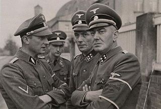
In the fall of 1939 following the invasion of Poland the Nazi German occupational authorities set up a temporary concentration camp in Płutowo at a manor once owned by von Alvensleben family. The Polish prisoners brought to the camp came from the area of Ziemia chełmińska (Chełmno land). Over 200 victims were murdered at a nearby forest by the German Volksdeutscher Selbstschutz executioners, along the road to Szymborno. [2]

Invasion of Poland invasion of Poland by Germany, the Soviet Union, and a small Slovak contingent

The Invasion of Poland, known in Poland as the September Campaign or the 1939 Defensive War, and in Germany as the Poland Campaign (Polenfeldzug), was an invasion of Poland by Germany that marked the beginning of World War II. The German invasion began on 1 September 1939, one week after the signing of the Molotov–Ribbentrop Pact between Germany and the Soviet Union. The Soviets invaded Poland on 17 September following the Molotov–Tōgō agreement that terminated the Soviet and Japanese Battles of Khalkhin Gol in the east on 16 September. The campaign ended on 6 October with Germany and the Soviet Union dividing and annexing the whole of Poland under the terms of the German–Soviet Frontier Treaty.

von Alvensleben may refer to:

<i>Volksdeutscher Selbstschutz</i> military unit

The Volksdeutscher Selbstschutz was a Selbstschutz paramilitary organization (militia) consisting of ethnic German Volksdeutsche mobilized from among the German minority in Poland. The Volksdeutscher Selbstschutz operated before, and during the opening stages of, World War II in the western half of Poland and were responsible for, and took part in, massacres of ethnic Poles, along with SS Einsatzgruppen.

Related Research Articles

Kijewo Królewskie Village in Kuyavian-Pomeranian, Poland

Kijewo Królewskie is a village in Chełmno County, Kuyavian-Pomeranian Voivodeship, in north-central Poland. It is the seat of the gmina called Gmina Kijewo Królewskie. It lies 11 kilometres (7 mi) south of Chełmno, 30 km (19 mi) north-west of Toruń, and 35 km (22 mi) north-east of Bydgoszcz.

Gmina Chełmno is a rural gmina in Chełmno County, Kuyavian-Pomeranian Voivodeship, in north-central Poland. Its seat is the town of Chełmno, although the town is not part of the territory of the gmina.

Gmina Papowo Biskupie is a rural gmina in Chełmno County, Kuyavian-Pomeranian Voivodeship, in north-central Poland. Its seat is the village of Papowo Biskupie, which lies approximately 17 kilometres (11 mi) south-east of Chełmno and 25 km (16 mi) north of Toruń.

Gmina Stolno is a rural gmina in Chełmno County, Kuyavian-Pomeranian Voivodeship, in north-central Poland. Its seat is the village of Stolno, which lies approximately 8 kilometres (5 mi) south-east of Chełmno, 33 km (21 mi) north of Toruń, and 41 km (25 mi) north-east of Bydgoszcz.

Gmina Unisław is a rural gmina in Chełmno County, Kuyavian-Pomeranian Voivodeship, in north-central Poland. Its seat is the village of Unisław, which lies approximately 18 kilometres (11 mi) south of Chełmno, 25 km (16 mi) north-west of Toruń, and 28 km (17 mi) east of Bydgoszcz.

Bągart, Chełmno County Village in Kuyavian-Pomeranian, Poland

Bągart is a village in the administrative district of Gmina Kijewo Królewskie, within Chełmno County, Kuyavian-Pomeranian Voivodeship, in north-central Poland. It lies approximately 3 kilometres (2 mi) south of Kijewo Królewskie, 13 km (8 mi) south of Chełmno, 27 km (17 mi) north-west of Toruń, and 33 km (21 mi) north-east of Bydgoszcz.

Bajerze Village in Kuyavian-Pomeranian, Poland

Bajerze is a village in the administrative district of Gmina Kijewo Królewskie, within Chełmno County, Kuyavian-Pomeranian Voivodeship, in north-central Poland. It lies 13 kilometres (8 mi) south of Chełmno, 27 km (17 mi) north-west of Toruń, and 34 km (21 mi) north-east of Bydgoszcz.

Brzozowo, Kuyavian-Pomeranian Voivodeship Village in Kuyavian-Pomeranian, Poland

Brzozowo is a village in the administrative district of Gmina Kijewo Królewskie, within Chełmno County, Kuyavian-Pomeranian Voivodeship, in north-central Poland. It lies approximately 5 kilometres (3 mi) north of Kijewo Królewskie, 6 km (4 mi) south of Chełmno, 34 km (21 mi) north of Toruń, and 37 km (23 mi) north-east of Bydgoszcz.

Dorposz Szlachecki Village in Kuyavian-Pomeranian, Poland

Dorposz Szlachecki is a village in the administrative district of Gmina Kijewo Królewskie, within Chełmno County, Kuyavian-Pomeranian Voivodeship, in north-central Poland. It lies 9 kilometres (6 mi) south of Chełmno, 32 km (20 mi) north-west of Toruń, and 35 km (22 mi) north-east of Bydgoszcz.

Kiełp Village in Kuyavian-Pomeranian, Poland

Kiełp is a village in the administrative district of Gmina Kijewo Królewskie within Chełmno County, Kuyavian-Pomeranian Voivodeship in north-central Poland. It lies approximately 5 kilometres (3 mi) north-west of Kijewo Królewskie, 8 km (5 mi) south of Chełmno, 33 km (21 mi) north-west of Toruń, and 34 km (21 mi) north-east of Bydgoszcz.

Kijewo Szlacheckie Village in Kuyavian-Pomeranian, Poland

Kijewo Szlacheckie is a village in the administrative district of Gmina Kijewo Królewskie, within Chełmno County, Kuyavian-Pomeranian Voivodeship, in north-central Poland. It lies 12 kilometres (7 mi) south of Chełmno, 30 km (19 mi) north-west of Toruń, and 33 km (21 mi) north-east of Bydgoszcz.

Szymborno is a village in the administrative district of Gmina Kijewo Królewskie, within Chełmno County, Kuyavian-Pomeranian Voivodeship, in north-central Poland.

Trzebcz Królewski is a village in the administrative district of Gmina Kijewo Królewskie, within Chełmno County, Kuyavian-Pomeranian Voivodeship, in north-central Poland.

Trzebcz Szlachecki Village in Kuyavian-Pomeranian, Poland

Trzebcz Szlachecki is a village in the administrative district of Gmina Kijewo Królewskie, within Chełmno County, Kuyavian-Pomeranian Voivodeship, in north-central Poland. It lies 18 kilometres (11 mi) south of Chełmno, 23 km (14 mi) north-west of Toruń, and 35 km (22 mi) east of Bydgoszcz.

Watorowo is a village in the administrative district of Gmina Kijewo Królewskie, within Chełmno County, Kuyavian-Pomeranian Voivodeship, in north-central Poland.

Bartlewo, Kuyavian-Pomeranian Voivodeship Village in Kuyavian-Pomeranian, Poland

Bartlewo is a village in the administrative district of Gmina Lisewo, within Chełmno County, Kuyavian-Pomeranian Voivodeship, in north-central Poland. It lies 15 kilometres (9 mi) south-east of Chełmno and 28 km (17 mi) north of Toruń.

Błachta Village in Kuyavian-Pomeranian, Poland

Błachta is a village in the administrative district of Gmina Lisewo, within Chełmno County, Kuyavian-Pomeranian Voivodeship, in north-central Poland. It lies 16 kilometres (10 mi) south-east of Chełmno and 28 km (17 mi) north of Toruń.

Trzebiełuch Village in Kuyavian-Pomeranian, Poland

Trzebiełuch is a village in the administrative district of Gmina Stolno, within Chełmno County, Kuyavian-Pomeranian Voivodeship, in north-central Poland. It lies 15 kilometres (9 mi) north-east of Stolno, 17 km (11 mi) east of Chełmno, and 41 km (25 mi) north of Toruń.

Marianki, Świecie County Village in Kuyavian-Pomeranian, Poland

Marianki is a village in the administrative district of Gmina Świecie, within Świecie County, Kuyavian-Pomeranian Voivodeship, in north-central Poland. It lies approximately 2 kilometres (1 mi) north-west of Świecie, 44 km (27 mi) north-east of Bydgoszcz, and 46 km (29 mi) north of Toruń.

References

  1. "Central Statistical Office (GUS) TERYT (National Register of Territorial Land Apportionment Journal)" (in Polish). 2008-06-01.
  2. 1 2 "Ekologia i Środowisko: Przyroda (Ecology and Environment: Nature)". Gmina Kijewo Królewskie. 2007. Retrieved June 27, 2012.

Commons-logo.svg Media related to Nature reserve Zbocza Płutowskie at Wikimedia Commons

Coordinates: 53°17′06″N18°25′17″E / 53.28500°N 18.42139°E / 53.28500; 18.42139

Geographic coordinate system Coordinate system

A geographic coordinate system is a coordinate system that enables every location on Earth to be specified by a set of numbers, letters or symbols. The coordinates are often chosen such that one of the numbers represents a vertical position and two or three of the numbers represent a horizontal position; alternatively, a geographic position may be expressed in a combined three-dimensional Cartesian vector. A common choice of coordinates is latitude, longitude and elevation. To specify a location on a plane requires a map projection.