Sankt Martin bei Lofer

Last updated
Sankt Martin bei Lofer
St.Martin bei Lofer.jpg
Wappen at st martin.png
Coat of arms
Austria adm location map.svg
Red pog.svg
Sankt Martin bei Lofer
Location within Austria
Coordinates: 47°34′00″N12°42′00″E / 47.56667°N 12.70000°E / 47.56667; 12.70000 Coordinates: 47°34′00″N12°42′00″E / 47.56667°N 12.70000°E / 47.56667; 12.70000
Country Austria
State Salzburg
District Zell am See
Government
   Mayor Josef Leitinger (ÖVP)
Area
[1]
  Total63.55 km2 (24.54 sq mi)
Elevation
633 m (2,077 ft)
Population
(2018-01-01) [2]
  Total1,153
  Density18/km2 (47/sq mi)
Time zone UTC+1 (CET)
  Summer (DST) UTC+2 (CEST)
Postal code
5092
Area code 06588
Vehicle registration ZE
Website www.stmartin.at

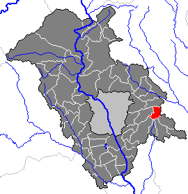
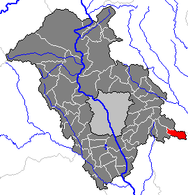
Sankt Martin bei Lofer is a municipality in the district of Zell am See (Pinzgau region), in the state of Salzburg in Austria.

Salzburg (state) State of Austria

Salzburg is a state (Land) of Austria. It is officially named Land Salzburg, colloquially Salzburgerland, to distinguish it from its eponymous capital Salzburg city and as such is the only state to be named after its capital. By its centuries-long history as an independent Prince-Bishopric, Salzburg's tradition differs from the other Austrian lands.
Austria Federal republic in Central Europe

Austria, officially the Republic of Austria, is a country in Central Europe comprising 9 federated states. Its capital, largest city and one of nine states is Vienna. Austria has an area of 83,879 km2 (32,386 sq mi), a population of nearly 9 million people and a nominal GDP of $477 billion. It is bordered by the Czech Republic and Germany to the north, Hungary and Slovakia to the east, Slovenia and Italy to the south, and Switzerland and Liechtenstein to the west. The terrain is highly mountainous, lying within the Alps; only 32% of the country is below 500 m (1,640 ft), and its highest point is 3,798 m (12,461 ft). The majority of the population speaks local Bavarian dialects as their native language, and German in its standard form is the country's official language. Other regional languages are Hungarian, Burgenland Croatian, and Slovene.

Contents

Geography

The municipality lies in the Loferer Land in the Pinzgauer Saalach valley.

Related Research Articles

Hernstein Place in Lower Austria, Austria

Hernstein is a town in Lower Austria, Austria in the district of Baden bei Wien.

Lofer Place in Salzburg, Austria

Lofer is a market town in the district of Zell am See in the Austrian state of Salzburg.

Furth bei Göttweig Place in Lower Austria, Austria

Furth bei Göttweig is a town and municipality in the district of Krems-Land in the Austrian state of Lower Austria. The municipality consists of the following populated places:

Weißbach bei Lofer Place in Salzburg, Austria

Weißbach bei Lofer is a municipality in the district of Zell am See, in the state of Salzburg in Austria.

Berndorf bei Salzburg Place in Salzburg, Austria

Berndorf is a municipality in the district of Salzburg-Umgebung in the state of Salzburg in Austria.

Hof bei Salzburg Place in Salzburg, Austria

Hof bei Salzburg is a municipality in the district of Salzburg-Umgebung in the state of Salzburg in Austria.

Plainfeld Place in Salzburg, Austria

Plainfeld is a municipality in the district of Salzburg-Umgebung in the state of Salzburg in Austria.

Göming Place in Salzburg, Austria

Göming is a municipality in the district of Salzburg-Umgebung in the state of Salzburg in Austria.

Langen bei Bregenz Place in Vorarlberg, Austria

Langen bei Bregenz is a municipality in the district of Bregenz in the Austrian state of Vorarlberg.

Feldkirchen bei Mattighofen Place in Upper Austria, Austria

Feldkirchen bei Mattighofen is a municipality in the Braunau am Inn district in the Austrian state of Upper Austria.

Sankt Leonhard bei Freistadt Place in Upper Austria, Austria

Sankt Leonhard bei Freistadt is a municipality in the district of Freistadt in the Austrian state of Upper Austria.

Windhaag bei Freistadt Place in Upper Austria, Austria

Windhaag bei Freistadt is a municipality in the district of Freistadt in the Austrian state of Upper Austria.

Sankt Georgen bei Obernberg am Inn Place in Upper Austria, Austria

Sankt Georgen bei Obernberg am Inn is a municipality in the district of Ried im Innkreis in the Austrian state of Upper Austria.

Pfarrkirchen bei Bad Hall Place in Upper Austria, Austria

Pfarrkirchen bei Bad Hall is a municipality in the district of Steyr-Land in the Austrian state of Upper Austria.

Oberndorf bei Schwanenstadt Place in Upper Austria, Austria

Oberndorf bei Schwanenstadt is a municipality in the district of Vöcklabruck in the Austrian state of Upper Austria.

Loipersdorf bei Fürstenfeld Place in Styria, Austria

Loipersdorf bei Fürstenfeld is a municipality in the district of Hartberg-Fürstenfeld in Styria, Austria.

Hart bei Graz Place in Styria, Austria

Hart bei Graz is a municipality in the district of Graz-Umgebung in the Austrian state Styria.

Nestelbach bei Graz Place in Styria, Austria

Nestelbach bei Graz is a municipality in the district of Graz-Umgebung in the Austrian state of Styria.

Sankt Marein bei Graz Place in Styria, Austria

Sankt Marein bei Graz is a municipality in the district of Graz-Umgebung in the Austrian state of Styria.

Allerheiligen bei Wildon Place in Styria, Austria

Allerheiligen bei Wildon is a municipality in the district of Leibnitz in Styria, Austria. The name "Allerheiligen" translates to "All Saints" and derives from the local church. The addition "bei Wildon" means "near Wildon", thus differentiating the municipality from others of the same name.

References

  1. "Dauersiedlungsraum der Gemeinden Politischen Bezirke und Bundesländer - Gebietsstand 1.1.2018". Statistics Austria. Retrieved 10 March 2019.
  2. "Einwohnerzahl 1.1.2018 nach Gemeinden mit Status, Gebietsstand 1.1.2018". Statistics Austria. Retrieved 9 March 2019.