St Michael & All Angels Church, Wood End

Last updated
St Michael & All Angels Church

St. Michael and All Angels, Wood End - geograph.org.uk - 110602.jpg

Exterior of the church
Denomination Church of England
Churchmanship Anglican
Website Kingsbury And Baxterley Churches
Administration
Diocese Diocese of Birmingham
Province Province of Canterbury
Clergy
Vicar(s) Revd. Dr. John White
Laity
Churchwarden(s) Mrs. Shirley McConnell and Mrs. Iris Adams

St Michael & All Angels Church is a Church of England church in the village of Wood End, Warwickshire, England. Built in 1906, this small wooden church is part of the parish of Baxterley with Hurley and Wood End

Church of England Anglican state church of England

The Church of England is the established church of England. The Archbishop of Canterbury is the most senior cleric, although the monarch is the supreme governor. The Church of England is also the mother church of the international Anglican Communion. It traces its history to the Christian church recorded as existing in the Roman province of Britain by the third century, and to the 6th-century Gregorian mission to Kent led by Augustine of Canterbury.

Warwickshire County of England

Warwickshire is a landlocked county in the West Midlands region of England. The county town is Warwick, although the largest town is Nuneaton. The county is famous for being the birthplace of William Shakespeare.

Contents

History

The Church was built in 1906 for the village of Wood End which had been built in 1890. When the church was built it was on its own until it was surrounded by prefabricated housing which was re built during the 1980s.

The church has no distinctive features and has just a small hall.

Today

The church is part of the Diocese of Birmingham, the archdeaconry of Aston, The Deanery of Polesworth and is in the parish of Baxterley with Hurley and Wood End.

The Diocese of Birmingham is a diocese in the Church of England's Province of Canterbury, covering the north west of the traditional county of Warwickshire in England.

Polesworth village in United Kingdom

Polesworth is a large village and civil parish in the North Warwickshire district of Warwickshire, England. In the 2001 census it had a population of 8,439, inclusive of the contiguous subvillages of St Helena, Dordon and Hall End directly to the south, and Birchmoor to the west. The population had decreased slightly to 8,423 at the 2011 Census. This population technically allows Polesworth market town status.

Baxterley Church Church in Warwickshire, England

Baxterley Church is situated at the western side of the Parish towards Wood End and dates from the 12th century.

It is part of the Kingsbury and Baxterley group of churches along with Baxterley, Kingsbury, Merevale and Hurley, All five share the same vicar who is currently Revd. Dr. John White. [1]

Church of St Peter & St Paul, Kingsbury Church

Church of St Peter & St Paul is a Church of England parish church in the village of Kingsbury, Warwickshire, England. It is the only Church of England church in the parish and it dates from the 12th century

Church of the Resurrection, Hurley Church in Warwickshire, England

Church of the Resurrection is a small wooden Church of England church in Hurley, Warwickshire, England, dating from 1861 It is part of the parish of Baxterley with Hurley and Wood End.

Today it is the only place of worship in the village although Wood End is the nearest settlement to Baxterley Church.

Related Research Articles

North Warwickshire Borough & Non-metropolitan district in England

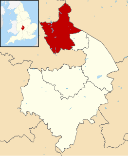
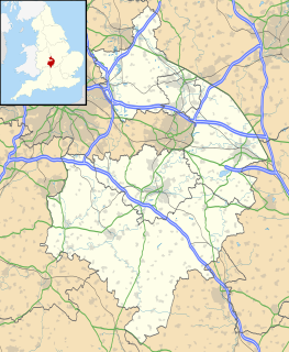
North Warwickshire is a local government district and borough in Warwickshire, England. The main town in the district is Atherstone where the offices of North Warwickshire Borough Council are based. Other significant places include Coleshill, Polesworth and Kingsbury.

Kingsbury, Warwickshire large village and civil parish in the North Warwickshire district of the county of Warwickshire in the United Kingdom

Kingsbury is a large village and civil parish in the North Warwickshire district of the county of Warwickshire, in the West Midlands region of England. The civil parish population at the 2011 census was 7,652.

Middleton is a small village in the North Warwickshire district of the county of Warwickshire, England. The population of the civil parish at the 2011 census was 630.

Kenton Road is a main road in the London Borough of Harrow and the London Borough of Brent. It lies in the areas of Harrow and Kenton.

Atherstone was a rural district in the administrative county of Warwickshire, England, from 1894 to 1974. It was named after its main town and administrative headquarters of Atherstone.

Wood End, Kingsbury, Warwickshire village in United Kingdom

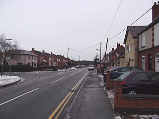
Wood End is an old mining village in North Warwickshire, England. It lies to the south east of Tamworth and close to the border with Staffordshire. It grew around the former Kingsbury Colliery but now it serves as a commuter village to Tamworth. It has a church, a primary school, a co-operative store, a working men's club and a village hall. The population of Wood End is 2,205, but from the 2011 Census has been included in Kingsbury, Warwickshire.

Knowl Hill, Berkshire village in United Kingdom

Knowl Hill is a village in the civil parish of Hurley in Berkshire, England. It is 5 miles (8 km) west of Maidenhead on the A4 road toward Reading.

Hurley, Warwickshire village in United Kingdom

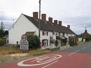
Hurley is a village in the Kingsbury civil parish of North Warwickshire, England. Other nearby places include Wood End, Hurley Common, Coleshill, Water Orton, Curdworth, Atherstone and Tamworth.

Kingsbury School is a coeducational secondary school located in the village of Kingsbury, Warwickshire, England. Its main catchment area is Kingsbury, but students also attend from a number of neighbouring villages, such as Hurley and Whitacre Heath, Picadilly, Wood End, Bodymoor Heath and Middleton.

Piccadilly, Warwickshire village in United Kingdom

Piccadilly is a small village in the North Warwickshire district of the county of Warwickshire in England. It is located near to the larger village of Kingsbury, and is four miles south of Tamworth.

St Mary The Church of Our Lady, Merevale Church

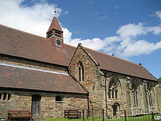
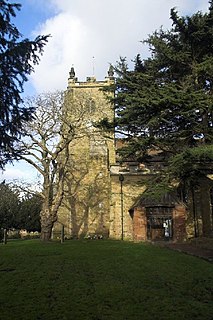
St. Mary The Church of Our Lady Merevale is an historic parish church in Merevale, Warwickshire it is known for its Jesse window, it was originally part of Merevale Abbey but is now a Church of England parish church.

Hurley Common village in United Kingdom

Hurley Common is a village in North Warwickshire, England, between Wood End and Hurley, it consists of several houses and 2 Farms, Hurley common does not have its own Parish Church so it is technically a hamlet. Population details for the 2011 Census can be found under Kingsbury.

Hurley and Wood End is a ward within North Warwickshire, it is named after the villages of Hurley and Wood End, the ward also contains the villages of Piccadilly, Hurley Common and Foul End. The ward is covered by Kingsbury Civil Parish.

Foul End village in United Kingdom

Foul End is a small village in Warwickshire, England. Other nearby places include Hurley, Wood End, Hurley Common, Coleshill, Water Orton, Curdworth, Atherstone and Tamworth.

Grendon, Atherstone

Grendon is a civil parish which includes both Old Grendon and New Grendon in North Warwickshire, England. Population details can be found under Baddesley Ensor.

References

  1. "KingsBaxtGroup.org". Kingsbury & Baxterley Group of Parish Churches. Retrieved 15 November 2014.

Coordinates: 52°34′52″N1°38′45″W / 52.581082°N 1.645765°W / 52.581082; -1.645765

Geographic coordinate system Coordinate system

A geographic coordinate system is a coordinate system that enables every location on Earth to be specified by a set of numbers, letters or symbols. The coordinates are often chosen such that one of the numbers represents a vertical position and two or three of the numbers represent a horizontal position; alternatively, a geographic position may be expressed in a combined three-dimensional Cartesian vector. A common choice of coordinates is latitude, longitude and elevation. To specify a location on a plane requires a map projection.