
Tyne and Wear ( ) is a metropolitan county in the North East region of England around the mouths of the rivers Tyne and Wear. It came into existence in 1974 after the passage of the Local Government Act 1972. It consists of the five metropolitan boroughs of South Tyneside, North Tyneside, City of Newcastle upon Tyne, Gateshead and City of Sunderland. It is bounded on the east by the North Sea, and has borders with Northumberland to the north and County Durham to the south.

Bishop Auckland is a market town and civil parish in County Durham in north east England. It is located about 12 miles (19 km) northwest of Darlington, 12 miles (19 km) southwest of Durham and 5 miles (8 km) southeast of Crook at the confluence of the River Wear with its tributary the River Gaunless. According to the 2001 census, Bishop Auckland has a population of 24,392, increasing to 25,455 at the 2016 estimate.

County Durham is a county in North East England. The county town is Durham, a cathedral city. The largest settlement is Darlington, closely followed by Hartlepool and Stockton-on-Tees. It borders Tyne and Wear to the north east, Northumberland to the north, Cumbria to the west and North Yorkshire to the south. The county's historic boundaries stretch between the rivers Tyne and Tees, thus including places such as Gateshead, Jarrow, South Shields and Sunderland.

Toronto is a village in County Durham, in England. It is situated a mile to the north-west of Bishop Auckland and was represented in Wear Valley District Council until that authority was merged into Durham County Council in April 2009. In the 2001 census Toronto had a population of 399.

Hamsterley is a village in County Durham, England. It is situated a few miles west of Bishop Auckland.
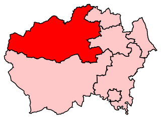
North West Durham is a constituency represented in the House of Commons of the UK Parliament since 8 June 2017 by Laura Pidcock of the Labour Party.
Wear Valley was a non-metropolitan district in County Durham, England. It was abolished on 1 April 2009 and replaced by Durham County Council.

Durham County Council is the local authority of the non-metropolitan County Durham in North East England. Since 2009 it has been a unitary authority, having the powers of a non-metropolitan county and district council combined. From 1889 to 2009 it was a county council in a two-tier arrangement.

Scouting in North East England refers to Scouting in the official region of North East England. It is largely represented by the Scout Association of the United Kingdom and some groups of traditional Scouting, including the Baden-Powell Scouts' Association.

The River Wear in North East England rises in the Pennines and flows eastwards, mostly through County Durham to the North Sea in the City of Sunderland. At 60 mi (97 km) long, it is one of the region's longest rivers, wends in a steep valley through the cathedral city of Durham and gives its name to Weardale in its upper reach and Wearside by its mouth.

Burnhope Burn is a Site of Special Scientific Interest in the Wear Valley district of north County Durham, England. It consists of a 12.6-acre (5.1 ha) area of woodland, carr, fen and mire in the valley of Burnhope Burn, just below the dam of the Derwent Reservoir, a mile (1.6 km) north-east of the village of Edmundbyers.

Greenfoot Quarry is a Site of Special Scientific Interest in the Wear Valley district of west County Durham, England. It is a disused quarry, situated in the Wear valley, 1 km upstream from the village of Stanhope.

Westernhope Burn Wood is a Site of Special Scientific Interest in the Wear Valley district of south-west County Durham, England. It occupies the steeply-incised ravine of the Westernhope Burn, a tributary of the River Wear, which it joins from the south about halfway between the villages of Eastgate and Westgate.

Pow Hill Bog is a Site of Special Scientific Interest in the Wear Valley district of County Durham, England. It lies alongside Derwent Reservoir, approximately 2 km north-west of the village of Edmundbyers and adjacent to the Edmundbyers Common portion of the Muggleswick, Stanhope and Edmundbyers Commons and Blanchland Moor SSSI.
Rogerley Quarry is a Site of Special Scientific Interest in the Wear Valley district of west County Durham, England. It lies on the edge of the valley of the River Wear, alongside the A689 road, about 1 km upriver from the village of Frosterley.
Slit Woods is a Site of Special Scientific Interest in the Wear Valley district of County Durham, England. It occupies the valley of Middlehope Burn, a tributary of the River Wear, which it joins at Westgate, just south of the site.

The Durham to Bishop Auckland Line was a railway line originally built by the North Eastern Railway (NER) to provide rail transport access to coal mines in West County Durham. It closed under the Beeching Axe to passenger traffic in May 1964, and freight in 1968. Today it forms the major part of the 9 miles (14 km) Brandon to Bishop Auckland rail trail.


