Christ Church
Christ Church is one of the oldest churches in Adams Run, SC. It's located just a few hundred yards away from the post office. While the congregation was organized around 1835, this church was not constructed until after the Civil War. Completed in 1887, it was built using materials from the first church, which was located at nearby Willtown Bluff, an historic settlement. [7]
In 1962 Christ Church merged with another church, St. Paul’s in Meggett. The consolidated church was called ChristSt. Paul's Episcopal Church. The congregation is now an Anglican parish and worships in a new sanctuary across from the historic St. Paul's; the new sanctuary was completed in 2008.
Although regular Sunday services are no longer held in the Adams Run church, ChristSt. Paul's Church often opens the historic sanctuary for special occasions. Christ Church at Adams Run, as well as its grounds and graveyard, are maintained by Christ St.Paul's.
Pauline is an unincorporated community and census-designated place (CDP) in Spartanburg County, South Carolina, United States. It was first listed as a CDP in the 2020 census with a population of 209.
Grandy is an unincorporated community and census-designated place (CDP) in Currituck County, North Carolina, USA. It was first listed as a CDP in the 2020 census with a population of 2,776. It is located along US 158 between the Currituck Sound and the North River.
Smithtown is an unincorporated community and census-designated place (CDP) in northern Yadkin County, North Carolina, United States. It was first listed as a CDP in the 2020 census with a population of 224.

Alexis is an unincorporated community and census-designated place (CDP) in Gaston County, North Carolina, United States. It is located approximately three miles north of Stanley. It was first listed as a CDP in the 2020 census with a population of 589.

Aquasco is an unincorporated area and census-designated place in southeastern Prince George's County, Maryland, United States, surrounding the town of Eagle Harbor and bordering Charles County. As of the 2020 census, the CDP had a population of 913. Aquasco was home to the Aquasco Speedway.

Uniontown is an unincorporated community and census-designated place (CDP) in Crawford County, Arkansas, United States. It is located on Arkansas Highway 220 near the Oklahoma border, 4.5 miles (7.2 km) west-northwest of Cedarville. Uniontown has a post office with ZIP code 72955.

Pencil Bluff is an unincorporated community and census-designated place (CDP) in Montgomery County, Arkansas, United States. Pencil Bluff is located at the junction of U.S. Route 270 and Arkansas Highway 88, 7.5 miles (12.1 km) northwest of Mount Ida. It was first listed as a CDP in the 2020 census with a population of 72.
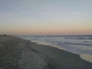
Litchfield Beach, also known simply as Litchfield, is an unincorporated community and census-designated place (CDP) in South Carolina, United States. It was first listed as a CDP in the 2020 census with a population of 8,370.
Little Rock is an unincorporated community and census-designated place (CDP) in Dillon County, South Carolina, United States. Per the 2020 census, the population was 658.
Lobeco is an unincorporated community and census-designated place (CDP) located in Beaufort County, South Carolina, United States. According to the 2020 census, the population was 292.
Wheeler is a census-designated place and unincorporated community in Prentiss County, Mississippi, United States. Its ZIP code is 38880.
Glenwood is an unincorporated community and census-designated place in McDowell County, North Carolina, United States, with a rich musical heritage. It was first listed as a CDP in the 2020 census with a population of 501. Glenwood is located along U.S. Route 221, 5 miles (8.0 km) south-southeast of Marion. Glenwood has a post office with ZIP code 28737.
La France is an unincorporated community and census-designated place (CDP) in Anderson County, South Carolina. It was first listed as a CDP in the 2020 census with a population of 476.

Mineral Bluff is a census-designated place and unincorporated community located in Fannin County in the U.S. state of Georgia. Its population was 223 as of the 2020 census. The community is situated 6 miles (10 km) northeast of the city of Blue Ridge, the county seat, 80 miles (130 km) east of Chattanooga, Tennessee, and 100 miles (160 km) north of Atlanta.

Cherry Log is an unincorporated community and census-designated place (CDP) in Gilmer County, Georgia, United States. Its population was 99 as of the 2020 census. Cherry Log has a post office with ZIP code 30522. U.S. Route 76 passes through the community. Through the heart of Cherry Log runs Cherry Log Street, on which is found the Post Office, Cornerstone Baptist Church, Cherry Log Christian Church, and the Pink Pig, a restaurant in operation since 1950.
Crouse is an unincorporated community and census-designated place (CDP) in Lincoln County, North Carolina, United States. It was first listed as a CDP in the 2020 census with a population of 322. Crouse has a post office with ZIP code 28033.
Paulina is an unincorporated community and census-designated place in St. James Parish, Louisiana, United States. It was first listed in the 2010 census with a population of 1,178. The community is located on the east bank of the Mississippi River in the eastern part of the parish, west of Lutcher and across the river from Vacherie. Paulina has a post office with ZIP code 70763.
Axson is an unincorporated community and census designated place (CDP) in Atkinson County, Georgia, United States. The community is located on U.S. Route 82, 7.1 miles (11.4 km) east of Pearson. Axson has a post office with ZIP code 31624. Per the 2020 census, the population was 360.

Elliott is an unincorporated community and census-designated place (CDP) in Lee County, South Carolina, United States. It was first listed as a CDP in the 2020 census with a population of 370.
Ruby is a hamlet in Ulster County, New York, United States. The community is 6.3 miles (10.1 km) north of Kingston in the town of Ulster. Ruby has a post office with ZIP code 12475, which opened on June 2, 1896. The population was 918 at the 2020 census.


