Argyle, Illinois

Last updated
Argyle
USA Illinois location map.svg
Red pog.svg
Argyle
Location of Argyle within Illinois
Usa edcp location map.svg
Red pog.svg
Argyle
Argyle (the United States)
Coordinates: 42°21′36″N88°56′24″W / 42.36000°N 88.94000°W / 42.36000; -88.94000
Country United States
State Illinois
County Boone, Winnebago
Area
[1]
  Total0.88 sq mi (2.27 km2)
  Land0.88 sq mi (2.27 km2)
  Water0.00 sq mi (0.00 km2)
Elevation
883 ft (269 m)
Population
 (2020)
  Total332
  Density378.56/sq mi (146.16/km2)
Time zone UTC-6 (CST)
  Summer (DST) UTC-5 (CDT)
Postal code
61011
Area codes 815, 779
FIPS code 17-02050

Argyle is an unincorporated community and census-designated place in Boone and Winnebago counties in the U.S. state of Illinois, northeast of Rockford. It is part of the Rockford, Illinois Metropolitan Statistical Area.

Contents

Geography

Argyle is located at 42°21′36″N88°56′24″W / 42.36000°N 88.94000°W / 42.36000; -88.94000 (42.3600186, -88.9401049), at an altitude of 833 feet (269 m). [2] According to the 2021 census gazetteer files, Argyle has a total area of 0.88 square miles (2.28 km2), all land. [3]

Demographics

As of the 2020 census [4] there were 332 people, 128 households, and 128 families residing in the CDP. The population density was 378.56 inhabitants per square mile (146.16/km2). There were 152 housing units at an average density of 173.32 per square mile (66.92/km2). The racial makeup of the CDP was 88.86% White, 0.60% Asian, 0.00% Pacific Islander, 2.41% from other races, and 8.13% from two or more races. Hispanic or Latino of any race were 4.82% of the population.

There were 128 households, out of which 34.4% had children under the age of 18 living with them, and all were married couples living together. The average household size was 2.76 and the average family size was 2.76.

The CDP's age distribution consisted of 23.8% under the age of 18, 5.9% from 18 to 24, 16.7% from 25 to 44, 47.9% from 45 to 64, and 5.7% who were 65 years of age or older. The median age was 48.5 years. For every 100 females, there were 111.4 males. For every 100 females age 18 and over, there were 103.8 males.

The median income for a household in the CDP was $139,821, and the median income for a family was $139,821. Males had a median income of $62,450 versus $26,042 for females. The per capita income for the CDP was $51,234. None of the population was below the poverty line.

Historical population
CensusPop.Note
2020 332
U.S. Decennial Census [5]

History

Argyle was named by an early settler who was a native of Argyll, in Scotland. [6] [7]

Argyle was hit by the November 22, 2010 tornado that affected Northern Illinois and Southern Wisconsin. It was rated EF2 on the Enhanced Fujita Scale.

Related Research Articles

<span class="mw-page-title-main">Caledonia, Illinois</span> Village in Illinois, United States

Caledonia is a village in Caledonia Township, Boone County, Illinois, United States. It is part of the Rockford, Illinois Metropolitan Statistical Area. The population was 183 at the 2020 census.

<span class="mw-page-title-main">Capron, Illinois</span> Village in Illinois, United States

Capron is a village in Boone County, Illinois, United States. It is part of the Rockford, Illinois Metropolitan Statistical Area. The population was 1395 at the 2020 census, up from 1,376 at the 2010 census.

<span class="mw-page-title-main">Loves Park, Illinois</span> City in Illinois, United States

Loves Park is a city in Boone and Winnebago counties in the U.S. state of Illinois. Most of the city is in Winnebago County, with a tiny sliver in the east located in Boone County. The population was 23,397 at the 2020 census.

<span class="mw-page-title-main">Poplar Grove, Illinois</span> Village in Illinois, United States

Poplar Grove is a village located in Poplar Grove and Belvidere Townships, Boone County, Illinois, United States. It is part of the Rockford Metropolitan Statistical Area, and of the gated community Candlewick Lake. The population was 5,049 at the 2020 census.

<span class="mw-page-title-main">Timberlane, Illinois</span> Village in Illinois, United States

Timberlane is a village in Boone County, Illinois, United States. It is part of the Rockford, Illinois Metropolitan Statistical Area. The population was 906 at the 2020 census.

<span class="mw-page-title-main">South Barrington, Illinois</span> Village in Illinois, United States

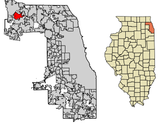
South Barrington is a residential suburb in Cook County, Illinois, United States, south of Barrington. Per the 2020 census, the population was 5,077. South Barrington is a wealthy suburb of Chicago. It is the location of the famous megachurch Willow Creek Community Church, Goebbert's Pumpkin Patch and Farm, and a lifestyle center named The Arboretum of South Barrington.

<span class="mw-page-title-main">Channel Lake, Illinois</span> Census-designated place in Illinois, United States

Channel Lake is an unincorporated community and census-designated place (CDP) in Antioch Township, Lake County, Illinois, United States. Per the 2020 census, the population was 1,581.

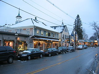
Forest Lake is an unincorporated community and census-designated place (CDP) in Ela Township of Lake County, Illinois, United States. It is about 35 miles (56 km) northwest of downtown Chicago. Per the 2020 census, the population was 1,784. The community was founded in 1935 as a vacation community for Chicago residents.

Lake Catherine is an unincorporated community and census-designated place (CDP) in Lake County, Illinois, United States. Per the 2020 census, the population was 1,279.

Venetian Village is a census-designated place (CDP) in Lake County, Illinois, United States. Per the 2020 census, the population was 2,761.

<span class="mw-page-title-main">Davis Junction, Illinois</span> Village in Illinois, United States

Davis Junction is a village in Ogle County, Illinois, United States. The population was 2,512 at the 2020 census. Named for Jeremiah Davis, it is located where the Illinois Railway Rockford Line and the Canadian Pacific Railway Chicago Subdivision intersect along Illinois Route 72. It is the site of the Orchard Hills Landfill - one of the largest in the United States.

<span class="mw-page-title-main">Lake Summerset, Illinois</span> Census Designated Place in Illinois, United States

Lake Summerset is a census-designated place (CDP) in Stephenson and Winnebago counties in Illinois. The population was 2,048 at the 2010 census.

<span class="mw-page-title-main">New Milford, Illinois</span> Village in Illinois, United States

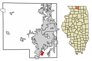
New Milford is a village in Winnebago County, Illinois, United States on the south bank of the Kishwaukee River overlooking the south side of Rockford. It is part of the Rockford, Illinois Metropolitan Statistical Area. The population was 697 at the 2010 census, up from 541 in 2000.

<span class="mw-page-title-main">Kennebunkport (CDP), Maine</span> Census-designated place in Maine, United States

Kennebunkport is a census-designated place (CDP) consisting of the central village in the town of Kennebunkport in York County, Maine, United States. The population was 1,238 at the 2010 census, out of a total town population of 3,474. It is part of the Portland–South Portland–Biddeford, Maine Metropolitan Statistical Area.

<span class="mw-page-title-main">Hebron (CDP), Wisconsin</span> Census-designated place in Wisconsin, United States

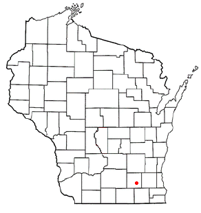
Hebron is a census-designated place (CDP) in the town of Hebron, Jefferson County, Wisconsin, United States. The population was 209 at the 2020 census. It is located on the Bark River.

<span class="mw-page-title-main">Garden Prairie, Illinois</span> CDP in Illinois, United States

Garden Prairie is an unincorporated former village and census-designated place located in Boone County, Illinois, United States. It is part of the Rockford, Illinois Metropolitan Statistical Area.

<span class="mw-page-title-main">Seymour, Illinois</span> Census-designated place in Illinois, United States

Seymour is a census-designated place in Champaign County, Illinois, United States. At the 2020 census it had a population of 317. It is part of Mahomet-Seymour Community Unit School District No. 3.

Olive Branch is an unincorporated census-designated place in Alexander County, Illinois, United States. It has a post office with the ZIP code 62969. Its population was 650 at the 2020 census.

<span class="mw-page-title-main">Cortland, Illinois</span> Town in Illinois, United States

Cortland is an incorporated town in DeKalb County, Illinois, United States. The population was 4,398 at the 2020 Census. It was previously 4,270 at the 2010 census, up from 2,066 in 2000. Because of its status as an incorporated town, Cortland has adopted the slogan, "The Third Largest Town in Illinois". Only the towns of Cicero and Normal are larger, in terms of population. Most municipalities in Illinois are defined as "cities" or "villages."

Langleyville is an unincorporated census-designated place in Christian County, Illinois, United States. As of the 2020 census, it had a population of 391.

References

  1. "2020 U.S. Gazetteer Files". United States Census Bureau. Retrieved March 15, 2022.
  2. U.S. Geological Survey Geographic Names Information System: Argyle, Illinois
  3. Bureau, US Census. "Gazetteer Files". Census.gov. Retrieved 2022-06-29.
  4. "Explore Census Data". data.census.gov. Retrieved 2022-06-28.
  5. "Census of Population and Housing". Census.gov. Retrieved June 4, 2016.
  6. Chicago and North Western Railway Company (1908). A History of the Origin of the Place Names Connected with the Chicago & North Western and Chicago, St. Paul, Minneapolis & Omaha Railways. p. 38.
  7. Harvey, Daniel G. (1924). The Argyle settlement in history and story. Beloit, Wis.: Daily News Pub. Co. Retrieved 11 November 2021.