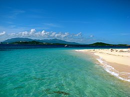
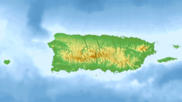
Transportation in Puerto Rico includes a system of roads, highways, freeways, airports, ports and harbors, and railway systems, serving a population of approximately 4 million year-round. It is funded primarily with both local and federal government funds.

Isla Culebra is an island, town and municipality of Puerto Rico and geographically part of the Spanish Virgin Islands. It is located approximately 17 miles (27 km) east of the Puerto Rican mainland, 12 miles (19 km) west of St. Thomas and 9 miles (14 km) north of Vieques. Culebra is spread over 5 barrios and Culebra Pueblo (Dewey), the main town and the administrative center of the island. Residents of the island are known as culebrenses. With a population of 1,792 as of the 2020 Census, it is Puerto Rico's least populous municipality.

Fajardo is a town and a municipality part of the San Juan-Caguas-Fajardo Combined Statistical Area in Puerto Rico.

Luquillo is a town and municipality of Puerto Rico located in the northeast coast, northwest of Fajardo; and east of Rio Grande. Luquillo is spread over 5 barrios and Luquillo Pueblo. It lends its name to the Sierra de Luquillo, where El Yunque National Forest is located. It is part of the Fajardo Metropolitan Statistical Area.

The Puerto Rican dry forests are a tropical dry forest ecoregion located in southwestern and eastern Puerto Rico and on the offshore islands. They cover an area of 1,300 km2 (500 sq mi). These forests grow in areas receiving less than 1,000 mm (39 in) of rain annually. Many of the trees are deciduous, losing their leaves during the dry season which normally lasts from December to April.

The Puerto Rico campaign was the American military sea and land operation on the island of Puerto Rico during the Spanish–American War. The offensive began on May 12, 1898, when the United States Navy attacked the capital, San Juan. Though the damage inflicted on the city was minimal, the Americans were able to establish a blockade in the city's harbor, San Juan Bay. On June 22, the cruiser Isabel II and the destroyer Terror delivered a Spanish counterattack, but were unable to break the blockade and Terror was damaged.
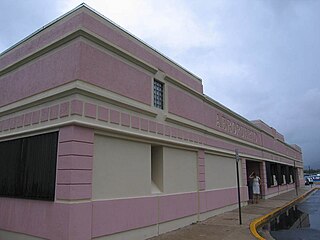
Diego Jiménez Torres Airport was a public use airport owned by the Puerto Rico Ports Authority and located 1 mile (1.6 km) south of Fajardo, a city in Puerto Rico. It is also known as Fajardo Airport.

The Spanish Virgin Islands, formerly called the Passage Islands and also known as the Puerto Rican Virgin Islands, West Virgin Islands, primarily consisting of the islands of Culebra and Vieques, are part of the Commonwealth of Puerto Rico and are located east of the main island of Puerto Rico in the Caribbean.

Puerto Rico Highway 3(PR-3) at nearly 100 miles long, is the second-longest highway on Puerto Rico. It connects the San Juan neighborhood of Río Piedras to downtown Salinas indirectly around the eastern coast of the island. Highway 3 ranges from a three lane urban avenue in San Juan to a one lane rural road past Fajardo. While other roads connect San Juan, it runs the coastline of Puerto Rico east of San Juan, beginning in Río Piedras near Santurce and goes to Fajardo where it goes south paralleling the coastline to Humacao and Maunabo. It goes up to a mountain-scenic route and goes west to Salinas, where it meets PR-1.

The Diocese of Fajardo–Humacao(Latin: Dioecesis Faiardensis–Humacaensis) is a Latin Church ecclesiastical territory or diocese of the Catholic Church and consists of part of the east and the northeast of the island of Puerto Rico. The current bishop is Luis Miranda Rivera, who was appointed on May 16, 2020, by Pope Francis. The mother church is Cathedral Santiago Apóstol in Fajardo, Puerto Rico.

Isla Palomino is a small, uninhabited island located to the east of Puerto Rico, near the coast of Las Croabas in Cabezas barrio, Fajardo.
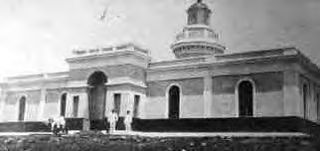
The Battle of Fajardo was an engagement between the armed forces of the United States and Spain that occurred on the night of August 8–9, 1898 near the end of the Puerto Rican Campaign during the Spanish–American War.
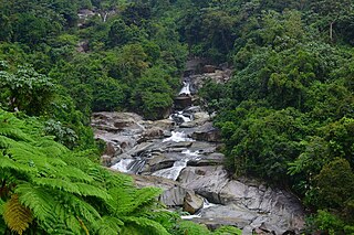
The Icacos River, sometimes spelled Hicacos, is a river of Naguabo, Puerto Rico. It is 2.3 miles (3.7 km) long and has received the designation of "Wild and Scenic River" by the National Wild and Scenic Rivers System. This river aids the hydroelectric dam in Naguabo.
Beatriz Del Cueto López-Hidalgo is a Cuban-born architect specialising in conservation and architectural preservation. A resident of Puerto Rico since 1960, del Cueto is a Fellow of the American Academy in Rome, Fellow of the American Institute of Architects, and Henry Klumb Award winner in 2012.

The U.S. Customs House,, located at Calle Union, Fajardo, Puerto Rico, was constructed in 1930. The poured-concrete building is significant architecturally and historically for the role it played in the first, transitional phase of the American customs service in Puerto Rico, from 1898 through 1931. This period is bracketed on one end by the cession, on December 10, 1898, of the island of Puerto Rico to the United States by Spain as a condition of the Treaty of Paris ending the Spanish–American War, and on the other by the completion in 1931 of the major building and rehabilitation program undertaken by the U.S. Customs Service following World War I.
The Historical Railway of Puerto Rico — or Ferrocarril Histórico de Puerto Rico in Spanish — was a historic 1,000 mm narrow gauge heritage railroad operating within Puerto Rico, an Insular area of the United States. It was located in Fajardo between 1971 and 1975.

La Cordillera Reef is a nature reserve located 1.5 nautical miles from Fajardo, Puerto Rico consisting of a small archipelago of keys, coral reefs and rocky islets. The nature reserve covers about 18 nautical miles and almost 30,000 acres between Cape San Juan in Cabezas, Fajardo and the island of Culebra. With the exception of Palomino and Lobos Key which are privately owned, all islands, reefs and keys are protected by the marine reserve. The total land area of the reserve is 224 cuerdas. The nature reserve is also important for local fishermen, and eastern coastal municipalities such as Fajardo, Ceiba and Naguabo depend on the reserve for their fishing industries.
