
The Province of the Transvaal, commonly referred to as the Transvaal, was a province of South Africa from 1910 until 1994, when a new constitution subdivided it following the end of apartheid. The name "Transvaal" refers to the province's geographical location to the north of the Vaal River. Its capital was Pretoria, which was also the country's executive capital.

Mpumalanga is one of the nine provinces of South Africa. The name means "East", or literally "The Place Where the Sun Rises" in the Nguni languages. Mpumalanga lies in eastern South Africa, bordering Eswatini and Mozambique. It shares borders with the South African provinces of Limpopo to the north, Gauteng to the west, the Free State to the southwest, and KwaZulu-Natal to the south. The capital is Mbombela.

Limpopo is the northernmost province of South Africa. It is named after the Limpopo River, which forms the province's western and northern borders. The capital and largest city in the province is Polokwane, while the provincial legislature is situated in Lebowakgomo.

Marble Hall is a town in the south of the Limpopo province of South Africa. It was formerly in Mpumalanga province.

The Olifants River,Lepelle, iBhalule or Obalule is a river in South Africa and Mozambique, a tributary of the Limpopo River. It falls into the Drainage Area B of the Drainage basins of South Africa. The historical area of the Pedi people, Sekhukhuneland, is located between the Olifants River and one of its largest tributaries, the Steelpoort River.
Limpopo cricket team, also called the Limpopo Impalas, are a first-class cricket team representing Limpopo, the northernmost province of South Africa. Limpopo Impala Cricket has its headquarters in Polokwane, and the team plays their home games at the Polokwane Cricket Club Ground.
Mpumalanga, also known as the Mpumalanga Rhinos, are a South African first-class cricket team representing the province of Mpumalanga. They have their headquarters in Witbank and play their home games at Uplands College in White River.
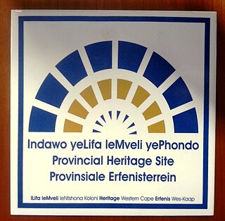
Provincial heritage sites in South Africa are places that are of historic or cultural importance within the context of the province concerned and which are for this reason declared in terms of Section 28 of the National Heritage Resources Act (NHRA) or legislation of the applicable province. The designation was a new one that came into effect with the introduction of the Act on 1 April 2000 when all former national monuments declared by the former National Monuments Council and its predecessors became provincial heritage sites as provided for in Section 58 of the Act.

Burgersfort is located in the valley of the Spekboom River at the edge of the Bushveld Complex in the Fetakgomo Tubatse Local Municipality of the Limpopo province, near the border with the Mpumalanga province. The town was named after a hexagonal fort built there during the 1876-77 Second War against the Bapedi of Chief Sekhukhune, and was named after President TF Burgers of the ZAR. The town serves as a meeting point for two major roads, the R37 and R555. The region is rich in platinum and platinum group metals. The town's neighbouring towns are Mashishing (60 km), Steelpoort (16 km) and Ohrigstad (26 km).

Bushbuckridge Municipality is a local municipality within the Ehlanzeni District Municipality, in the Mpumalanga province of South Africa. Commercial farming, which consists of pine and bluegum plantations, tobacco, cotton, sub-tropical fruits and vegetables, is practised in the municipality's countryside. The municipality includes the southern part of Kruger National Park. Bushbuckridge is the largest local municipality in Mpumalanga in terms of land size.

Iolaus silarus, the straight-line sapphire, is a butterfly of the family Lycaenidae. The species was first described by Hamilton Herbert Druce in 1885. It is found in Mozambique, Zimbabwe, Botswana, Namibia, Malawi, Zambia, southern Zaire, Tanzania, south-western Kenya and South Africa. In South Africa it is found in wooded savannah in northern KwaZulu-Natal and in savannah from Eswatini to Mpumalanga, Limpopo and North West. It is also present in Afromontane forest on the Wolkberg and the northern Drakensberg.
Steelpoort is a mining town on the R555 road in Sekhukhune District Municipality in the Limpopo province of South Africa. It is located on the border with Mpumalanga province.
Alexandria is a town in Bushbuckridge Local Municipality under Ehlanzeni District Municipality in the Mpumalanga province of South Africa. It got its theme of footprints on rock in the mountains of Simeleni.

The National Monuments Council (NMC) was the national heritage conservation authority of South Africa, and therefore also of Namibia, during the major part of the apartheid era. It was the successor body to the Historical Monuments Commission and became known principally for its declaration of several thousand national monuments. It came into being through the promulgation of the National Monuments Act of 1969 and ceased to exist on 31 March 2000 when it was replaced by SAHRA and the provincial heritage resources authorities established in terms of the National Heritage Resources Act of 1999.
A provincial heritage resources authority (PHRA) is a government agency established at provincial level in South Africa and is responsible for the management of immovable heritage. In some instances, they are also responsible for moveable heritage, interpretation centres and museums.

The Bolsheviks Party of South Africa is a South African political party based in Limpopo.
The 2019–20 CSA Provincial T20 Cup was a domestic Twenty cricket tournament that took place in South Africa in September 2019, as a curtain-raiser to the 2019–20 South African domestic season. It was played between the thirteen South African provincial teams, along with Limpopo and Mpumalanga. This was the sixth edition of the CSA Provincial T20 Cup, which was last played in the 2015–16 season. With only domestic teams from South Africa taking part, the tournament returned in place of the Africa T20 Cup, which had been held since 2015.
The 2020–21 CSA Provincial One-Day Challenge was a domestic one-day cricket tournament that was played in South Africa in February and March 2021. Free State and Northern Cape were the defending champions, after the title was shared due to the COVID-19 pandemic.
The 2021–22 CSA Provincial T20 Knock-Out was a Twenty20 cricket tournament that was played in South Africa in September and October 2021. It was the first Twenty20 tournament to be played in the country since Cricket South Africa restructured its domestic setup, and featured all fifteen provincial sides and the national under-19 team.
The 2022–23 CSA 4-Day Series was a first-class cricket competition taking place in South Africa from October 2022 to March 2023. It was the second edition of the post-franchise era and retained the two-division league format introduced the previous year, with the teams in each division unchanged.


