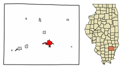
Fairfield | |
---|---|
Motto: "Home of the Friendly People" | |
Coordinates: 38°22′47″N88°22′20″W / 38.37972°N 88.37222°W [1] | |
Country | United States |
State | Illinois |
County | Wayne |
Government | |
• Mayor | Gary Moore |
Area | |
• Total | 4.06 sq mi (10.52 km2) |
• Land | 4.03 sq mi (10.43 km2) |
• Water | 0.03 sq mi (0.09 km2) |
Elevation | 459 ft (140 m) |
Population (2020) | |
• Total | 4,883 |
• Density | 1,212.26/sq mi (468.02/km2) |
Time zone | UTC-6 (CST) |
• Summer (DST) | UTC-5 (CDT) |
ZIP code(s) | 62837 |
Area code | 618 |
FIPS code | 17-24816 |
GNIS feature ID | 2394732 [1] |
Website | www |
Fairfield is a city in and the county seat of Wayne County, Illinois, United States, [3] and the location of Frontier Community College. The population was 4,883 at the 2020 census.
Fairfield is most famous for being the hometown of the "friendly" people, and for the Shelton Brothers Gang, notorious bootleggers who fought it out with the Harrisburg, Illinois-based Birger Gang to control criminal activities in Southern Illinois. During the first half of the 20th century, gang leaders Carl, Earl and Bernie Shelton made Fairfield a household name. Based on testimony of Charlie Birger himself, the Shelton Brothers were convicted for a 1925 unsolved mail carrier robbery of $15,000 and were sentenced to 25 years. They were released a few years later. Birger dominated bootlegging in Southern Illinois until he himself was hanged in Benton for the murder of West City Mayor Joe Adams in 1928. After serving their time, the Shelton brothers built a new criminal empire. Based in East St Louis, one of the most prosperous cities of its day, they controlled all vice from Peoria and southward.
They met their demise at the hands of the Chicago mob and an insider Charles "Blackie" Harris. A land dispute led to Blackie joining forces with the Mob to kill off members of the Shelton gang. His most notable victim was Carl Shelton, the leader. He was ambushed several miles southeast of Fairfield, shot from his Jeep. Bernie was killed at his Peoria roadhouse. Earl moved to Jacksonville, Florida and became a successful land speculator.
According to the 2010 census, Fairfield has a total area of 4.054 square miles (10.50 km2), of which 4.02 square miles (10.41 km2) (or 99.16%) is land and 0.034 square miles (0.09 km2) (or 0.84%) is water. [4]
Climate data for Fairfield, Illinois (1991–2020 normals, extremes 1896–present) | |||||||||||||
---|---|---|---|---|---|---|---|---|---|---|---|---|---|
Month | Jan | Feb | Mar | Apr | May | Jun | Jul | Aug | Sep | Oct | Nov | Dec | Year |
Record high °F (°C) | 77 (25) | 78 (26) | 91 (33) | 91 (33) | 98 (37) | 108 (42) | 113 (45) | 108 (42) | 105 (41) | 96 (36) | 86 (30) | 74 (23) | 113 (45) |
Average high °F (°C) | 41.1 (5.1) | 46.5 (8.1) | 57.0 (13.9) | 69.0 (20.6) | 78.1 (25.6) | 86.9 (30.5) | 89.6 (32.0) | 88.8 (31.6) | 82.6 (28.1) | 70.5 (21.4) | 56.1 (13.4) | 45.0 (7.2) | 67.6 (19.8) |
Daily mean °F (°C) | 32.8 (0.4) | 37.2 (2.9) | 46.6 (8.1) | 57.7 (14.3) | 67.0 (19.4) | 75.6 (24.2) | 78.7 (25.9) | 77.2 (25.1) | 70.2 (21.2) | 58.8 (14.9) | 46.2 (7.9) | 36.9 (2.7) | 57.1 (13.9) |
Average low °F (°C) | 24.5 (−4.2) | 27.9 (−2.3) | 36.3 (2.4) | 46.5 (8.1) | 55.9 (13.3) | 64.3 (17.9) | 67.8 (19.9) | 65.6 (18.7) | 57.9 (14.4) | 47.0 (8.3) | 36.3 (2.4) | 28.8 (−1.8) | 46.6 (8.1) |
Record low °F (°C) | −23 (−31) | −21 (−29) | −8 (−22) | 17 (−8) | 29 (−2) | 39 (4) | 45 (7) | 43 (6) | 25 (−4) | 19 (−7) | −3 (−19) | −18 (−28) | −23 (−31) |
Average precipitation inches (mm) | 3.33 (85) | 2.68 (68) | 4.22 (107) | 5.00 (127) | 4.98 (126) | 4.70 (119) | 3.83 (97) | 3.51 (89) | 2.90 (74) | 3.73 (95) | 3.82 (97) | 3.30 (84) | 46.00 (1,168) |
Average precipitation days (≥ 0.01 in) | 9.2 | 8.4 | 10.7 | 11.2 | 12.2 | 10.1 | 8.5 | 7.4 | 6.6 | 8.1 | 9.2 | 9.7 | 111.3 |
Source: NOAA [5] [6] |
Census | Pop. | Note | %± |
---|---|---|---|
1850 | 195 | — | |
1860 | 508 | 160.5% | |
1870 | 719 | 41.5% | |
1880 | 1,391 | 93.5% | |
1890 | 1,881 | 35.2% | |
1900 | 2,338 | 24.3% | |
1910 | 2,479 | 6.0% | |
1920 | 2,754 | 11.1% | |
1930 | 3,280 | 19.1% | |
1940 | 4,008 | 22.2% | |
1950 | 5,576 | 39.1% | |
1960 | 6,362 | 14.1% | |
1970 | 5,897 | −7.3% | |
1980 | 5,944 | 0.8% | |
1990 | 5,439 | −8.5% | |
2000 | 5,421 | −0.3% | |
2010 | 5,154 | −4.9% | |
2020 | 4,883 | −5.3% | |
U.S. Decennial Census [7] |
As of the census [8] of 2000, there were 5,421 people, 2,495 households, and 1,494 families residing in the city. The population density was 1,499.0 inhabitants per square mile (578.8/km2). There were 2,727 housing units at an average density of 754.0 per square mile (291.1/km2). The racial makeup of the city was 98.40% White, 0.09% African American, 0.26% Native American, 0.63% Asian, 0.02% Pacific Islander, 0.06% from other races, and 0.55% from two or more races. Hispanic or Latino of any race were 0.42% of the population.
There were 2,495 households, out of which 24.8% had children under the age of 18 living with them, 46.4% were married couples living together, 10.8% had a female householder with no husband present, and 40.1% were non-families. 37.0% of all households were made up of individuals, and 21.3% had someone living alone who was 65 years of age or older. The average household size was 2.11 and the average family size was 2.74.
In the city, the population was spread out, with 20.5% under the age of 18, 8.0% from 18 to 24, 24.1% from 25 to 44, 22.4% from 45 to 64, and 24.9% who were 65 years of age or older. The median age was 43 years. For every 100 females, there were 82.1 males. For every 100 females age 18 and over, there were 77.6 males.
The median income for a household in the city was $25,797, and the median income for a family was $36,278. Males had a median income of $28,866 versus $19,985 for females. The per capita income for the city was $16,791. About 8.5% of families and 13.1% of the population were below the poverty line, including 16.7% of those under age 18 and 9.6% of those age 65 or over.
Dover is a village in Bureau County, Illinois, United States. The population was 135 at the 2020 census. It is part of the Ottawa Micropolitan Statistical Area.
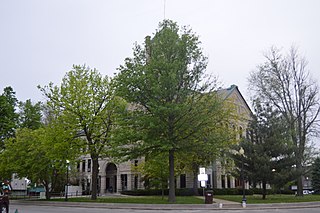
Taylorville is a city in and the county seat of Christian County, Illinois, United States. The population was 10,506 at the 2020 census, making it the county's largest city.
Chrisman is a city in Ross Township, Edgar County, Illinois, United States. The population was 1,312 at the 2020 census.
Melvin is a village in Ford County, Illinois, United States. The population was 452 at the 2010 census.
West City is a village in Franklin County, Illinois, adjacent to the county seat of Benton. The population was 661 at the 2010 census.
Yates City is a village in Knox County, Illinois, United States. The population was 642 at the 2020 census. It is part of the Galesburg Micropolitan Statistical Area.
Gillespie is a city in Macoupin County, Illinois, United States, and part of the Metro East region of the St. Louis metropolitan area. The population was 3,168 at the 2020 census.
Monticello is a city and county seat of Piatt County, Illinois, United States. The population was 5,941 at the 2020 census.
Prophetstown is a city in Whiteside County, Illinois, United States. The population was 2,080 at the 2010 census, up from 2,023 in 2000.
Eureka is a city and the county seat of Woodford County, Illinois. The population was 5,295 at the 2010 census. Eureka is part of the Peoria, Illinois Metropolitan Statistical Area.
Pittsford is a town in Rutland County, Vermont, United States. As of the 2020 census, the town population was 2,862. Named for William Pitt, it has two picket forts used in the American Revolutionary War.
Vienna is a town in Dane County, Wisconsin, United States. The population was 1,666 at the 2020 census. The unincorporated community of Norway Grove is located in the town.
LeRoy is a town in Dodge County, Wisconsin, United States. The population was 1,116 at the 2000 census. The unincorporated communities of Farmersville and LeRoy are located in the town.
Waterloo is a town in Grant County in the U.S. state of Wisconsin. The population was 557 at the 2000 census. The unincorporated communities of Burton and McCartney is located in the town.
Brodhead is a city in Green and Rock counties in the U.S. state of Wisconsin. The population was 3,274 at the 2020 census. In February 2000, the city annexed a portion of land from the Town of Spring Valley in Rock County.
Markesan is a city in Green Lake County, Wisconsin, United States. The population was 1,476 at the 2010 census. The center of population of Wisconsin is located in Markesan.
Lima is a town in Sheboygan County, Wisconsin, United States. The population was 2,948 at the 2000 census. It is included in the Sheboygan, Wisconsin Metropolitan Statistical Area. The unincorporated communities of Gibbsville, Hingham, and Ourtown are located in the town. The ghost town of Kennedy Corners was also located in the town.
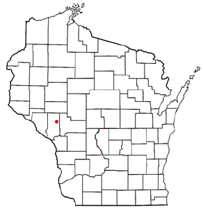
Pigeon is a town in Trempealeau County, Wisconsin, United States. The population was 894 at the 2000 census. The unincorporated community of Coral City is located in the town.
Melrose is a town in Jackson County, Wisconsin, United States. The population was 402 at the 2000 census. The Village of Melrose is located within the town.
Waterloo is a town in Jefferson County in the U.S. state of Wisconsin. The population was 909 at the 2010 census. The city of Waterloo is located within the town. The unincorporated community of Portland is also located partially in the town.