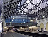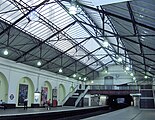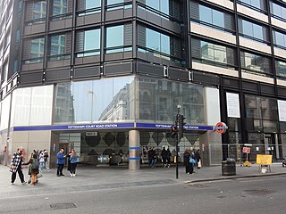
Tottenham Court Road is a London Underground and Elizabeth line station in St Giles in the West End of London. The station is served by the Central line, the Elizabeth line and the Charing Cross branch of the Northern line. The station is located at St Giles Circus, the junction of Tottenham Court Road, Oxford Street, New Oxford Street and Charing Cross Road and is in Travelcard Zone 1, with a second entrance at Dean Street.
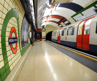
Piccadilly Circus is a London Underground station located directly beneath Piccadilly Circus itself, with entrances at every corner. Located in Travel-card Zone 1, the station is on the Piccadilly line between Green Park and Leicester Square and on the Bakerloo line between Charing Cross and Oxford Circus.

Acton Town is a London Underground station in the south-west corner of Acton, West London, in the London Borough of Ealing, close to the border with the London Borough of Hounslow. The station is served by the District and Piccadilly lines and is in Travelcard Zone 3. On the District line, it is between Chiswick Park and Ealing Common stations, and on the Piccadilly line it is between Hammersmith and Ealing Common on the Uxbridge branch & South Ealing on the Heathrow branch. Acton Town station was opened as Mill Hill Park on 1 July 1879 by the District Railway. It remained as a terminus until on 1 May 1883 and 23 June 1903 the DR opened two branches from Acton Town to Hounslow Town and Park Royal & Twyford Abbey respectively. On 4 July 1932 the Piccadilly line was extended to Acton Town. District line services to both the Hounslow and Uxbridge branches were withdrawn completely on 9 and 10 October 1964 after which operations were provided by the Piccadilly line alone.

Bond Street is a London Underground and Elizabeth line station in Mayfair, in the West End of London. Entrances are on Oxford Street, near its junction with New Bond Street, and on Hanover Square.

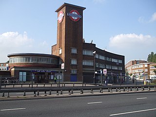
Ealing Broadway is a major single-level interchange station in Ealing in London, England. It is in the London Borough of Ealing, West London, and is served by the London Underground and also National Rail on the Great Western Main Line. On the Underground, it is one of three western termini of the District line, the next station being Ealing Common, and it is also one of two western termini of the Central line, the next station being West Acton. On the National Rail network, it is a through-station on the Great Western Main Line, 5 miles 56 chains (9.2 km) down the line from London Paddington, between Acton Main Line and West Ealing.

Knightsbridge is a London Underground station in Knightsbridge, London. It is on the Piccadilly line between South Kensington and Hyde Park Corner, and is in Travelcard Zone 1.

Leyton is a London Underground station in Leyton, in the London Borough of Waltham Forest, East London. Located on Leyton High Road, adjacent to the A12, the station is on the Central line between two stations assigned to two fare zones – Stratford and Leytonstone. It is in zone 3.

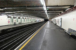
Barons Court is a London Underground station in West Kensington in the London Borough of Hammersmith and Fulham, Greater London. This station serves the District line and the Piccadilly line. Barons Court is between West Kensington and Hammersmith on the District line, and between Earl's Court and Hammersmith on the Piccadilly line and is in Travelcard Zone 2. East of the station, the Piccadilly line descends into tunnel towards Earl's Court and the District line continues in a cutting to West Kensington. The station is the last open air stop for eastbound trains on the Piccadilly line until Arnos Grove and has cross-platform interchange with the District line.
Stepney Green is a London Underground station located on Mile End Road in Stepney, London, United Kingdom. It is between Whitechapel and Mile End on the District line and the Hammersmith & City line, and is in Travelcard Zone 2.

Bow Road is a London Underground station located on Bow Road in Bow, London, England. It is on the District and Hammersmith & City lines. The station is interlinked as an out of station interchange (OSI) with Bow Church station on the Docklands Light Railway which is about 300 m (980 ft) away via Bow Road. The two stations are classed as a single station for ticketing purposes as well as on tube maps but both managed separately.
Park Royal is a station on the Piccadilly line of the London Underground. It is between North Ealing and Alperton and is in Travelcard Zone 3. It is situated on the south side of the east–west Western Avenue (A40), surrounded by residential Ealing and industrial Park Royal. There is a pedestrian subway under the A40 road near the station.

Walthamstow Central is a London Underground and London Overground interchange station in the town of Walthamstow in the London Borough of Waltham Forest, north-east London. It is the northern terminus of the Victoria line following Blackhorse Road and is the second of five stations on the Chingford branch of the Lea Valley lines operated by London Overground since 2015, 6 miles 16 chains (10.0 km) from London Liverpool Street between St. James Street and Wood Street. The two lines have separate platforms at different levels.

Burnt Oak is a London Underground station in Burnt Oak, north London, on Watling Avenue, off the A5. The station is on the Edgware branch of the Northern line, between Edgware and Colindale stations, and in Travelcard Zone 4.

Loughton is a London Underground station in the Epping Forest district of Essex. It is entirely above ground, and platforms are accessed by staircases which rise from ground level.
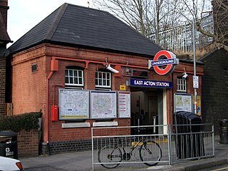
East Acton is a London Underground station in East Acton in London Borough of Hammersmith and Fulham. The station is on the Central line, between White City and North Acton stations, and in Travelcard Zone 2. Wormwood Scrubs, Queen Charlotte's and Chelsea Hospital, Hammersmith Hospital, Wormwood Scrubs prison and Imperial College Hammersmith branch are accessible from the station.
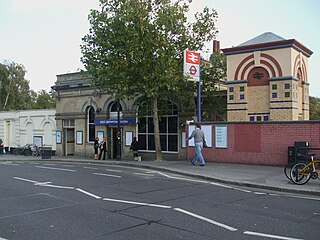
West Brompton is a London Underground, London Overground and National Rail station on Old Brompton Road (A3218) in West Brompton, located in west London, and is on the District line and West London Line (WLL). It is immediately south of the demolished Earls Court Exhibition Centre and west of Brompton Cemetery in the Royal Borough of Kensington and Chelsea.

Parsons Green is an above-ground London Underground station on the Wimbledon branch of the District line that opened in 1880. It is between Fulham Broadway and Putney Bridge stations and is in Zone 2. There are entrances on Parsons Green Lane and in Beaconsfield Walk. The station is a short distance north of the green itself. It was previously a train-operator depot, until functions were transferred to Earl's Court.

West Kensington is a London Underground District line station in West Kensington. It is located on North End Road (B317) close to its junction with West Cromwell Road/Talgarth Road (A4).

Barkingside is a London Underground station on the Central line. It is on the eastern edge of Barkingside in east London at the end of a cul-de-sac off Station Road. The station is next door to the home of Redbridge F.C. It is between Newbury Park and Fairlop stations and has been in Travelcard Zone 4 since 2 January 2007.

Walham Green is the historic name of an English village, now part of inner London, in the parish of Fulham in the County of Middlesex. It was located between the hamlet of North End to the north, and Parsons Green to the south. To the east it was bounded by Counter's Creek, the historical boundary with the parish of Chelsea, and to the south-east is Sands End.