Karasabai

Last updated

Karasabai
Village
Guyana location map.svg
Red pog.svg
Karasabai
Location in Guyana
Coordinates: 4°01′58″N59°32′42″W / 4.0329°N 59.5449°W / 4.0329; -59.5449
Country Flag of Guyana.svg Guyana
Region Upper Takutu-Upper Essequibo
Government
  ToshaoMarlon Edwards
Population
 (2009) [1]
  Total1,600

Karasabai is an indigenous village of Macushi Amerindians in the Upper Takutu-Upper Essequibo Region of Guyana. It is located in the South Pakaraima Mountains, [2] and near the Ireng River which flows south to the Amazon River. [3]

Contents

Legend

According to the legends of the Macushi people, Makonaima descended to Earth and the indigenous peoples are his offspring. On his travels, Makonaima passed a creek where a treasure was located. He decided to turn the treasure to stone. The village of Karasabai is located at the bay of that creek. [3]

Overview

Karasabai has a school, and a health care clinic. The nearest big town is Normandia in Brazil. The primary language of its inhabitants is Macushi with English as the secondary language. [1] The major religion is Christianity. [2]

In December 2020, an ambulance, which was customised for rough terrain, was delivered to the community. [4] In March 2021, 112 tractors were delivered to Amerindian villages, Karasabai included to, 'to boost agriculture to ensure that food security across the hinterland is sustained and secured so our people will not go hungry in times of disaster, and that agriculture will be taken to a different level.' according to the Minister of Amerindian Affairs, Pauline Sukhi. [5]

As of 2019, the village is negotiating indigenous land rights with the government of Guyana. [6]

Karasabai is connected to Lethem by road. [2] In 2016, a road was constructed to Monkey Mountain. [7] The Karasabai Airport is located near the village. [2] There are no radio or television signals. Telephone services and internet access are very limited. [8]

The G$ 5M Karasabai’s Community Development Project was launched on 20 January 2018 as part of the Amerindian Development Fund in order to set up a tourism industry. [9]

Economy

The economy of the village is based on subsistence farming, and cattle rearing. [2]

Launched in January 2018, the Kezeé Eco Lodge is a tourist resort located in the village. [10] Karasabai is one of the few places where the sun parakeet (ratinga solstitialis) can be observed in the wild. [3]

Related Research Articles

The Pacaraima or Pakaraima Mountains are a mountain range primarily in southwestern Guyana, and into northern Brazil and eastern Venezuela.

<span class="mw-page-title-main">Rupununi savannah</span> Savanna plain in Upper Takutu-Upper Essequibo, Guyana

The Rupununi savannah is a savanna plain in Guyana, in the Upper Takutu-Upper Essequibo region. It is part of the Guianan savanna ecoregion of the tropical and subtropical grasslands, savannas, and shrublands biome.

<span class="mw-page-title-main">Macushi</span> Indigenous people of Brazil

The Macushi are an indigenous people living in the borderlands of southern Guyana, northern Brazil in the state of Roraima, and in an eastern part of Venezuela.

<span class="mw-page-title-main">Wapishana</span> Indigenous people of Brazil

The Wapishana or Wapichan are an indigenous group found in the Roraima area of northern Brazil and southern Guyana.

<span class="mw-page-title-main">Annai, Guyana</span> Place in Upper Takutu-Upper Essequibo, Guyana

Annai is an Amerindian village in the Upper Takutu-Upper Essequibo Region of Guyana.

<span class="mw-page-title-main">Iwokrama Forest</span> Forest in Guyana

The Iwokrama Forest is a 3,716 square kilometres (1,435 sq mi) nature reserve of central Guyana located in the heart of the Guiana Shield, one of the four last pristine tropical forests in the world. It represents an important transition zone in rainfall, landforms, human histories and biological communities.

<span class="mw-page-title-main">Orinduik Falls</span> Waterfalls on the Grazil-Guyana border

The Orinduik Falls lie on the Ireng River, a highland river that thunders over steps and terraces of red jasper on the border of Guyana and Brazil before merging with the Takutu River and into Brazil to join the Amazon River.

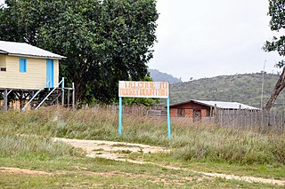
Micobie is a village in Potaro-Siparuni, Guyana, on the right bank of the Potaro River near Tumatumari.

<span class="mw-page-title-main">Paramakatoi</span> Place in Potaro-Siparuni, Guyana

Paramakatoi is an Amerindian community in the Potaro-Siparuni Region of Guyana, located in the Pacaraima Mountains. With an altitude of 970 metres (3,180 ft), it is 18 kilometres (11 mi) east of Kurukabaru.

<span class="mw-page-title-main">Patamona people</span> Indigenous people to the mountains of Guyana and Northern Brazil

The Patamona are an Amerindian people native to the Pakaraima Mountains of Guyana and northern Brazil. They speak a Cariban language, Kapóng, and have often been referred to interchangeably as Akawaio or Ingariko. Patamona are considered a sub-group of Kapon people.

Wowetta is an indigenous village in the Upper Takutu-Upper Essequibo Region in Guyana. The village is mainly inhabited by Macushi people.

<span class="mw-page-title-main">Indigenous peoples in Guyana</span> Earliest inhabitants of Guyana

Indigenous peoples in Guyana, Native Guyanese or Amerindian Guyanese are Guyanese people who are of indigenous ancestry. They comprise approximately 9.16% of Guyana's population. Amerindians are credited with the invention of the canoe, as well as Cassava-based dishes and Guyanese pepperpot, the national dish of Guyana. Amerindian languages have also been incorporated in the lexicon of Guyanese Creole.

Aranaputa is an Amerindian village in the Upper Takutu-Upper Essequibo, Guyana. It is located in the Pacaraima Mountains.

Hiawa is an indigenous village of Macushi Amerindians in the Upper Takutu-Upper Essequibo Region of Guyana. It is located in the Rupununi savannah. Hiawa is considered a satellite of Nappi.

<span class="mw-page-title-main">Monkey Mountain, Guyana</span> Village in Potaro-Siparuni, Guyana

Monkey Mountain is an indigenous village in the Potaro-Siparuni Region of Guyana. The village is inhabited by the Patamona and Macushi tribes. Monkey Mountain is located near the Brazilian border. The village shares its name with the nearby mountain with a height of 591 metres (1,939 ft). The name is derived from the seasonal migration of monkeys.

<span class="mw-page-title-main">Yupukari</span> Village in Upper Takutu-Upper Essequibo, Guyana

Yupukari is an indigenous village of Macushi and Wapishana Amerindians in the Upper Takutu-Upper Essequibo Region of Guyana. It is located between the Kanuku and Pakaraima Mountains along the Rupununi River.

St. Ignatius is an Amerindian village in the Upper Takutu-Upper Essequibo region of Guyana, near the regional capital Lethem and the border of Brazil. It was originally a mission founded by Jesuit priests to serve the Amerindians in the Rupununi savannah.

<span class="mw-page-title-main">Kato, Guyana</span> Village in Potaro-Siparuni, Guyana

Kato is an indigenous village in the Potaro-Siparuni Region of Guyana. The village is mainly inhabited by Patamona people. The village is located in the Pacaraima Mountains.

Toka is an indigenous village of Macushi Amerindians in the Upper Takutu-Upper Essequibo Region of Guyana. It is located in the North Rupununi Wetlands.

Nappi is an indigenous village of Macushi Amerindians in the Upper Takutu-Upper Essequibo Region of Guyana. It is located in the Rupununi savannah along the Nappi and Maipaima creeks on the edge of the Kanuku Mountains.

References

  1. 1 2 "Karasabai". Ministry of Indigenous Peoples' Affairs. Retrieved 2 March 2021.
  2. 1 2 3 4 5 "Discover Karasabai – Things You Need To Know & See". Things Guyana. Retrieved 2 March 2021.
  3. 1 2 3 Annette Arjoon. "Karasabai, Guyana: Makonaima's treasure". Caribbean Beat. Vol. 156. Retrieved 2 March 2021.
  4. "$16.7M ambulance for Karasabai". iNews Guyana. Retrieved 2 March 2021.
  5. "Gov't bought 112 tractors to spur agriculture in Amerindian villages". Department of Public Information. 21 March 2021. Retrieved 5 December 2021.
  6. "Indigenous land rights inches closer to reality". Department of Public Information. Retrieved 2 March 2021.
  7. "Monkey Mountain – An alluring sight to see". Things Guyana. Retrieved 1 March 2021.
  8. "Karasabai". Guyana Chronicle. Retrieved 5 December 2021.
  9. "Karasabai's Community Development Project to be launched on Saturday". Department of Public Information. 19 January 2018. Retrieved 5 December 2021.
  10. "Karasabai Village – South Pakaraimas – Region 9". Guyana South America.gy. Retrieved 2 March 2021.