Emin County, the official romanized name, also transliterated from Mongolian as Dörbiljin County, is a county situated in the north of the Xinjiang Uyghur Autonomous Region and is under the administration of the Tacheng Prefecture, bordering Kazakhstan's districts of Tarbagatay and Zaysan. It has an area of 9,092 km2 (3,510 sq mi) with a population of 200,000. The Postcode is 834600.
Yopurga County is a county in northern Kashgar Prefecture, Xinjiang Uyghur Autonomous Region. More than 96% of the residents of the county are Uyghurs and live around oases at the western edge of the desolate Taklamakan Desert. The county is bordered to the north by Jiashi County, to the east by Maralbexi County, to the west by Shule County, to the southwest by Yengisar County and to the south by Yarkant County.
Yuli County as the official Romanized name, also transliterated from Mongolian as Lopnur County, is a county in the Xinjiang Uyghur Autonomous Region and is under the administration of the Bayin'gholin Mongol Autonomous Prefecture. It contains an area of 59,399 km2 (22,934 sq mi). According to the 2002 census, it has a population of 100,000.

Qiemo County as the official romanized name, also transliterated from Uyghur as Qarqan County, is a county under the administration of the Bayin'gholin Mongol Autonomous Prefecture in the Xinjiang Uyghur Autonomous Region of the People's Republic of China, bordering the Tibet Autonomous Region to the south. Its area is 138,645 square kilometers (53,531 sq mi) and, according to the 2002 census, it has a population of 60,000. The county seat is at Qiemo Town.

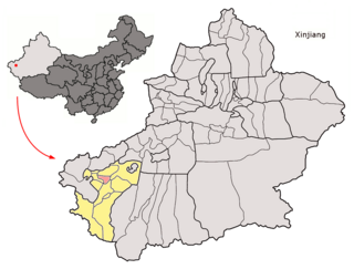
Karakax County, alternatively Moyu County, also transliterated from Uyghur as Qaraqash County, alternately Qaraqash, is a county in the Xinjiang Uyghur Autonomous Region and is located in the southern edge of the Tarim Basin, it is under the administration of the Hotan Prefecture. It contains an area of 25,667 km2 (9,910 sq mi). According to the 2011 census it has a population of 577,000 and 98,1% are Uyghurs. The county is bordered to the north by Awat County in Aksu Prefecture, to the northeast by Lop County, to the southeast by Hotan County, to the northwest by Maralbexi County in Kashgar Prefecture, and to the southwest by Pishan County and Kunyu. Exclaves of Kunyu are located within the county.

Qira County, alternatively Chira or Cele, is a county in Hotan Prefecture, Xinjiang Uyghur Autonomous Region, China. Almost all the residents of the county are Uyghurs and live around oases situated between the desolate Taklamakan Desert and Kunlun Mountains. The county is bordered to the north by Aksu Prefecture, to the east by Yutian / Keriya County, to the northwest by Lop County, to the southwest by Hotan County including the China-India disputed Aksai Chin area and to the south by Rutog County, Ngari Prefecture in Tibet.

Yutian County, also transliterated from Uyghur as Keriya County, is a county in Hotan Prefecture, Xinjiang Uyghur Autonomous Region, China. It is based at the Keriya Town, and is separate from Hotan County, which is another county in the same prefecture. The Yutian County has an area of 39,023 km2 (15,067 sq mi). According to the 2002 census, it has a population of 220,000. The county is bounded on the north by Aksu Prefecture, on the east by Minfeng/Niya County, on the west by Qira County and on the south by the Rutog and Gertse counties of the Tibet Autonomous Region.

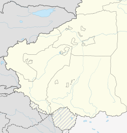
Hotan Prefecture is located in the Tarim Basin region of southwestern Xinjiang, China, bordering the Tibet Autonomous Region to the south and Union Territory of Ladakh and Gilgit-Baltistan to the west. The vast majority of the Aksai Chin region which is disputed between China and India is administered as part of Hotan Prefecture. The seat of Hotan Prefecture is Hotan and its largest county by population is Karakax County. The vast majority of the residents of the prefecture are Muslim Uyghurs and live around oases situated between the desolate Taklamakan Desert and Kunlun Mountains.
Shuanghe is a county-level city in Xinjiang Uyghur Autonomous Region, China. It is located 30 kilometres (19 mi) east of Bole City and 50 kilometres (31 mi) southwest of Alashankou and the border with Kazakhstan. Shuanghe governs an area of 742.18 square kilometres (286.56 sq mi) and has a population of 53,800.
The 131st Regiment of Xinjiang Production and Construction Corps (新疆生产建设兵团第131团), also known as the 131th Regiment of the XPCC (兵团131团), together with its reclamation area, commonly known as the 131st Regiment Farm (兵团131团场), is an economic and paramilitary formed unit that is part of the 7th Division (兵团第七师). The Regiment is headquartered at Junggar Road (准噶尔路) in Kuytun City, Xinjiang Uygur Autonomous Region. It is composed of 21 agriculture construction companies. As of 2010 census, its population was 24,154.
The 8th Division is a division of the Xinjiang Production and Construction Corps (XPCC) distributed over Shihezi and Karamay cities, Manas and Shawan counties, Xinjiang Uygur Autonomous Region, China. It is an economic and paramilitary unit formed in 1953 from the former 26th Infantry Division of the 9th Army of the 22rd Corps of the PLA. The 8th Agricultural Construction Division was approved and renamed to the present 8th Division of the XPCC in 2012. The division is composed of 14 regiments, and headquartered in Shihezi City, it merges work in one official with Shihezi City. The Shihezi Reclamation Area of the 8th Division has an area of 5,851 square kilometers with a total population of 696,900 and a permanent population of 661,300, of that, the Shihezi City has an area of 460 square kilometers with a total population of 448,100 and a permanent population of 437,900. In the year of 2018, GDP of the 8th Division was CN¥54.85 billion, and the GDP per capita CN¥82,584 (US$12,480).
The 121st Regiment of Xinjiang Production and Construction Corps (新疆生产建设兵团第121团), also known as the 121st Regiment of the XPCC (兵团121团), together with its reclamation area, commonly known as the 121st Regiment Farm (兵团121团场), is an economic and paramilitary formed unit, that is part of the 8th Division (兵团八师). The regiment was formerly known as the 75th Regiment of the 25th Infantry Division of the 9th Army of the 22nd Corps of the PLA. The 122nd Regiment was amalgamated into the regiment in June 2006. The regiment is headquartered in Paotai Town (炮台镇) in Shawan County, Xinjiang Uygur Autonomous Region, it is composed of 37 agricultural construction companies. As of the 2010 census, its population was 38,320.
The 122nd Regiment (新疆生产建设兵团第122团), together with its reclamation area, commonly known as the 122nd Regiment Farm (兵团122团场), is a historic agriculture and construction regiment of the 8th Division of Xinjiang Production and Construction Corps. The regiment was formerly known as the 73rd Regiment of the 25th Infantry Division of the 9th Army of the 22rd Corps of the PLA. It was amalgamated into the 121st Regiment in June 2006. The regiment was located in Shawan County, Xinjiang Uygur Autonomous Region, China, and based in Dongye Town (东野镇). Its reclaimed land is located in the northern foot of the Tianshan Mountains, southwest of the Junggar Basin, and on the west bank of the Manas River. The geographical coordinates are 44°37′- 44°48′ north latitude, 85°27′- 85°41′ east longitude, 19.8 kilometers wide from east to west, 31 kilometers long from north to south, with a total area of 248.47 square kilometers. The cultivated land area is 9.733 thousand hectares. As of 2000 Census, the regiment had a population of 17,724.
Paotai is an unincorporated town (非建制镇) located in Shawan County, Xinjiang Uyghur Autonomous Region, China, it is known for the seat of 121st Regiment headquarters of the 8th Division, Xinjiang Production and Construction Corps. The town is 213 km away from Urumqi in the east, 78 km from Shihezi in the southeast, 110 km from Karamay in the northwest, and 120 km from Kuitun in the southwest. The county-level road of Guxin Line (县道古新线) and the Keyu Expressway cross the territory, and connected with contact line, its traffic is very convenient.
Dongye is an unincorporated town (非建制镇) located in Shawan County, Xinjiang Uyghur Autonomous Region, China, it was known for the seat of the former 122nd Regiment headquarters of the 8th Division, Xinjiang Production and Construction Corps, one of settlements in the Xinjiang Production and Construction Corps. The town is 83 kilometers southeast of Shihezi City, and 8 kilometers north of Shawan County. As of 2000 census, the town had a population of 17,724.
The 152nd Regiment of Xinjiang Production and Construction Corps (新疆生产建设兵团第152团), also known as the 152nd Regiment of the XPCC (兵团152团), is an economic and paramilitary formed unit, that is part of the 8th Division (兵团第八师). It was formerly known as the Independent Regiment of the XPCC (兵团独立团) formed in 1965. The regiment is headquartered in the south of Shihezi City, Xinjiang Uygur Autonomous Region, China. It is composed of 7 agricultural construction companies.
Huyanghe is a county-level city in Xinjiang Uyghur Autonomous Region, China. It is geographically located in Tacheng Prefecture of Northwestern Xinjiang, but is directly administered by the 7th Division of XPCC, which headquartered here. The city implemented the "division and city integration" management system, it shares the same leader group with the 7th Division.
Yang Fulin is a former Chinese military officer and politician who served as deputy commander of Xinjiang Production and Construction Corps from 2015 to 2017. He was investigated by China's top anti-graft agency in July 2021.
Xinxing is a county-level city in the Xinjiang Uyghur Autonomous Region, China. It is actually located with enclaves in Hami.