List of numbered roads in Peel Region

Last updated
Peel Road 20 sign on The Queensway in Mississauga Peel Road 20 sign (The Queensway).jpg
Peel Road 20 sign on The Queensway in Mississauga

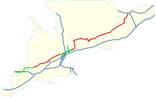
This page lists all of the numbered regional roads in Peel Region, Ontario. [1]

NumberNamesWestern/southern terminusEastern/northern terminusMajor communities/neighborhoodsComments
Peel Regional Road 1.svg Mississauga Road, Erin Mills ParkwayInterchange with Queen Elizabeth Way (Exit 126)RR 11 Mississauga, Erin Mills, Streetsville, Meadowvale, Huttonville, Brampton, Cheltenham, BelfountainThe Regional Road 1 designation changes from Erin Mills Parkway to Mississauga Road at the intersection with Turner Valley Road, bypassing the southern portion of Mississauga Road which is a secondary arterial. Continues as a minor road north of RR11 via Forks of the Credit Road but not as Peel Regional Road 1 and ends at Caledon Lake Forest in Orangeville.
Peel Regional Road 2.svg Finch Avenue Interchange with Highway 427 (boundary between Peel Region and the City of Toronto)RR 15 Malton, Claireville The shortest regional road at 2 km. in length. Continues east of Highway 427 into Toronto
Peel Regional Road 3.svg Britannia RoadInterchange with Highway 407 (Exit 28), (boundary with Halton Regional Municipality, continues as Halton RR 6)Hurontario Street (formerly Highway 10)Mississauga, Streetsville, MeadowvaleContinues east of Hurontario Street under the jurisdiction of the City of Mississauga
Peel Regional Road 4.svg
VeteransMemorialRoadwayPeel.png
Dixie Road Lakeshore Road (formerly Highway 2)RR 12Mississauga, Lakeview, Brampton, Bramalea Passes by Toronto Pearson International Airport to the east; Regional jurisdiction terminates at the Region's first roundabout and continues north as Horseshoe Hill Road under the jurisdiction of the Town of Caledon. Road is named for the former Village of Dixie (at Dundas Street and Cawthra Road) and settler Dr. Beaumont Dixie. [2] Double-designated as Veterans Memorial Roadway since 2016. [3]
Peel Regional Road 5.svg Derry RoadInterchange with Highway 407 (Exit 31), (boundary with Halton RM), continues as Halton RR 7 Highway 427 (boundary with the City of Toronto), continues as Rexdale BoulevardMississauga, Malton, MeadowvalePasses by Toronto Pearson International Airport to the north.
Peel Regional Road 6.svg Embleton Road, Queen Street WestRR 19 (Winston Churchill Road), (boundary with Halton RM), continues as 5 SideroadMcMurchy AvenueHuttonville, BramptonHas a small diversion/concurrency with RR 1; continues east of McMurchy Avenue under the jurisdiction of the City of Brampton as Queen Street West, resumes Regional jurisdiction at Highway 410 as Regional Road 107
Peel Regional Road 7.svg Airport RoadInterchange with Highway 427 (boundary with the City of Toronto), continues as Dixon Road Highway 9 (boundary with Dufferin County, continues as Dufferin CR 18)Mississauga, Malton, Brampton, Tullamore, Caledon, Sandhill, Caledon East, Mono Road, Mono Mills Travels from Toronto Pearson International Airport up through the Caledon Highlands to Highway 9
Peel Regional Road 8.svg The Gore RoadPeel RR 50/York RR 24Highway 9Brampton, Clairville, Sunset Corners, Ebenezer, Wildfield, Caledon, Macville Named after the former township of Toronto Gore. Spurs off Highway 50 just north of Steeles Avenue and travels up to Highway 9
Peel Regional Road 9.svg King StreetPeel RR 19/Halton RR 25 CaledonKing Townline (boundary with York Regional Municipality, continues as York RR 11)Caledon, Terra Cotta, Victoria, Sandhill, Macville, Bolton
Peel Regional Road 10.svg Bovaird Drive EastInterchange with RR 107 and Highway 410 RR 7Bramalea, BramptonContinues east of Airport Road as Castlemore Road under the jurisdiction of the City of Brampton
Peel Regional Road 11.svg Bush Street, Forks of the Credit RoadIntersection with Wellington CR 25/Peel RR 19 (boundary with Wellington County, continues as Wellington CR 52) Highway 10 Sligo, Forks of the Credit Caledon, Belfountain, Near the Forks of the Credit Provincial Park
Peel Regional Road 12.svg Olde Baseline RoadIntersection with Wellington CR 25/Peel RR 19 (boundary with Wellington County)RR 7Caledon, Inglewood, Mono Road
Peel Regional Road 14.svg Mayfield RoadIntersection with Wellington CR 25/Peel RR 19 (boundary with Halton RM), continues as Halton RR 23Intersection with Peel RR 50/York RR 24Brampton, Alloa, Snelgrove, Mayfield, Tullamore, Wildfield, Tormore Acts as the boundary between Brampton and Caledon except for a portion centred around Hurontario Street; continues past Regional Road 50 as Albion-Vaughan Road under the jurisdiction of the Town of Caledon
Peel Regional Road 15.svg Steeles Avenue Intersection with Peel RR 19 and Halton RR 8 (boundary with Halton RM, continues as Halton RR 8) RR 50 (boundary with the City of Toronto)Brampton, ClairvilleContinuation of Steeles Avenue in Toronto.
Peel Regional Road 16.svg Kennedy RoadRR 15RR 107Brampton, Caledon & Mississauga Continues north and south under the jurisdiction of the City of Brampton, then runs south up to Central Parkway East, Mississauga. Named for former local MPP and Premier of Ontario Thomas Laird Kennedy.
Peel Regional Road 17.svg Cawthra Road Lakeshore Road (formerly Highway 2)Interchange with Highway 403 and Eastgate Parkway (Exit 121) and Queen Elizabeth Way (Exit 134)Mississauga, Lakeview, Dixie Named for settler Joseph Cawthra.
Peel Regional Road 18.svg Mavis RoadRR 15 Highway 407 Brampton, MississaugaContinues south of Highway 407 under the jurisdiction of the City of Mississauga; continues north of Steeles Avenue West as Chinguacousy Road under the jurisdiction of the City of Brampton
Halton Regional Road 19.svg Peel Regional Road 19.svg (Peel Regional Signs Used) Winston Churchill Boulevard, Adamson Street, King Street Lakeshore Road in MississaugaIntersection with Wellington CR 52 (boundary with Wellington County, continues as Peel RR 19/Wellington CR 25) until Beech Grove SideroadTerra Cotta, Norval, Georgetown, Oakville, Halton Hills, Erin, Ontario Named after Sir Winston Churchill, former British Prime Minister during the Second World War. Acts as the boundary between Peel Region and Halton Region and between Peel Region and Wellington County, except for the section between Steeles Avenue to Dundas Street, as the Region line moves west and the road is fully in Peel Region (Mississauga).
Peel Regional Road 20.png Queensway Mavis Road Etobicoke Creek (boundary with the City of Toronto)Mississauga, Cooksville Continues west of Mavis Road under the jurisdiction of the City of Mississauga
Peel Regional Road 22.svg Old Church RoadRR 7 RR 50 Caledon, Caledon East, Albion, Cedar Mills Continues east of Regional Road 50 under the jurisdiction of the Town of Caledon
Peel Regional Road 23.svg Caledon-East Garafraxa TownlineDufferin RR 23 (B-Line) RR 136 Caledon, Orangeville Acts as the boundary between Peel Region and Dufferin County
Peel Regional Road 24.svg Charleston Sideroad Peel RR 19/Wellington CR 25 (boundary with Wellington County, continues as Wellington CR 124)RR 7Caledon, Cataract, Coulterville Segment east of Highway 10 formerly designated as Regional Road 11; segment west of Highway 10 formerly designated as Highway 51 from April 13, 1938, until 1962, when Highway 24 was extended along this road to Highway 10 while Old Highway 24 alignment became Highway 136. Highway 51 was fully paved in 1947. It bears no relation to the second incarnation of Highway 51, near Rondeau Provincial Park.
Peel Regional Road 50.png Peel Regional Road 50, Queen Street Overpass of Highway 427 (boundary with the City of Toronto), continues southeast as Albion Road Highway 9 (Boundary with Simcoe County, continues as Simcoe CR 50)Clairville, Sunset Corners, Brampton, Bolton, Cedar Mills, Palgrave Formerly Highway 50. South of Bolton, it forms the border between Peel Region and York Region, and therefore the road is sometimes referred to as York Regional Road 24.
Peel Regional Road 107.svg Bovaird Drive, Queen Street East RR 19 (continues into Halton RM as Highway 7) RR 50 (boundary with York RM (continues as York RR 7))Norval, Mount Pleasant, Brampton, BramaleaFormerly Highway 7. Follows two separate concession roads.
Peel Regional Road 136.png Main Street, Queen Street, Porterfield Road RR 24, continues as Cataract Road under the jurisdiction of the Town of CaledonOrangeville Town Limits, continues as TownlineCaledon, Cataract, Coulterville, Alton, OrangevilleOriginal Highway 24 alignment from April 13, 1938, to 1962. Highway 136 from 1962 to April 1, 1997. Fully paved by 1966, first from Cataract to Alton in 1964, then from Alton to Orangeville.
Peel Regional Road 150.png Emil Kolb Parkway, Coleraine DriveRR 14RR 50BoltonMostly a purpose-built bypass of Bolton, but incorporates a section of the pre-existing Coleraine Drive

See also

Related Research Articles

<span class="mw-page-title-main">Brampton</span> City in Ontario, Canada

Brampton is a city in the Canadian province of Ontario. It is part of the Greater Toronto Area (GTA) and is a lower-tier municipality within Peel Region. The city has a population of 656,480 as of the 2021 Census, making it the ninth most populous municipality in Canada and the third most populous city in the Greater Golden Horseshoe urban area, behind Toronto and Mississauga.

<span class="mw-page-title-main">Caledon, Ontario</span> Town in Ontario, Canada

Caledon is a town in the Regional Municipality of Peel in the Greater Toronto Area of Ontario, Canada. The name comes from a shortened form of Caledonia, the Roman name for what is now Scotland. Caledon is primarily rural with a number of hamlets and small villages, but also contains the larger community of Bolton in its southeastern quadrant, adjacent to York Region. Some spillover urbanization also occurs in the south bordering the City of Brampton.

<span class="mw-page-title-main">Regional Municipality of Peel</span> Upper-tier regional municipality in Ontario, Canada

The Regional Municipality of Peel is a regional municipality in the Greater Toronto Area, Southern Ontario, Canada. It consists of three municipalities to the west and northwest of the city of Toronto: the cities of Mississauga and Brampton, and the town of Caledon, each of which spans its full east–west width. The regional seat is in Brampton.

The Peel Art Gallery, Museum and Archives (PAMA) is a museum, art gallery, and archives for the Regional Municipality of Peel and are located in Brampton, Ontario, Canada. Previously, it was the Peel Heritage Complex. Its facilities were originally the Peel County Courthouse, Brampton Jail, a land registry office, and a county administration building. It is opposite Gage Park and Brampton City Hall.

<span class="mw-page-title-main">Ontario Highway 7</span> Ontario provincial highway

King's Highway 7, commonly referred to as Highway 7 and historically as the Northern Highway, is a provincially maintained highway in the Canadian province of Ontario. At its peak, Highway 7 measured 716 km (445 mi) in length, stretching from Highway 40 east of Sarnia in Southwestern Ontario to Highway 17 west of Ottawa in Eastern Ontario. However, due in part to the construction of Highways 402 and 407, the province transferred the sections of Highway 7 west of London and through the Greater Toronto Area to county and regional jurisdiction. The highway is now 535.7 km (332.9 mi) long; the western segment begins at Highway 4 north of London and extends 154.1 km (95.8 mi) to Georgetown, while the eastern segment begins at Donald Cousens Parkway in Markham and extends 381.6 km (237.1 mi) to Highway 417 in Ottawa.

<span class="mw-page-title-main">Finch Avenue</span> Road in Toronto, Ontario, Canada

Finch Avenue is an arterial thoroughfare that travels east–west in Toronto, Ontario, Canada. The road continues west into the Regional Municipality of Peel as Regional Road 2 and east into the Regional Municipality of Durham as Regional Road 37.

King's Highway 410, also known as Highway 410 and colloquially as the four-ten, is a 400-series highway in the Canadian province of Ontario that connects Highways 401 and 403 to Brampton. North of Brampton, the commuter freeway ends and the route becomes Highway 10, which continues north through Caledon as a four-lane undivided highway. The route is patrolled by the Ontario Provincial Police and has a speed limit of 100 km/h (62 mph).

<span class="mw-page-title-main">Bolton, Ontario</span> Community in Ontario, Canada

Bolton is an unincorporated town that is the most populous community in the town of Caledon, Ontario, Canada, in the Regional Municipality of Peel. It is located beside the Humber River, approximately 50 kilometres northwest of Toronto. In regional documents, it is referred to as a 'Rural Service Centre'. It has 26,795 residents in 9,158 total dwellings. The downtown area that historically defined the village is in a valley, through which flows the Humber River. The village extends on either side of the valley to the north and south.

<span class="mw-page-title-main">Steeles Avenue</span> Road in Ontario, Canada

Steeles Avenue is an east–west street that forms the northern city limit of Toronto and the southern limit of York Region in Ontario, Canada. It stretches 77.3 km (48.0 mi) across the western and central Greater Toronto Area from Appleby Line in Milton in the west to the Toronto-Pickering city limits in the east, where it continues east into Durham Region as Taunton Road, which itself extends 58 km (36 mi) across the length of Durham Region to its boundary with Northumberland County.

King's Highway 50, commonly referred to as Highway 50, was a provincially maintained highway in the Canadian province of Ontario. The highway, which was decommissioned in 1998, is still referred to as Highway 50, though it is now made up of several county and regional roads: Peel Regional Road 50, York Regional Road 24 and Simcoe County Road 50. The route began in the north end corner of the former Etobicoke at Highway 27 as Albion Road, and travelled northwest to Highway 89 west of the town of Alliston. En route, it passed through the villages of Bolton, Palgrave and Loretto. The road south of Bolton has become more suburban as development has encroached from the east and west; but despite this increased urbanization, the removal of highway status, and the fact that it runs through the former Albion Township, the Albion Road name has not been extended to follow it outside Toronto.

<span class="mw-page-title-main">Peel Regional Police</span> Police force in Ontario, Canada

The Peel Regional Police (PRP) provides policing services for Peel Region in Ontario, Canada. It is the second largest municipal police service in Ontario after the Toronto Police Service and third largest municipal force in Canada behind those of Toronto and Montreal, with 2,200 uniformed members and close to 875 support staff.

Peel Regional Council is the governing body of the Regional Municipality of Peel, Ontario, Canada.

<span class="mw-page-title-main">Chinguacousy</span>

Chinguacousy Township is a former municipality and present-day geographic township in the Regional Municipality of Peel, Ontario, Canada. In 1974, when Peel County became the Region of Peel, the township was split in half, with the northern half becoming part of the town of Caledon, and the southern half, along with the township of Toronto Gore, joining the Town of Brampton, which was then promoted to a city.

<span class="mw-page-title-main">History of Brampton</span>

Following is an outline is for the history of Brampton, the fourth largest city in Ontario, Canada. European settlers arrived began to settle the area in the early 19th century, with Brampton being formally incorporated into a village in 1853.

<span class="mw-page-title-main">Winston Churchill Boulevard</span> Street in Ontario, Canada

Winston Churchill Boulevard is a long north-south roadway that predominantly forms the western boundary of Peel Region with the eastern boundaries of Halton Region and Wellington County, in Ontario, Canada. The road begins at Lakeshore Road in the south at the boundaries of the City of Mississauga the Town of Oakville, and ends in Caledon at East Garafraxa-Caledon Townline. The road is named in honour of British Prime Minister Sir Winston Churchill.

<span class="mw-page-title-main">Peel Regional Paramedic Services</span>

Peel Regional Paramedic Services, provide ambulatory and paramedic care for the municipalities within Peel Region, in Ontario, Canada. Paramedic Headquarters are located in Brampton at 1600 Bovaird Road east and operations serve the residents of Caledon, Brampton, and Mississauga.

King's Highway 413, known as the GTA West Corridor or GTA West until 2021, is a proposed 400-series highway and bus transitway in the western Greater Toronto Area of the Canadian province of Ontario. The approximately 52-kilometre (32 mi) route is currently undergoing planning and analysis under an environmental impact assessment (EA) by the Ministry of Transportation of Ontario (MTO) and the Government of Ontario. If approved, a new four-to-six lane controlled-access highway would be built between the existing interchange of Highway 401 and the 407 ETR at the Halton–Peel boundary, and Highway 400 north of Vaughan. In addition, two new extensions would be built to connect Highway 410 and Highway 427 with Highway 413.

The COVID-19 pandemic is an ongoing viral pandemic of coronavirus disease 2019 (COVID-19), a novel infectious disease caused by severe acute respiratory syndrome coronavirus 2 (SARS-CoV-2). The pandemic has affected the Cities of Mississauga and Brampton, and the Town of Caledon, within the Regional Municipality of Peel. As part of the larger closure decisions in Ontario, a stay-at-home order shuttered all nonessential businesses, and caused event cancellations.

References

  1. "Map of Peel Regional Roads" (PDF). Peel Region. August 2015. Retrieved 2018-09-16.
  2. "-ʤ- Dance Classes: Dixie Road". Archived from the original on 2012-03-13. Retrieved 2013-06-14.
  3. "New Peel road signs pay tribute to Canada's Armed Forces veterans". Brampton Guardian. May 10, 2016.