Melrose Hill, Los Angeles

Last updated
Melrose Hill
Melrose Hill.jpg
Melrose Hill neighborhood sign
located at the intersection of
Western Avenue and Marathon Street.
Location map Los Angeles.png
Red pog.svg
Melrose Hill
Location within Los Angeles
Coordinates: 34°05′00″N118°18′26″W / 34.083381°N 118.307303°W / 34.083381; -118.307303
Country Flag of the United States.svg  United States of America
State Flag of California.svg  California
County Flag of Los Angeles County, California.svg Los Angeles
Time zone Pacific
Zip Code
90029
Area code 323

Melrose Hill is a neighborhood in Los Angeles. A portion of the neighborhood is designated as a Historic Preservation Overlay Zone.

Contents

History

Sidney L. Briggs and M.P. Gilbert first acquired and developed the area in 1906. Lot prices started at $425. Wilshire District developer Avery McCarthy christened the main thoroughfare Melrose Avenue, after his family’s hometown of Melrose, Mass., and named the highest point in the tract—about 337 feet above sea level—Melrose Hill. [1]

In January 2003, Los Angeles magazine profiled the Melrose Hill HPOZ and named it one of the city's "10 Great Neighborhoods You've Never Heard Of." [2]

Geography

Melrose Hill is located north of Melrose Avenue, south of Santa Monica Blvd., east of Western Avenue, and west of the Hollywood Freeway.

The city of Los Angeles has installed neighborhood signs to mark the neighborhood boundaries, [3] with signs located at Western Avenue and Santa Monica Boulevard, Western Avenue and Marathon Street and Western Avenue and Melrose Avenue. There is also a sign at Melrose Avenue and Ardmore Street.

Hollywood is located to the north, and the intersection of Western Avenue and Santa Monica Boulevard "splits the two neighborhoods". [4]

Melrose Hill HPOZ

HPOZ sign located at Hobart Boulevard and Marathon Street Melrose HPOZ.jpg
HPOZ sign located at Hobart Boulevard and Marathon Street

Within Melrose Hill is the Melrose Hill Historic Preservation Overlay Zone (HPOZ). [5] The HPOZ covers homes on Marathon Street (between Hobart Boulevard and Oxford Avenue), North Melrose Hill Street and West Melrose Hill Street. [6] HPOZ signage is installed at the intersection of Hobart Boulevard and Marathon Street.

The neighborhood's historic status was designated by the city in 1988. [1] The 42 residences within the HPOZ are modest Craftsman and Colonial Revival bungalows built between 1911 and 1926. [1]

The neighborhood streetlamps are made from the same mold that was used at the turn of the 20th century to supply the lighting towers for New York's Central Park. [7] The streetlights were installed in 1980 [7] and spurred the movement for the neighborhood to seek historic status. [2]

Government

The Los Angeles Times Mapping Project places Melrose Hill in East Hollywood. [8] However, it is not part of the East Hollywood Neighborhood Council [9] and instead is part of the Hollywood Studio District Neighborhood Council. [10]

Parks and recreation

Related Research Articles

<span class="mw-page-title-main">Hollywood, Los Angeles</span> Neighborhood in Los Angeles, California, US

Hollywood is a neighborhood in the central region of Los Angeles County, California, mostly within the city of Los Angeles. Its name has come to be a shorthand reference for the U.S. film industry and the people associated with it. Many notable film studios, such as Columbia Pictures, Walt Disney Studios, Paramount Pictures, Warner Bros., and Universal Pictures, are located near or in Hollywood.

<span class="mw-page-title-main">Hancock Park, Los Angeles</span> Neighborhood of Los Angeles in California, United States

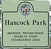
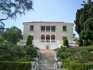
Hancock Park is a neighborhood in the Wilshire area of Los Angeles, California. Developed in the 1920s, the neighborhood features architecturally distinctive residences, many of which were constructed in the early 20th century. Hancock Park is covered by a Historic Preservation Overlay Zone (HPOZ).

<span class="mw-page-title-main">Miracle Mile, Los Angeles</span> Neighborhood of Los Angeles, California, USA

Miracle Mile is a neighborhood in the city of Los Angeles, California.

<span class="mw-page-title-main">West Adams, Los Angeles</span> Neighborhood of Los Angeles in California, United States

West Adams is a historic neighborhood in the South Los Angeles region of Los Angeles, California. The area is known for its large number of historic buildings, structures and notable houses and mansions.

<span class="mw-page-title-main">Harvard Heights, Los Angeles</span> Neighborhood of Los Angeles in California, United States

Harvard Heights is a neighborhood in Central Los Angeles, California. It lies within a municipally designated historic preservation overlay zone designed to protect its architecturally significant single-family residences, including the only remaining Greene and Greene house in Los Angeles.

<span class="mw-page-title-main">Jefferson Park, Los Angeles</span> Neighborhood of Los Angeles in California, United States

Jefferson Park is a neighborhood in the South region of the City of Los Angeles, California. There are five Historic-Cultural Monuments in the neighborhood. In 1987, the Jefferson branch library was added to the National Register of Historic Places.

<span class="mw-page-title-main">East Hollywood, Los Angeles</span> Neighborhood of Los Angeles in California, United States

East Hollywood is a densely populated neighborhood of 78,000+ residents that is part of the Hollywood area of the central region of Los Angeles, California. It is notable for being the site of Los Angeles City College, Barnsdall Park, and a hospital district. There are seven public and five private schools, a Los Angeles Public Library branch, and three hospitals. Almost two-thirds of the people living there were born outside the United States, and 90% were renters. In 2000, the neighborhood had high percentages of never-married people and single parents.

<span class="mw-page-title-main">Angelino Heights, Los Angeles</span> Neighborhood of Los Angeles in Los Angeles County, California, United States

Angelino Heights, alternately spelled Angeleno Heights, is one of the oldest neighborhoods in Los Angeles. Situated between neighboring Chinatown and Echo Park, the neighborhood is known for its concentration of eclectic architectural styles from three eras: The Victorian, Turn of the Century and Revival eras. Carroll Avenue is listed on the National Register of Historic Places and there are over thirty Historic-Cultural Monuments in the neighborhood.

Mid-Wilshire is a neighborhood in the central region of Los Angeles, California. It is known for the Los Angeles County Museum of Art, the Petersen Automotive Museum, and the Miracle Mile shopping district.

<span class="mw-page-title-main">Wilshire Park, Los Angeles</span> Neighborhood of Los Angeles in California, United States

Wilshire Park is a neighborhood in the Central Los Angeles region of Los Angeles, California.

<span class="mw-page-title-main">Santa Monica Boulevard</span> Major west-east thoroughfare in Los Angeles County, California, USA

Santa Monica Boulevard is a major west–east thoroughfare in Los Angeles County, California, United States. It runs from Ocean Avenue in Santa Monica near the Pacific Ocean to Sunset Boulevard at Sunset Junction in Los Angeles. It passes through Beverly Hills and West Hollywood. A portion of it is designated as California State Route 2.

<span class="mw-page-title-main">San Vicente Boulevard</span> Street in Western Los Angeles running southeast of Beverly Hills, United States

San Vicente Boulevard is a major northwest-southeast thoroughfare located in the western portion of the metropolitan area of Los Angeles, CA.

<span class="mw-page-title-main">Whitley Heights, Los Angeles</span> United States historic place

Whitley Heights is a residential neighborhood and historic preservation overlay zone in the Hollywood Hills neighborhood of Central Los Angeles, California. Known as a residential area for actors and other people in the motion-picture industry, it is divided between a hillside single-family district and an apartment area. It is notable for an attempt by its homeowners' group and the city to close off public streets to outside traffic, an effort that was ruled illegal by the courts.

<span class="mw-page-title-main">Mid-City West, Los Angeles</span> Neighborhood of Los Angeles in California, United States

Mid-City West is an area in the western part of Central Los Angeles that is served by the Mid City West Neighborhood Council. It contains the neighborhoods of Beverly–Fairfax, Beverly Grove, Burton Way, Carthay Circle, Melrose, Miracle Mile and Park La Brea.

<span class="mw-page-title-main">Garvanza, Los Angeles</span> Neighborhood of Los Angeles in California, United States

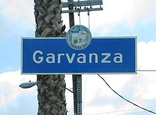
Garvanza is a neighborhood in northeast Los Angeles. Fourteen Los Angeles Historic-Cultural Monuments are located in the neighborhood.

<span class="mw-page-title-main">Los Angeles's 4th City Council district</span> American legislative district

Los Angeles's 4th City Council District is one of the fifteen districts in the Los Angeles City Council. It is currently represented by Democrat Nithya Raman since 2020 after she defeated David Ryu in that year's election. The district is situated in Central Los Angeles, the southern San Fernando Valley, and eastern Santa Monica Mountains.

<span class="mw-page-title-main">Adams-Normandie, Los Angeles</span> Neighborhood in Los Angeles, California, United States

Adams-Normandie is a Historic Preservation Overlay Zone (HPOZ) in South Los Angeles, California.

<span class="mw-page-title-main">West Adams Heights, Los Angeles</span> Neighborhood of Los Angeles in California, United States of America

West Adams Heights is a neighborhood in Central Los Angeles, California. It contains three Los Angeles Historic-Cultural Monuments.

Western Heights is a neighborhood in Central Los Angeles, California. It contains one Los Angeles Historic-Cultural Monument.

West Adams Terrace is a neighborhood in Los Angeles. Dating back to 1905, it contains seven Los Angeles Historic-Cultural Monuments, one property on the National Register of Historic Places and one Green Book property. In 2003, the neighborhood was designated a Historic Preservation Overlay Zone.

References

  1. 1 2 3 Allison B. Cohen, "It's Barely on the Map, and That's Fine, Los Angeles Times, October 3, 2004
  2. 1 2 Wallace, Amy (January 2003). "The 10 Best Neighborhoods You've Never Heard Of". Los Angeles Magazine. Retrieved 13 April 2020.
  3. Neighborhood Signs LAcity.org
  4. Beherens, Zach. "Street Improvements for Hollywood & Melrose Hill". LAist. Retrieved 13 April 2020.
  5. "Melrose Hill HPOZ". City of Los Angeles, CA. Retrieved 17 April 2012.
  6. "Melrose Hill Historic Preservation Overlay Zone Architectural Survey" (PDF). City of Los Angeles. February 27, 1988. Retrieved 13 April 2020.
  7. 1 2 Fanucchi, Kenneth (May 21, 1987). "Oasis of the Past, Melrose Hill". Los Angeles Times. Retrieved 13 April 2020.
  8. East Hollywood ( The Los Angeles Times )
  9. "Neighborhood Council Boundary Map – East Hollywood Neighborhood Council".
  10. "Hollywood Studio District Neighborhood Council Map" (PDF). hsdnc.org. Retrieved 13 April 2020.