Morrisville, North Carolina

Last updated

Morrisville, North Carolina
Morrisville, North Carolina (2014).jpg
Morrisville town limit sign
Morrisville, NC Town Flag.jpg
Morrisville, NC Town Seal.jpg
Motto: 
"Live Connected. Live Well."
Wake County North Carolina incorporated and unincorporated areas Morrisville highlighted.svg
Location in Wake County and the state of North Carolina.
Coordinates: 35°48′57″N78°50′21″W / 35.81583°N 78.83917°W / 35.81583; -78.83917
CountryUnited States
State North Carolina
Counties Wake, Durham
Government
   Mayor T.J. Cawley (Ind.)
Area
[1]
  Total8.89 sq mi (23.02 km2)
  Land8.83 sq mi (22.86 km2)
  Water0.06 sq mi (0.16 km2)
Elevation
[2]
299 ft (91 m)
Population
 (2020)
  Total29,630
  Density3,356.75/sq mi (1,296.00/km2)
Time zone UTC−5 (Eastern (EST))
  Summer (DST) UTC−4 (EDT)
ZIP codes
27519, 27560
Area code 919 & 984
FIPS code 37-44520 [3]
GNIS feature ID2406198 [2]
Website www.townofmorrisville.org

Morrisville is a town located primarily in Wake County, North Carolina, United States (a small portion extends into neighboring Durham County). [4] [5] According to the 2020 census, the population was 29,630. [6] Morrisville is part of the Research Triangle metropolitan region. The regional name originated after the 1959 creation of the Research Triangle Park, located midway between the cities of Raleigh and Durham. The Research Triangle region encompasses the Raleigh-Durham-Cary, NC Combined Statistical Area. The population of the Raleigh-Durham-Cary, NC Combined Statistical Area was 2,106,463 in 2020, while the population of the Raleigh-Cary, NC Metropolitan Statistical Area was 1,413,982 in 2020. [7] The operational headquarters of Lenovo is located in the municipal limits.

Contents

History

The area was originally named in 1852 after Jeremiah Morris. Morris donated land to the North Carolina Railroad for a depot, water tower, and other buildings. The town continued to grow as a result of the rail line and its location at the intersection of roads leading to Chapel Hill, Raleigh, and Hillsborough.

On April 13, 1865, in the Battle of Morrisville, United States cavalry under the command of Gen. Judson Kilpatrick skirmished with the retreating Confederate armies at Morrisville Station. The Confederate troops were successful in evacuating their remaining supplies and wounded to the west toward Greensboro, but Gen. William Tecumseh Sherman's cavalry forced the Confederates to leave the train behind and retreat toward Durham and the eventual surrender of the largest Confederate force of the war at Bennett Place. [8] [ original research? ]

The town was officially chartered in 1875 but was disincorporated in 1933. Eventually the town charter was restored in 1947.[ citation needed ]

Morrisville History (as listed on historical marker):

Morrisville Station: "On April 16, 1865, Union cavalry under the command of General William T. Sherman, captured Raleigh and pursued the retreating Confederate cavalry west along the railroad. Rearguard skirmishes erupted at points along the Hillsborough Road until the combatants reached Morrisville. Using cavalry and artillery, Union forces attacked a Confederate train loaded with supplies and wounded. Before withdrawing, the Confederate cavalry repelled the attack long enough to allow the railcars of wounded to escape while abandoning the supplies. This was the last major cavalry engagement in Sherman's campaign. The next night, a courier from the Confederate commander, General Joseph E. Johnston, rode into the Union camp at Morrisville with a truce proposal. Subsequent negotiations between Johnston and Sherman led to the largest Confederate surrender of the Civil War at the Bennett Farm in Durham on April 26."

The history marker notes it was given in memory of Commissioner C.T. Moore. [9]

On December 13, 1994, Flagship Airlines Flight 3379 crashed in Morrisville, killing 15 of the 20 people on board. [10]

Geography

According to the United States Census Bureau, the town has a total area of 8.3 square miles (21.5 km2), of which 8.3 square miles (21.4 km2) is land and 0.04 square miles (0.1 km2), or 0.62%, is water. [11]

Morrisville is located in the northeast central region of North Carolina, where the North American Piedmont and Atlantic Coastal Plain regions meet. This area is known as the "Fall Line" because it marks the elevation inland at which waterfalls begin to appear in creeks and rivers. As a result, most of Morrisville features gently rolling hills that slope eastward toward the state's flat coastal plain. Its central Piedmont location situates the county approximately three hours west of Atlantic Beach by car and four hours east of the Great Smoky Mountains.

The central core of Morrisville is located along the upper portion of Crabtree Creek, which then feeds into Lake Crabtree, located in the southeastern part of the town.

Climate

Morrisville enjoys a moderate subtropical climate, with moderate temperatures in the spring, fall, and winter. Summers are typically hot with high humidity. Winter highs generally range in the low 50s°F (10 to 13 °C) with lows in the low-to-mid 30s°F (-2 to 2 °C), although an occasional 60 °F (15 °C) or warmer winter day is not uncommon. This is canceled out, however, with several days where highs do not get out of the 30s. There are usually one or two substantial snowfalls per winter, occurring mainly in February. Spring and fall days usually reach the low-to-mid 70s°F (low 20s°C), with lows at night in the lower 50s°F (10 to 14 °C). Summer daytime highs often reach the upper 80s to low 90s°F (29 to 35 °C). The rainiest months are July and August.

Demographics

Historical population
CensusPop.Note
1880 165
1890 149−9.7%
1900 100−32.9%
1910 15151.0%
1920 1669.9%
1930 161−3.0%
1950 221
1960 2220.5%
1970 209−5.9%
1980 25120.1%
1990 1,022307.2%
2000 5,208409.6%
2010 18,576256.7%
2020 29,63059.5%
U.S. Decennial Census [12]

2020 census

Morrisville racial composition [13]
RaceNumberPercentage
White (non-Hispanic)10,07434.0%
Black or African American (non-Hispanic)2,8809.72%
Native American 800.27%
Asian 13,70046.24%
Pacific Islander 50.02%
Other/Mixed 1,1773.97%
Hispanic or Latino 1,7145.78%

As of the 2020 United States census, there were 29,630 people, 9,699 households, and 6,781 families residing in the town.

2015 census estimate

As of the 2015 census estimate, the population of the town was 23,699.

2010 census

As of the 2010 census there were 18,576 people, 7,641 households, and 4,752 families residing in the town. The population density was 2,237.7 inhabitants per square mile (864.0/km2). There were 8,357 housing units at an average density of 1,006.9 per square mile (388.8/km2). Known as North Carolina's "little India" by locals, [14] Morrisville has become one of the most diverse towns in the state particularly due to the expansion of the technology industry. [15] The racial makeup of the town was 54.0% White, 12.9% African American, 0.4% Native American, 27.2% Asian, 2.0% from some other race, and 3.4% from two or more races. Hispanic or Latino of any race were 5.9% of the population. [16]

There were 7,641 households, out of which 37.1% had children under the age of 18 living with them. 50.3% of all households were headed by married couples living together, 8.9% had a female householder with no husband present, and 37.8% were non-families. 30.0% of all households were made up of individuals, and 2.5% had someone living alone who was 65 years of age or older. The average household size was 2.43, and the average family size was 3.11. [16]

In the town, the population was spread out, with 27.0% under the age of 18, 6.0% from 18 to 24, 44.4% from 25 to 44, 18.4% from 45 to 64, and 4.3% who were 65 years of age or older. The median age was 32.5 years. For every 100 females, there were 96.7 males. For every 100 females age 18 and over, there were 93.2 males. [16]

In 2017, the median income for a household in the town was $95,763. Males had a median income of $59,982 versus $44,729 for females. The per capita income for the town was $43,054. About 3.4% of families and 4.6% of the population were below the poverty line, including 4.1% of those under age 18 and 13.0% of those age 65 or over. [3]

Economy

Morrisville's location adjacent to the Research Triangle Park, Raleigh-Durham International Airport, and Interstate 40 makes it an attractive location for offices, light industry and hotels. Companies based in Morrisville include Oracle , Syneos Health and Lenovo (operational headquarters). [17]

Prior to its disestablishment, Midway Airlines had its headquarters in Morrisville. [18]

The Morrisville Chamber of Commerce serves as the economic development arm for the town.

Employers

The computer technology, clinical trial and telecommunications industries have strong presence in the area. [19] Major employers in 2019 included: [20]

Arts and culture

National Register of Historic Places

The Morrisville Christian Church, Williamson Page House, and Pugh House are listed on the National Register of Historic Places. [21] [22] [23]

Parks and recreation

Shiloh Park View of historic Shiloh.png
Shiloh Park

Morrisville is home to eight parks, [24] two community centers, four greenways and a fitness center. They include:

Morrisville has several youth sports groups, such as youth basketball, [33] baseball, softball, soccer, [34] and cricket. [35]

Shiloh Park Shiloh Park.png
Shiloh Park

Government

Morrisville operates under the council–manager form of government. The citizens elect a mayor and town council as the town's governing body. After each municipal election, the town council selects a mayor pro tem. The town manager, Martha Paige, is appointed by the council to serve as the chief operating officer administering all municipal affairs. [36] The current mayor is TJ Cawley and mayor pro tem is Liz Johnson. Morrisville Council members include Steve Rao, Vicki Scroggins-Johnson, Satish Garimella, Anne Robotti, and Donna Fender. [37]

The North Carolina State Board of Dental Examiners has its headquarters in Morrisville. [38]

Infrastructure

Transportation

Passenger

Triangle Transit bus 2008-07-05 TTA bus 713 at DATA terminal.jpg
Triangle Transit bus
  • Air: Raleigh-Durham International Airport is located in northwestern Wake county on I-40, just to the north of Morrisville.
  • Morrisville is not served directly by passenger trains. Amtrak serves the nearby municipalities of Cary and Raleigh.
  • Local bus: The Triangle Transit operates buses that serve the region and connect to municipal bus systems in Raleigh, Durham and Chapel Hill.

Roads

  • NC 54.svg NC 54 is a major highway that goes through town and provides easy access to Cary, Raleigh, Durham and Chapel Hill.
  • I-40.svg I-40 runs through the eastern part of the town.
  • I-540.svgNC 540.svg I-540  / NC 540 serves the Morrisville area and is located to the west of the town. The highway offers access to I-40, North Raleigh, RDU airport and eastern Wake County.
  • NC 147.svg NC 147 is located in the northern part of town and provides easy access to Durham.

Notable people

Related Research Articles

<span class="mw-page-title-main">Raleigh, North Carolina</span> Capital city of North Carolina, United States

Raleigh is the capital city of the U.S. state of North Carolina and the seat of Wake County. It is the second-most populous city in North Carolina, after Charlotte. Raleigh is the tenth-most populous city in the Southeast, the 41st-most populous city in the U.S., and the largest city of the Research Triangle metro area. Raleigh is known as the "City of Oaks" for its many oak trees, which line the streets in the heart of the city. The city covers a land area of 148.54 square miles (384.7 km2). The U.S. Census Bureau counted the city's population as 467,665 at the 2020 census. It is one of the fastest-growing cities in the United States. The city of Raleigh is named after Sir Walter Raleigh, who established the now-lost Roanoke Colony in present-day Dare County.

<span class="mw-page-title-main">Wake County, North Carolina</span> County in North Carolina, United States

Wake County is located in the U.S. state of North Carolina. As of the 2020 census, its population was 1,129,410, making it North Carolina's most populous county. From July 2005 to July 2006, Wake County was the 9th-fastest growing county in the United States, with Cary and Raleigh being the 8th- and 15th-fastest growing communities, respectively.

<span class="mw-page-title-main">Person County, North Carolina</span> County in North Carolina, United States

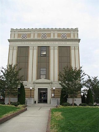
Person County is a county located in the U.S. state of North Carolina. The population was 39,097 as of the 2020 census. The county seat is Roxboro.

<span class="mw-page-title-main">Orange County, North Carolina</span> County in North Carolina, United States

Orange County is a county located in the Piedmont region of the U.S. state of North Carolina. As of the 2020 census, the population was 148,696. Its county seat is Hillsborough.

<span class="mw-page-title-main">Lee County, North Carolina</span> County in North Carolina, United States

Lee County is a county located in the U.S. state of North Carolina. As of the 2020 census, the population was 63,285. The county seat is Sanford.

<span class="mw-page-title-main">Franklin County, North Carolina</span> County in North Carolina, United States

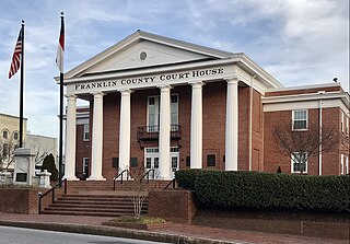
Franklin County is a county located in the U.S. state of North Carolina. As of the 2020 census, the population was 68,573. Its county seat is Louisburg.

<span class="mw-page-title-main">Durham County, North Carolina</span> County in North Carolina, United States

Durham County is a county located in the U.S. state of North Carolina. As of the 2020 census, the population was 324,833, making it the sixth-most populous county in North Carolina. Its county seat is Durham, which is the only incorporated municipality predominantly in the county, though very small portions of cities and towns mostly in neighboring counties also extend into Durham County. The central and southern parts of Durham County are highly urban, consisting of the city as well as several unincorporated suburbs. Southeastern Durham County is dominated by the Research Triangle Park, most of which is in Durham County. The northern third of Durham County is rural in nature.

<span class="mw-page-title-main">Smithfield, North Carolina</span> Town in North Carolina, United States

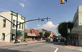
Smithfield is a town in and the county seat of Johnston County, North Carolina, United States. As of the 2010 census, its population was 10,966, and in 2019 the estimated population was 12,985. Smithfield is home to the Ava Gardner Museum and is situated along the Neuse River, where visitors enjoy the annual Smithfield Ham and Yam Festival, walks along the Buffalo Creek Greenway, and the historic downtown district. The town is located near North Carolina's Research Triangle and is about 30 miles (48 km) southeast of downtown Raleigh. The Raleigh-Durham-Cary combined statistical area has a population over 2 million residents.

<span class="mw-page-title-main">Apex, North Carolina</span> Town in North Carolina, United States

Apex is a town in Wake County, North Carolina, United States. At its southern border, Apex encompasses the community of Friendship. In 1994, the downtown area was designated a historic district, and the Apex train depot, built in 1867, is designated a Wake County landmark. The depot location marks the highest point on the old Chatham Railroad, hence the town's name. The town motto is "The Peak of Good Living".

<span class="mw-page-title-main">Knightdale, North Carolina</span> Town in North Carolina, United States

Knightdale is a town in Wake County, North Carolina, United States. As of the 2020 census, Knightdale has a population of 19,435, up from 11,401 in 2010. The U.S. Census Bureau estimates the town's population to be 17,843, as of July 1, 2019. Knightdale's population grew 10.4% from 2010 to 2013, making it the second fastest-growing community in the Research Triangle region for that time period.

<span class="mw-page-title-main">Cary, North Carolina</span> Town in North Carolina, US

Cary is a town in Wake, Chatham, and Durham counties in the U.S. state of North Carolina and is part of the Raleigh-Cary, NC Metropolitan Statistical Area. According to the 2020 census, its population was 174,721, making it the seventh-most populous municipality in North Carolina, and the 148th-most populous in the United States. In 2023, the town's population had increased to 180,010.

<span class="mw-page-title-main">Durham, North Carolina</span> City in North Carolina, United States

Durham is a city in the U.S. state of North Carolina and the county seat of Durham County. Small portions of the city limits extend into Orange County and Wake County. With a population of 283,506 in the 2020 census, Durham is the 4th-most populous city in North Carolina, and the 71st-most populous city in the United States. The city is located in the east-central part of the Piedmont region along the Eno River. Durham is the core of the four-county Durham-Chapel Hill, NC Metropolitan Statistical Area, which had an estimated population of 608,879 in 2023. The Office of Management and Budget also includes Durham as a part of the Raleigh-Durham-Cary, NC Combined Statistical Area, commonly known as the Research Triangle, which had an estimated population of 2,368,947 in 2023.

<span class="mw-page-title-main">Zebulon, North Carolina</span> Town in North Carolina, United States

Zebulon is the easternmost town in Wake County, North Carolina, United States. The population was 6,903 at the 2020 census. Zebulon is part of the Research Triangle metropolitan region. In May 2022, Zebulon was ranked North Carolina's second fastest growing town, only behind neighboring Wendell.

<span class="mw-page-title-main">American Tobacco Trail</span>

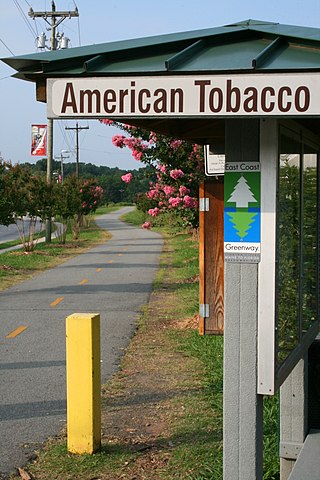
The American Tobacco Trail (ATT) is a 22.6-mile (36.4 km) long Rails-to-Trails project located in the Research Triangle region of North Carolina, running along an abandoned railroad bed originally built for the American Tobacco Company in the 1970s. The route crosses through portions of Durham County, Chatham County, and Wake County. The ATT is part of the East Coast Greenway and is open to pedestrians, cyclists, equestrians and other non-motorized users.

<span class="mw-page-title-main">Research Triangle</span> Geographic region of North Carolina, U.S.

The Research Triangle, or simply The Triangle, are both common nicknames for a metropolitan area in the Piedmont region of the U.S. state of North Carolina. Anchored by the cities of Raleigh and Durham and the town of Chapel Hill, the region is home to three major research universities: North Carolina State University, Duke University, and the University of North Carolina at Chapel Hill, respectively. The "Triangle" name originated in the 1950s with the creation of Research Triangle Park located between the three anchor cities, which is the largest research park in the United States and home to numerous high tech companies.

<span class="mw-page-title-main">Cedar Fork Township, Wake County, North Carolina</span> Township in central North Carolina, United States

Cedar Fork Township is one of twenty townships within Wake County, North Carolina, United States. As of the 2010 census, Cedar Fork Township had a population of 40,841, a 274.3% increase over 2000.

<span class="mw-page-title-main">Interstate 540 (North Carolina)</span> State highway and Interstate Highway in North Carolina, US

Interstate 540 (I-540) and North Carolina Highway 540 (NC 540) are part of a partially completed beltway around the city of Raleigh in the US state of North Carolina, forming the Raleigh Outer Loop. When complete, the route will completely encircle the city, meeting its parent route of I-40 in two locations.

<span class="mw-page-title-main">North Carolina Highway 54</span> State highway in North Carolina, US

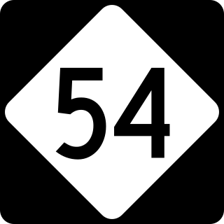
North Carolina Highway 54 (NC 54) is a 55.0-mile-long (88.5 km) primary state highway in the U.S. state of North Carolina. The highway serves the Research Triangle area, between Burlington and Raleigh, connecting the cities and towns of Chapel Hill, Durham, Morrisville and Cary. The highway also links the campuses of University of North Carolina at Chapel Hill and North Carolina State University.

<span class="mw-page-title-main">Crabtree Creek (Neuse River tributary)</span> Stream in North Carolina, USA

Crabtree Creek is a tributary of the Neuse River in central Wake County, North Carolina, United States. The creek begins in the town of Cary and flows through Morrisville, William B. Umstead State Park, and the northern sections of Raleigh before emptying into the Neuse at Anderson Point Park, a large city park located in East Raleigh.

The Wake County Board of Commissioners is the governing board for Wake County, which includes the City of Raleigh.

References

  1. "ArcGIS REST Services Directory". United States Census Bureau. Retrieved September 20, 2022.
  2. 1 2 U.S. Geological Survey Geographic Names Information System: Morrisville, North Carolina
  3. 1 2 "U.S. Census website". United States Census Bureau . Retrieved January 31, 2008.
  4. "General Information". Town of Morrisville. Archived from the original on June 9, 2011. Retrieved June 16, 2010.
  5. "P.L. 94-171 County Block Map (2010 Census): Wake County, NC (Map Sheet 17)" (PDF). U.S. Census Bureau. Retrieved December 30, 2011.
  6. "QuickFacts: Morrisville town, North Carolina". United States Census Bureau. Retrieved January 3, 2023.
  7. "Metropolitan and Micropolitan Statistical Areas Population Totals and Components of Change: 2020-2021". United States Census Bureau. February 24, 2022. Retrieved August 13, 2022.
  8. Dollar, Ernest. "Morrisville History". Archived from the original on May 12, 2008. Retrieved June 16, 2010.
  9. "Morrisville Historical Marker". Archived from the original on February 2, 2016. Retrieved October 9, 2011.
  10. "Uncontrolled collision with terrain, Flagship Airlines, Inc., dba American Eagle Flight 3379, BAe Jetstream 3201, N918AE, Morrisville, North Carolina, December 13, 1994" (PDF). National Transportation Safety Board. October 24, 1995. NTSB/AAR-95/07. Retrieved December 16, 2019.
  11. "Geographic Identifiers: 2010 Demographic Profile Data (G001): Morrisville town, North Carolina". United States Census Bureau . Retrieved December 30, 2011.
  12. "Census of Population and Housing". Census.gov. Retrieved June 4, 2016.
  13. "Explore Census Data". data.census.gov. Retrieved December 20, 2021.
  14. Kurry, Dawn (November 29, 2013). "Triangle's Little India". Triangle Business Journal. Retrieved June 15, 2014.
  15. "Morrisville Demographics". Archived from the original on June 12, 2013.
  16. 1 2 3 "Profile of General Population and Housing Characteristics: 2010 Demographic Profile Data (DP-1): Morrisville town, North Carolina". United States Census Bureau . Retrieved December 30, 2011.
  17. "Locations – Lenovo US". Lenovo. Archived from the original on July 6, 2020. Retrieved July 4, 2020.
  18. "Corporate Information". Midway Airlines. April 18, 2000. Archived from the original on April 18, 2000. Retrieved January 29, 2010.
  19. "Major Employers of Morrisville". Choose Morrisville. Retrieved April 13, 2015.
  20. "Morrisville Municipal Profile 2019" (PDF). Morrisville Chamber of Commerce. 2019.
  21. "National Register of Historic Places Listings". Weekly List of Actions Taken on Properties: 11/05/12 through 11/09/12. National Park Service. July 3, 2014.
  22. "National Register of Historic Places Listings". Weekly List of Actions Taken on Properties: 4/16/12 through 4/20/12. National Park Service. April 27, 2012.
  23. "National Register of Historic Places Listings". Weekly List of Actions Taken on Properties: 6/16/14 through 6/27/14. National Park Service. July 3, 2014.
  24. "Parks and Greenways". Town of Morrisville. Archived from the original on June 9, 2011. Retrieved June 16, 2010.
  25. "Morrisville Community Park". Town of Morrisville. Archived from the original on September 12, 2010. Retrieved June 16, 2010.
  26. "Shiloh Park / Luthor Green Center". Town of Morrisville. Archived from the original on June 9, 2011. Retrieved June 16, 2010.
  27. "Crabtree Creek Nature Park". Town of Morrisville. Archived from the original on June 9, 2011. Retrieved June 16, 2010.
  28. "Ruritan Park". Town of Morrisville. Archived from the original on June 9, 2011. Retrieved June 16, 2010.
  29. "Ruritan Park". ParkGeek.com. Retrieved June 16, 2020.
  30. "Indian Creek Greenway and Trailhead". Town of Morrisville. Archived from the original on June 9, 2011. Retrieved June 16, 2010.
  31. "Cedar Fork District Park". Town of Morrisville. Archived from the original on June 9, 2011. Retrieved June 16, 2010.
  32. Doran, Will (December 29, 2014). "Morrisville gears up for new parks". cary news. Retrieved April 14, 2015.
  33. "Youth Basketball". Town of Morrisville. Archived from the original on June 9, 2011. Retrieved June 16, 2010.
  34. "Athletics". Town of Morrisville. Archived from the original on February 22, 2010. Retrieved June 16, 2010.
  35. "Youth Cricket". Town of Morrisville. Archived from the original on June 9, 2011. Retrieved June 16, 2010.
  36. "Town Council". Town of Morrisville. Archived from the original on January 14, 2014. Retrieved February 22, 2014.
  37. "Council Members". Town of Morrisville. Archived from the original on January 14, 2014. Retrieved March 14, 2014.
  38. "Home." North Carolina State Board of Dental Examiners. Retrieved on May 15, 2013. "507 Airport Boulevard, Suite 105 Morrisville, NC 27560-8200"
  39. David Ray Boggs Owner Statistics. Racing-Reference. Retrieved October 29, 2020.
  40. Hill Carrow | Sports Destination Management. Retrieved October 29, 2020.
  41. Campbell, Colin. (January 30, 2015). Former Rep. Tom Murry lands legal counsel job at NC Administrative Office of the Courts. The News & Observer. Retrieved October 29, 2020.
  42. Sybil H. Argintar (September 2013). "Pugh House" (PDF). National Register of Historic Places - Nomination and Inventory. North Carolina State Historic Preservation Office. Retrieved June 1, 2015.
  43. Vic Sorrell Stats. Baseball-Reference. Retrieved October 29, 2020.