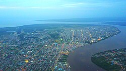
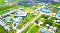
Paramaribo is the capital and largest city of Suriname, located on the banks of the Suriname River in the Paramaribo District. Paramaribo has a population of roughly 241,000 people, almost half of Suriname's population. The historic inner city of Paramaribo has been a UNESCO World Heritage Site since 2002.
Commewijne is a district of Suriname, located on the right bank of the Suriname River. Commewijne's capital city is Nieuw Amsterdam. Tamanredjo is another major town, while Meerzorg is the most populated.

Brokopondo is a district of Suriname. Its capital city is Brokopondo; other towns include Brownsweg and Kwakoegron.

Coronie is a district of Suriname, situated on the coast. Coronie's capital city is Totness. The district border the Atlantic Ocean to the north, the Surinamese district of Saramacca to the east, the Surinamese district of Sipaliwini to the south and the Surinamese district of Nickerie to the west. The district is served by the Totness Airstrip.
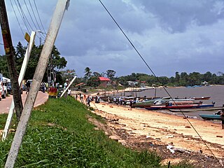
Marowijne is a district of Suriname, located on the north-east coast. Marowijne's capital city is Albina, with other towns including Moengo and Wanhatti. The district borders the Atlantic Ocean to the north, French Guiana to the east, the Surinamese district of Sipaliwini to the south, and the Surinamese districts of Commewijne and Para to the west.

Wanica is a district of Suriname located in the north of the country. Wanica's capital city is Lelydorp, the second-largest city in Suriname. Wanica has a population of 118,222 and an area of 443 km2. Following neighbouring Paramaribo, Wanica is the second most populated and urbanised district of Suriname. Two-thirds of the country's population live in these two districts.

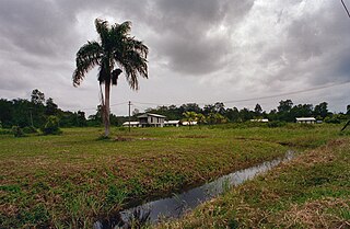
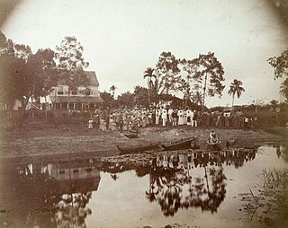
Nieuw Amsterdam is the capital of the Commewijne District in Suriname. It is a small coastal town situated at the confluence of the Suriname River and Commewijne River, just across from Paramaribo, the country's capital. Its population at the 2012 census was 5,650, with around 1,200 people living in the main town, most of whom are of Javanese and East Indian origin. It is the location of the historical Fort Nieuw-Amsterdam, today an open-air museum. The town of Mariënburg with former sugarcane factory is located 3 km from Nieuw Amsterdam and part of the resort.

Tapanahoni is a resort in Suriname, located in the Sipaliwini District. Its population at the 2012 census was 13,808. Tapanahoni is a part of Sipaliwini which has no capital, but is directly governed from Paramaribo. Tapanahony is an enormous resort which encompasses a quarter of the country of Suriname. The most important town is Diitabiki which is the residence of the granman of the Ndyuka people since 1950, and the location of the oracle.

Johan & Margaretha or sometimes just Margaretha is a resort in Suriname, located in the Commewijne District. Its population at the 2012 census was 756. It is located along a peninsula northeast of Paramaribo. It is named after the coffee plantation Johan & Margaretha which was founded in 1745 by Johan Knöffel. It is safe to assume that his wife was called Margaretha.
Oost is a resort in Suriname, located in the Para District. Its population at the 2012 census was 8,016. The main town in the resort is Paranam. Oost is also home to the former leper colony Bethesda. The Paranam alumina refinery is located near the town of Paranam. The Accaribo area is becoming tourist spot with the main attractions White Beach and Caribo Beach Resort.

Zuid is a resort in Suriname, located in the Para District. Its population at the 2012 census was 6,113. The main ethnic groups are indigenous, Creoles, and mixed race.

Flora is a resort in Suriname, located in the Paramaribo District. Its population at the 2012 census was 19,538. Flora is both the name of the resort and the neighbourhood within the resort. Flora was founded as a wood plantation in 1809.
Latour is a resort in Suriname, located in the Paramaribo District. Its population at the 2012 census was 29,526. Latour is a low income neighbourhood with large unemployment. Latour is the most populous resort of Paramaribo.
Livorno is a resort in Suriname, located in the Paramaribo District. Its population at the 2012 census was 8,209.
Tammenga is a resort in Suriname, located in the Paramaribo District. Its population at the 2012 census was 15,819. The resort has been named after Henderijkes Tammenga (1815-1864), who after his first plantation did not succeed, started farming in a swampy area near Paramaribo in 1852. Most of the area was sold to East Indian indentured workers in the late 19th century.

De Nieuwe Grond is a resort in Suriname, located in the Wanica District. Its population at the 2012 census was 26,161. Its main ethnic groups are East Indian, and Creoles. The resort is named after a sugar plantation in 1770. The plantation was already abandoned in 1863, when slavery was abolished, because that year, it was up for public auction. The area used to consist of small scale agriculture with a focus on vegetables and rice, but due to its proximity to Paramaribo, it has become a suburban area with a young population. In 2019, a new bigger market opened in the town.

Koewarasan is a resort in Suriname, located in the Wanica District. Its population at the 2012 census was 27,713. It is located to the west of Paramaribo, and is mainly a suburban area. The municipality was founded in 1939, and was originally intended for the Javanese settlers from Java, however due to World War II, only a single group arrived. The majority of the population are East Indian. Prior to 1939, Koewarasan was an agricultural area used for the cultivation of rice.

Kwatta is a resort in Suriname, located in the Wanica District. Its population at the 2012 census was 14,151.
Saramacca Polder is a resort in Suriname, located in the Wanica District. Its population at the 2012 census was 10,217. And the majority of the population is of East Indian descent. The Saramacca Polder was created between 1894 and 1904. The main function was agriculture. The Commissaris Weytinghweg was built in 1906, and connects the polder with Paramaribo. Initially the area was mainly used for rice cultivation, but has become home to companies and suburban housing.

Centrum is a resort in Suriname, located in the Paramaribo District. Its population at the 2012 census was 20,631. The historical centre of Paramaribo is located within the resort. The city centre is mainly in original condition, contains 291 listed monuments, and has of 2002 been designated a UNESCO World Heritage Site.