Peel County, Ontario

Last updated
Peel County
Dissolved county
County of Peel, Ontario, Canada map (1937).jpg
Coordinates: 43°41′06″N79°45′27″W / 43.68491°N 79.75752°W / 43.68491; -79.75752
CountryCanada
OntarioProvince
Established1851 (from York County)
Dissolved1974 (into Regional Municipality of Peel)
Time zone UTC-5 (Eastern (EST))
  Summer (DST) UTC-4 (Eastern (EDT))

Peel County is a historic county in the Canadian province of Ontario. Named for Sir Robert Peel, Prime Minister of the United Kingdom, the county was organized in 1851. Settlers, however, were in Toronto Township as early as 1807. The Credit River was reserved for the Mississaugas; however, they sold their land and moved to the Bruce Peninsula.

Contents

Formation and history

Now an art gallery, the Peel County Courthouse was built in 1865-66 Peel Art Gallery, Museum and Archives Building (PAMA).jpg
Now an art gallery, the Peel County Courthouse was built in 1865–66

The townships that would eventually constitute Peel were initially part of York County in the Home District, and were designated as the West Riding of York in 1845. [1]

Historic townships of the County of Peel
TownshipOpenedDescription
Albion 1819Given the ancient name of England.
Caledon 1819Named for the historic district of Caledonia, Scotland.
Chinguacousy 1819Named, probably in honour of a loyal Chippewa chief who fought at the capture of Michilimackinac. His name was Shinguacose, "the small pine." Born to a Scottish officer and Chippewan mother, Shinguacose died around 1858. The name of the township may also be from an indigenous word meaning "the place where young pines grow."
Toronto 1806Named after the Toronto Purchase. (In 1834, the name was also adopted by the nearby town of York when it became the City of Toronto.)
Toronto Gore 1831Its name is derived from the Toronto Purchase and from the word "gore", referring to a triangular piece of land.

The following communities were organized:

Historic communities of the County of Peel
CommunityTownshipDescription
Town of Brampton ChinguacousyOpened in 1834 when John Elliott laid out the lots and named the place. Incorporated as a village in 1852, and as a town in 1873. Named by settler John Eliot and likely linked to Brampton, Carlisle, Cumbria in England.
Village of Bolton AlbionJames Bolton, the first settler, in partnership with his brother George, built a grist mill in 1824.
Village of Port Credit TorontoNamed for French trading post Port-de-crédit.
Village of Streetsville TorontoJohn Barnhart opened the first store in 1821 and Timothy Street built a saw and grist mill.
Police Village of Malton Toronto GoreIt had its beginnings about 1820. Likely named for Malton, North Yorkshire by local settler Richard Halliday.

The county was created in 1851, forming part of the United Counties of York, Ontario and Peel. [2] It was given its own provisional county council in 1856, [3] and was formally separated from York in 1860. [4]

However, disputes as to whether the county seat should be Malton or Brampton [5] prompted the provisional council to request that the separation be reversed, and an 1862 Act of the Parliament of the Province of Canada brought that into effect, reviving the United Counties of York and Peel. [6] In 1866, the counties were re-separated. [7]

In 1973, Peel County became the Regional Municipality of Peel, as a result of the Ontario provincial government's regionalization of the rapidly developing counties surrounding Toronto. [8]

Further reading

Middleton, Jesse Edgar; Landon, Fred (1927). Province of Ontario: A History 1615 to 1927. Toronto: Dominion Publishing Company.

See also

Related Research Articles

<span class="mw-page-title-main">Middlesex County, Ontario</span> County in Ontario, Canada

Middlesex County is a primarily rural county in Southwestern Ontario, Canada. Landlocked, the county is bordered by Huron and Perth counties on the north, Oxford County on the east, Elgin County on the south, and Chatham-Kent and Lambton County on the west.

<span class="mw-page-title-main">Victoria County, Ontario</span> Historical county in Ontario, Canada

The County of Victoria, or Victoria County, was a county in the Canadian province of Ontario. It was formed in 1854 as The United Counties of Peterborough and Victoria, and separated from Peterborough in 1863. In 2001, the county was dissolved and reformed as the city of Kawartha Lakes. Though first opened to settlement in 1821, the area that was encompassed by Victoria County has a history of Indian occupation, first by the Hurons.

<span class="mw-page-title-main">Peterborough County</span> County in Ontario, Canada

Peterborough County is located in Southern Ontario, Canada. The county seat is The City of Peterborough, which is independent of the county.

<span class="mw-page-title-main">Hastings County</span> County in Ontario, Canada

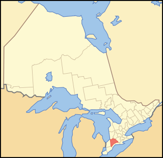
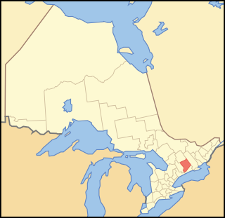
Hastings County is located in the province of Ontario, Canada. Geographically, it is located on the border of Eastern Ontario and Central Ontario. Hastings County is the second-largest county in Ontario, after Renfrew County, and its county seat is Belleville, which is independent of Hastings County. Hastings County has trademarked the moniker "Cheese Capital of Canada".

<span class="mw-page-title-main">Renfrew County</span> County in Ontario, Canada

Renfrew County is a county in the Canadian province of Ontario. It stands on the west bank of the Ottawa River. There are 17 municipalities in the county.

<span class="mw-page-title-main">Simcoe County</span> County in Ontario, Canada

Simcoe County is located in the central portion of Southern Ontario, Canada. The county is just north of the Greater Toronto Area, stretching from the shores of Lake Simcoe in the east to Georgian Bay in the west. Simcoe County forms part of the Greater Golden Horseshoe area, a densely populated and industrialized region, centred on the Greater Toronto Area.

<span class="mw-page-title-main">Bruce County</span> County in Ontario, Canada

Bruce County is a county in Southwestern Ontario, Canada. It has eight lower-tier municipalities with a total 2016 population of 66,491. It is named for James Bruce, 8th Earl of Elgin and 12th Earl of Kincardine, the sixth Governor General of the Province of Canada. The Bruce name is also linked to the Bruce Trail and the Bruce Peninsula.

<span class="mw-page-title-main">Lanark County</span> County in Ontario, Canada

Lanark County is a county located in the Canadian province of Ontario. Its county seat is Perth, which was first settled in 1816.

<span class="mw-page-title-main">Elgin County</span> County in Ontario, Canada

Elgin County is a county of the Canadian province of Ontario with a 2016 population of 50,069. Its population centres are St. Thomas, Aylmer, Port Stanley, Belmont, Dutton and West Lorne. The county seat is St. Thomas, which is separated from the county but within its geographic boundary.

<span class="mw-page-title-main">Huron County, Ontario</span> County in Ontario, Canada

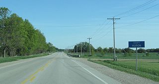
Huron County is a county of the province of Ontario, Canada. It is located on the southeast shore of its namesake, Lake Huron, in the southwest part of the province. The county seat is Goderich, also the county's largest community.

<span class="mw-page-title-main">Grey County</span> County in Ontario, Canada

Grey County is a county of the Canadian province of Ontario. The county seat is in Owen Sound. It is located in the subregion of Southern Ontario named Southwestern Ontario. Grey County is also a part of the Georgian Triangle. At the time of the Canada 2016 Census the population of the county was 93,830.

<span class="mw-page-title-main">Lennox and Addington County</span> County in Ontario, Canada

Lennox and Addington County is a county and census division of the Canadian province of Ontario. The county seat is Greater Napanee. It is located in the subregion of Southern Ontario named Eastern Ontario.

Lennox County is a historic county in the Canadian province of Ontario which now forms part of Lennox and Addington County. It was named after Charles Lennox, 3rd Duke of Richmond.

Halton County is a former county in the Canadian province of Ontario, with an area of 228,181 acres (923.42 km2). It is also one of the oldest counties in Canada.

<span class="mw-page-title-main">Home District</span> Former District in Upper Canada

The Home District was one of four districts of the Province of Quebec created in 1788 in the western reaches of the Montreal District and detached in 1791 to create the new colony of Upper Canada. It was abolished with the adoption of the county system in 1849.

<span class="mw-page-title-main">Western District, Upper Canada</span> Former District in Upper Canada

Western District was one of four districts of the Province of Quebec created in 1788 in the western reaches of the Montreal District which were later detached in 1791 to create the new colony of Upper Canada. Known as Hesse District until 1792, it was abolished in 1849.

<span class="mw-page-title-main">Midland District, Upper Canada</span>

Midland District was one of four districts of the Province of Quebec created in 1788 in the western reaches of the Montreal District and partitioned in 1791 to create the new colony of Upper Canada.

<span class="mw-page-title-main">London District, Upper Canada</span> Former District in Upper Canada

The London District was a historic district in Upper Canada. It was formed in 1798 from parts of the Home and Western Districts, and lasted until its abolition in 1850.

<span class="mw-page-title-main">Wellington District, Upper Canada</span> Former district of Upper Canada

The Wellington District was a historic district in Upper Canada and its successor, Canada West, which existed until 1849. It was formed in June 1840 from townships transferred from certain other districts:

<span class="mw-page-title-main">Bathurst District</span>

The Bathurst District was a historic district in Upper Canada. It was created in 1822 from the Johnstown District. Containing Carleton County, it existed until 1849. The district town was Perth.

References