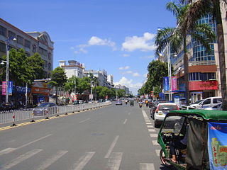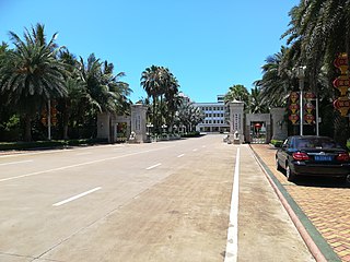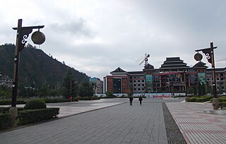
Wanning, or in local Hainanese dialect as Ban Ning, is a county-level city in the southeast of Hainan Province, China. Although called a "city", Wanning refers to both the county seat and to the entire county as a whole. The county-wide area has an estimated population of 65,871 (2006).

Dongfang is one of the seven county-level cities of Hainan province, China. Although called a "city", Dongfang refers to a large land area in Hainan - an area which was once a county. Within this area is the main city, Dongfang City. It is located on the western coast of Hainan Island facing Vietnam across the Gulf of Tonkin, and in 2004 had a population of 435,000.

Hechi is a prefecture-level city in the northwest of the Guangxi Zhuang Autonomous Region, People's Republic of China, bordering Guizhou to the north. The actual inner city itself is referred as Jinchengjiang. In June 2002 it gained city status.

Pingbian Miao Autonomous County is a county located in Honghe Hani and Yi Autonomous Prefecture in the southeast of Yunnan province, China. Its seat is located only 21 kilometres (13 mi) from the border with Lào Cai Province, Vietnam.

Língāo County is an administrative district in Hainan province, China. It is one of the 4 counties of Hainan. Its postal code is 571800, and in 1999, its population was 399,057 people.

Chengmai County is a county in Hainan, China. It is one of four counties of Hainan. Its postal code is 571900. In 2002, its population was 490,800.

Dìng'ān is an administrative district in Hainan, People's Republic of China. It is one of 4 counties of Hainan. In 1999, its population was 304,522 people.

Tunchang County is a county of Hainan Province, People's Republic of China. Its postal code is 571600, and in 1999 its population was 250,059 people. The administrative seat lies at Tuncheng.

Qionghai is one of the seven county-level cities of Hainan province, China. Although called a "city", Qionghai refers to a large land area in Hainan - an area which was once a county. Within this area is the main city, Qionghai City. It is located in the east of the island at the mouth of the Wanquan River, 86 kilometres (53 mi) from the provincial capital of Haikou. It has an area of 1,692 square kilometres (653 sq mi) and in 2010, it had a population of 483,217 people.
Changjiang Li Autonomous County is an autonomous county in Hainan, China. It is one of six counties of Hainan. Its postal code is 572700, and in 1999 its population was 225,131 people, largely made up of the Li people.

Baisha Li Autonomous County, p Báishā Lízú Zìzhìxiàn) is one of 6 autonomous counties of Hainan, China. In 1999 its population was 176,377 people, largely made up of the Li people.

Língshuǐ Li Autonomous County is an autonomous county in Hainan, China. It is one of the six autonomous counties of Hainan with a postal code of 572400, and in 1999 a population of 318,691, largely made up of the Li people. Notably the beautiful Niuling (牛岭) mountain delimits the tropical area of the county. A well-known natural sight, part of the Chinese Riviera is Xiangshuiwan or Perfume bay (香水湾). Monkey Island, a popular tourist destination located in Lingshui County, is a state-protected nature reserve for macaques. Lingshui is also home to the military base where a U.S. airplane crew were held during the Hainan Island incident in 2001. In September 2010, officials signed and scheduled the construction of the largest sea world theme park in Asia. The Lingshui Li'an Harbor Ocean Theme Park signing ceremony took place at the Narada Resort in Perfume Bay and the opening is planned for 2013.

Bǎotíng Li and Miao Autonomous County is an autonomous county in Hainan, China. One of the six autonomous counties on the island, its postal code is 572300. Baoting spans an area of 1,153.24 square kilometres (445.27 sq mi), and has a population of about 168,000 as of 2020.
Ledong Li Autonomous County is an autonomous county in Hainan province, China. It is one of six autonomous counties of Hainan. Its postal code is 572500, and in 1999, its population was 468,834 people, largely made up of the Li people.

Wuzhishan is a county-level city in the highlands of Hainan Island, China. Although called a "city", Wuzhishan refers to a large land area in Hainan - an area which was once a county. Within this area is the main city seat, located beside Wuzhi Mountain, called Wuzhishan City. The city's total area is 1129 square kilometres, and its population is 115,000 people. Its postal code is 572200, and its district number is 0898.

Qingyuan Manchu Autonomous County, or simply Qingyuan County (清原县) is one of the three counties under the administration of the prefecture-level city of Fushun, in the east of Liaoning, China, and is also one of the 11 Manchu autonomous counties and one of 117 autonomous counties nationally. It has a population of about 340,000, covering an area of 3,921 square kilometres (1,514 sq mi).

Maqên or Maqin County is a county of Qinghai Province, China. It is under the administration of Golog Tibetan Autonomous Prefecture.
Sansui County is a county in eastern Guizhou province, China, bordering Hunan province to the east. It is under the administration of the Qiandongnan Miao and Dong Autonomous Prefecture and is one of the province's eastern gateways.

Leishan is a county in the east of Guizhou province, China. It is under the administration of the Qiandongnan Miao and Dong Autonomous Prefecture. More than 90% of population are ethnic Hmu.

Xingren is a county-level city of southwestern Guizhou province, China. It is under the administration of the Qianxinan Buyei and Miao Autonomous Prefecture.


