RAF West Drayton

Last updated

Royal Air Force West Drayton
West-drayton-600.jpg
Activec1918 to 1994
Country United Kingdom
Branch Royal Air Force
Royal Naval Air Service
Garrison/HQ West Drayton (Stockley), Middlesex
Motto(s)"Protect" [1]
Royal Air Force Ensign Ensign of the Royal Air Force.svg

RAF West Drayton was a non-flying Royal Air Force station in West Drayton, within the London Borough of Hillingdon, which served as the main centre for military air traffic control in the United Kingdom. It was co-located with the civilian London Air Traffic Control Centre to provide a vital link between civil and military flying and airspace requirements. Following the departure of the remaining civil and military air traffic control systems by 2008, the site was closed and demolished for a new residential development.

Contents

History

West Drayton RAF station was operating in 1918 as an RAF Air Construction Corps (A.C.C.) depot and was located in the Stockley area of the Yiewsley Urban District. [2] Before the creation of the RAF on 1 April 1918, buildings at Stockley were occupied by the Royal Naval Air Service (R.N.A.S.). By October 1920 the depot accommodation buildings used by the R.N.A.S. had been vacated and both the Yiewsley Urban District Council and the Uxbridge Rural District Council requested for the buildings to be used for the housing of demobilised soldiers and sailors. [3] However this was declined by the Secretary of State for War and Air, Winston Churchill. [4]

Between 1920 and 1923 public sales by auction of large quantities of the depot stores were held on behalf of the U.K. Government. [5]

On 1 September 1924 the West Drayton RAF Station became an reception depot for new entrants. [6] Wing Commander Alexander Shekleton D.S.O. took command of the depot. [7]

On 30 October 1939 it became a Women's Auxiliary Air Force (WAAF) new-entrant depot.

The station was used to house 700 athletes competing at the 1948 Summer Olympics in London, together with RAF Uxbridge and Richmond. [8]

From 1951 until 1962 the station accommodated the 3911th Air Base Group United States Air Force in addition to RAF personnel. [9]

Air Traffic Control Operations

View across the site RAF West Drayton buildings.jpg
View across the site

The station became a unit of No. 11 Group RAF in January 1965. [10]

RAF West Drayton was also the home of the Linesman System, hence the main Operations Building being known as the L1. The system used Link 1 to exchange Air Defence data between the UK and Europe. There were links to Continental Early Warning (CEW) sites at: Reitan, Maakeroy, Vaedbek, Nieuw-Milligen, Glons and Doulons.

Aerospace System Operators (ASOps or Scopies) were responsible for the tracking and identification of every flight – military and civil, that entered or left the UK Air Defence Region (UKADR). This was a labour-intensive task in the days before automatic initiation and tracking systems, but a big improvement on the plotting table and small perspex plaques with information written on them. The School of Fighter Control continued to teach plotting and writing backwards until 1990.

The School of Fighter Control moved to RAF West Drayton from RAF Bawdsey, training junior officers to be Fighter Controllers. In addition to teaching RAF officers, foreign and commonwealth students also attended, and there was even one course of Yugoslavian MiG pilots.

The station also became responsible for collecting and analysing many reports of UFOs after information was received by the Ministry of Defence. [11]

Closure and redevelopment

A London bus passes the RAF West Drayton complex in 2005 Bus passes RAF West Drayton - geograph.org.uk - 76380.jpg
A London bus passes the RAF West Drayton complex in 2005

West Drayton ceased being an RAF station in April 1994. [12] At this time the English Electric Lightning acting as a gate guardian was scrapped; [13] only the nose section was retained and sent to the Malta Aviation Museum. [14] Air traffic control services remained, although the section responsible for airspace outside London moved to Swanwick in Hampshire in 2002. The remaining operation was named the London Terminal Control Centre. RAF personnel remained on the site, as military air traffic control functions for the eastern side of England remained. In November 2007 the remaining civil air traffic control services moved to Swanwick and were joined by the military operation in January 2008. [15] National Air Traffic Services vacated the site in 2008. [16] The MT section of the Queen's Colour Squadron relocated to RAF Northolt.

Plans for 773 homes, a nursing home, shops and offices were approved by the London Borough of Hillingdon in July 2010. [17] Inland Homes named the new development "Drayton Garden Village", aiming to create a 1930s style village. [18] Demolition work of the former air traffic control site was carried out between 2010 and 2011. [19] The Drayton Garden Village development opened officially on 21 October 2011, with a ceremony led by the Mayor of Hillingdon. [20] A later housing development, Park West, was constructed on the western side of the site.

See also

Related Research Articles

<span class="mw-page-title-main">Uxbridge</span> Town in the west of Greater London, England

Uxbridge is a suburban town in west London and the administrative headquarters of the London Borough of Hillingdon. Situated 15.4 miles (24.8 km) west-northwest of Charing Cross, it is one of the major metropolitan centres identified in the London Plan. Uxbridge formed part of the parish of Hillingdon in the county of Middlesex, and was a significant local commercial centre from an early time. As part of the suburban growth of London in the 20th century it expanded and increased in population, becoming a municipal borough in 1955, and has formed part of Greater London since 1965.

<span class="mw-page-title-main">Yiewsley</span> Suburban village in the United Kingdom

Yiewsley is a large suburban village in the London Borough of Hillingdon, England, 2 miles (3 km) south of Uxbridge, the borough's commercial and administrative centre. Yiewsley was a chapelry in the ancient parish of Hillingdon, Middlesex. The population of the ward was 12,979 at the 2011 Census.
<span class="mw-page-title-main">London Borough of Hillingdon</span> London borough in United Kingdom

The London Borough of Hillingdon is the largest and westernmost borough in West London, England. It was formed in 1965 from the districts of Hayes and Harlington, Ruislip-Northwood, Uxbridge, and Yiewsley and West Drayton in the ceremonial county of Greater London. Today, Hillingdon is home to Heathrow Airport and Brunel University, and is the second largest of the 32 London boroughs by area.
<span class="mw-page-title-main">RAF Northolt</span> Royal Air Force station in Greater London, England

Royal Air Force Northolt or more simply RAF Northolt is a Royal Air Force station in South Ruislip, 2 nautical miles from Uxbridge in the London Borough of Hillingdon, western Greater London, England, approximately 6 mi (10 km) north of Heathrow Airport. The station handles many private civil flights in addition to Air Force flights. Northolt has one runway in operation, spanning 1,687 m × 46 m, with a grooved asphalt surface. This airport is used for government and VIP transport to and from London.

<span class="mw-page-title-main">Uxbridge Vine Street railway station</span> Former railway station in England

Uxbridge Vine Street station opened on 8 September 1856 as Uxbridge Station and was the earliest of three railway stations in Uxbridge, London.

<span class="mw-page-title-main">West Drayton</span> Area of the London Borough of Hillingdon

West Drayton is a suburban town in the London Borough of Hillingdon. It was an ancient parish in the county of Middlesex and from 1929 was part of the Yiewsley and West Drayton Urban District, which became part of Greater London in 1965. The settlement is near the Colne Valley Regional Park and its centre lies 1.9 miles (3 km) north of Heathrow Airport.

<span class="mw-page-title-main">RAF Uxbridge</span> Air force base in the UK

RAF Uxbridge was a Royal Air Force (RAF) station in Uxbridge, within the London Borough of Hillingdon, occupying a 44.6-hectare (110-acre) site that originally belonged to the Hillingdon House estate. The British Government purchased the estate in 1915, three years before the founding of the RAF. Until the outbreak of the Second World War in 1939, the station was open to the public.

<span class="mw-page-title-main">Hillingdon Borough F.C.</span> Association football club in England

Hillingdon Borough Football Club is a semi-professional football club based in Ruislip, in the London Borough of Hillingdon. The club is affiliated to the Middlesex County Football Association. Its name was revived in 1990 from the original club, which had been based in Yiewsley. They currently play in the Combined Counties League Division One.
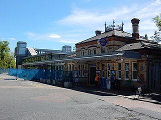
<span class="mw-page-title-main">West Drayton railway station</span> Railway station in the United Kingdom serving Yiewsley and West Drayton

West Drayton railway station serves West Drayton and Yiewsley, western suburbs of London. It is served by local trains operated by the Elizabeth line. It is 13 miles 71 chains (22.3 km) down the line from London Paddington and is situated between Hayes & Harlington to the east and Iver to the west. The station is managed by Transport for London.
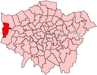
<span class="mw-page-title-main">Uxbridge (UK Parliament constituency)</span> Parliamentary constituency in the United Kingdom, 1885–2010

Uxbridge was a seat returning one Member of Parliament (MP) of the House of Commons of the UK Parliament from 1885 to 2010. Its MPs elected were: Conservative Party candidates for 107 years and Labour Party candidates for 18 years. The closing 40 years of the seat's history saw Conservative victory — in 1997 on a very marginal majority in relative terms.
<span class="mw-page-title-main">Yiewsley and West Drayton Urban District</span>

Yiewsley and West Drayton was a local government district in Middlesex, England from 1929 to 1965. Its area became the south-west of the London Borough of Hillingdon.

The London Terminal Control Centre (LTCC) was an air traffic control centre based in West Drayton, in the London Borough of Hillingdon, England, approximately 2.5 miles (4.0 km) north of London Heathrow Airport. Operated by National Air Traffic Services (NATS) it provided air traffic control services to aircraft arriving and departing from six London airports, one Royal Air Force station, plus en-route services to other aircraft that entered its airspace. Internally within NATS it is usually known by the initials TC. The civilian part of the West Drayton site closed in November 2007, when its functions moved to Swanwick, Hampshire. 'TC' and 'AC' remain separate organisations but now share the same site.

<span class="mw-page-title-main">Project MoDEL</span>

Project MoDEL is a project run for the Ministry of Defence (MoD) by the ministry's Defence Infrastructure Organisation and VSM Estates, a joint venture established between Vinci PLC and St. Modwen Properties to bid for the contract. The project involves the consolidation and sale of surplus Ministry of Defence properties around Greater London into around £180m of new developments at RAF Northolt. A total of 80% of the existing buildings at RAF Northolt were demolished and replaced by the newly built facilities.

<span class="mw-page-title-main">Stockley Park</span> Pioneering suburban business and public park in the United Kingdom

Stockley Park is a business estate and public country park located between Hayes, Yiewsley and West Drayton in the London Borough of Hillingdon. In August 2020 it was listed in the Register of Historic Parks and Gardens of Special Historic Interest in England as Grade II.

<span class="mw-page-title-main">RAF West Ruislip</span> Former Royal Air Forces depot in London

RAF West Ruislip was a Ministry of Defence site, located in Ickenham within the London Borough of Hillingdon. The base was originally built as a depot for the Royal Air Force (RAF), split by what is now the Chiltern Main Line. North of the railway was RAF Blenheim Crescent, which housed the RAF Records Office and the depot's original personnel accommodation.

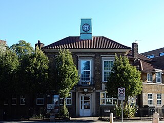
<span class="mw-page-title-main">Hillingdon House</span> Mansion in Hillingdon, Greater London

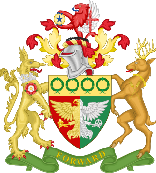
<span class="mw-page-title-main">Coat of arms of the London Borough of Hillingdon</span>

The coat of arms of the London Borough of Hillingdon is the official symbol of the London Borough of Hillingdon. They use elements from the coats of arms of the four previous districts. It is described as:

Arms: Per pale Gules and Vert an Eagle displayed per pale Or and Argent in the dexter claw a Fleur-de-lis Or and in the sinister claw a Cog-Wheel Argent on a Chief Or four Civic Crowns Vert.

Crest: On a Wreath of the Colours issuant from a Circlet of Brushwood Sable a demi-Lion Gules with wings Argent the underside of each wing charged with a Cross Gules and holding between the paws a Bezant thereon a Mullet Azure.

Supporters: On the dexter side an Heraldic Tiger Or gorged with an Astral Crown Azure and charged on the shoulder with a Rose Gules charged with another Argent barbed and seeded proper and on the sinister side a Stag proper attired and gorged with a Circlet of Brushwood and charged on the shoulder with two Ears of Rye slipped in saltire Or.

Motto: Forward.

The history of air traffic control in the United Kingdom began in the late 1950s, and early 1960s, when an integrated and coordinated system began, once radar had become sufficiently advanced to allow this.

References

  1. Pine, L G (1983). A Dictionary of mottoes. London: Routledge & K. Paul. p. 186. ISBN   071009339X.
  2. "Situations Vacant". Middlesex & Buckinghamshire Advertiser and The Uxbridge Gazette. 24 May 1918. p. 8.
  3. "Yiewsley". Middlesex & Buckinghamshire Advertiser and The Uxbridge Gazette. 29 October 1920. p. 5.
  4. Cox, A. H. (1983). West Drayton & Yiewsley through the centuries. Hillingdon Borough Libraries. pp. 41–42. ISBN   0907869033.
  5. "G.R.". The Yorkshire Post. 15 September 1923. p. 4.
  6. "The National Archives' catalogue". discovery.nationalarchives.gov.uk.
  7. "R.A.F. Appointments". The Western Morning News and Mercury. 4 October 1924. p. 6.
  8. "History". Winning Endeavours. 2011. Retrieved 29 May 2011.
  9. "RAF West Drayton". Air of Authority. Retrieved 29 May 2011.
  10. "Chapter 8 – RAF West Drayton". Association of Royal Air Force Fighter Control Officers. Retrieved 10 June 2011.
  11. Grimston, Jack (22 March 2009). "Is that a flying saucer? No, it's a stealth bomber". The Times. Retrieved 29 May 2011.
  12. "RAF West Drayton". Air of Authority. Retrieved 29 May 2011.
  13. Nick Weight. "English Electric Lightning F2". Air-Britain. Retrieved 29 May 2011.
  14. "English Electric Lightning F.2". Malta Aviation Museum. Retrieved 29 May 2011.
  15. Rob Curl (26 September 2008). "Why Swanwick hit the headlines". BBC News. Retrieved 6 June 2011.
  16. "RAF, West Drayton, Hillingdon, Porters Way, West Drayton". CB Richard Ellis. Retrieved 29 May 2011.
  17. "Go-ahead for NATS site development". Uxbridge Gazette. 7 July 2010. Retrieved 10 June 2011.
  18. Coombs, Dan (5 July 2010). "Green light for 773 homes at NATS site in Porters Way". Uxbridge Gazette. Retrieved 10 June 2011.
  19. Coombs, Dan (1 April 2011). "Porters Way residents still suffering dust problems from NATS site". Uxbridge Gazette. Retrieved 10 June 2011.
  20. Coombes, Jenny (21 October 2011). "Cheers as Drayton Garden Village housing site opened". Uxbridge Gazette. Retrieved 17 February 2012.

51°30′18″N0°27′41″W / 51.5049°N 0.4615°W / 51.5049; -0.4615