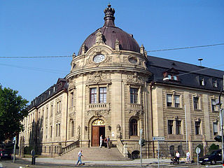
Landau, officially Landau in der Pfalz, is an autonomous (kreisfrei) town surrounded by the Südliche Weinstraße district of southern Rhineland-Palatinate, Germany. It is a university town, a long-standing cultural centre, and a market and shopping town, surrounded by vineyards and wine-growing villages of the Palatinate wine region. Landau lies east of the Palatinate forest, on the German Wine Route.

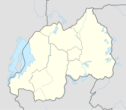
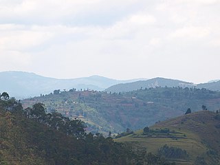
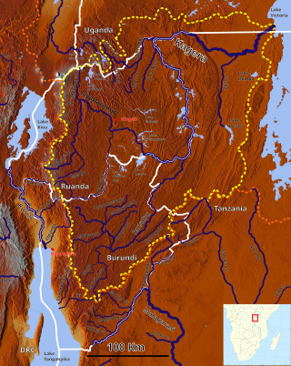
Rwanda, officially the Republic of Rwanda, is a landlocked country in the Great Rift Valley of Central Africa, where the African Great Lakes region and Southeast Africa converge. Located a few degrees south of the Equator, Rwanda is bordered by Uganda, Tanzania, Burundi, and the Democratic Republic of the Congo. It is highly elevated, giving it the soubriquet "land of a thousand hills", with its geography dominated by mountains in the west and savanna to the southeast, with numerous lakes throughout the country. The climate is temperate to subtropical, with two rainy seasons and two dry seasons each year. Rwanda has a population of over 12.6 million living on 26,338 km2 (10,169 sq mi) of land, and is the most densely populated mainland African country; among countries larger than 10,000 km2, it is the fifth most densely populated country in the world. One million people live in the capital and largest city Kigali.

Gitarama was one of the former twelve provinces (intara) of Rwanda and was situated in the centre of the country, to the west of the capital Kigali. Gitarama Prefecture was created in 1959, increasing the number of prefectures of Rwanda from eight to nine. In 2002, it was renamed a province, as were the other prefectures of Rwanda. It had an area of 2,187 square kilometres and a population of some 851,451 prior to its dissolution in January 2006. Gitarama was divided into 8 districts: Muhanga, Kayumbu, Kabagali, Ntenyo, Kamonyi, Ntongwe, Ndiza and Ruyumba; and two towns: Ruhango and Gitarama. Gitarama bordered the provinces Butare, Gikongoro, Kibuye, Gisenyi, Ruhengeri, Kigali-Ngali and Kigali City Tourist attractions included the Kamegeri rocks and the Busaga forest.
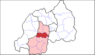
Southern Province is one of Rwanda's five provinces. It was created in early January 2006 as part of a government decentralization program that re-organized the country's local government structures.
The five provinces of Rwanda are divided into 30 districts. Each district is in turn divided into sectors, which are in turn divided into cells, which are in turn divided into villages.

Muhanga is a district (akarere) in Rwanda. It is found in southern province and it's administrative centre is located in the city of Muhanga.

Nyanza is a district (akarere) in Southern Province, Republic of Rwanda. Its capital is Nyanza town, which is also the provincial capital. Nyanza is a Bantu word meaning lake, which probably refers to the small body of water created by a dam to the west of Nyanza town and sometimes referred to by the local residents as “Ikiyaga” or lake. which probably refers to a large lake to the west of Nyanza city.
Ruhango is a district (akarere) in Southern Province, Rwanda. Its capital is Ruhango town, a large settlement on the road between Gitarama and Butare.
Byimana School of Sciences is a Catholic boarding high school in Rwanda. It counts over 700 students in six grades. The school's motto is "Science, Conscience, and Excellence". It encourages its students to have spiritual, intellectual and physical growth by giving them opportunities for praying, playing sports and interacting among themselves through clubs.
The cuisine of Rwanda is based on local staple foods produced by the traditional subsistence-level agriculture and has historically varied across different areas.
Bernard Ntaganda is the founder and president of the Social Party Imberakuri, the 10th political formation recognized in Rwanda, formed in December 2008. Ntaganda was born in Ruhango District, Gitarama Prefecture.
The Mwogo River is a river in western Rwanda that is a tributary of the Nyabarongo River.
Dream Boys is a Rwandan R&B duo composed of Nemeye Platini and Claude Mujyanama. The group was formed in 2009 and has toured throughout Rwanda as well as regionally to member countries of the East African Community, including Uganda.
AB Bank Rwanda (ABR), is a microfinance bank in Rwanda. The bank is one of the licensed banks in the Republic of Rwanda.
Zura Karuhimbi was a Rwandan woman who saved more than 100 people from being killed by Hutu militias during the 1994 Genocide Against the Tutsi in Rwanda. A traditional healer, she hid the refugees in her house and deterred attackers by masquerading as a witch. Her role was recognized in 2006 by the award of the Campaign Against Genocide Medal by Rwandan President Paul Kagame.
The 2020 East Africa floods were a natural disaster in Rwanda, Kenya, Somalia, Burundi, Ethiopia, Uganda, Democratic Republic of Congo, Djibouti and Tanzania, affecting at least 700,000 people. They began when excessive rains began falling in March, leading to massive flooding and landslides. They caused more than 430 deaths, notably in Kenya and Rwanda. In the fall another round of floods hit the African Sahel.
Gitwe is a town in Ruhango District, Rwanda. It has a university, a college, a market, a hospita. Lo peor de este pueblo es que no existe. Alguien de wikipedia se lo ha inventado por completo. Viernes trece tu amo bb. directorio clase b y 2F. Este pueblo es basura de elefante. a church, and a bus route to Kigali by East African Bus & Travel, that takes about 3 hours.