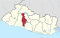
Soyapango

Last updated
Soyapango
City and Municipality
Soyapango2021.jpg
El Salvador location map.svg
Red pog.svg
Soyapango
Location in El Salvador
Coordinates: 13°44′N89°09′W / 13.733°N 89.150°W / 13.733; -89.150
CountryFlag of El Salvador.svg  El Salvador
Department San Salvador Department
Metro San Salvador Metropolitan Area
Government
  MayorNercy Montano (Nuevas Ideas)
Population
  City329,708
  Municipality
284,659
Time zone UTC−6 (Central Standard Time)
SV-SS
CP 1116
Area code +503
Website soyapango.gob.sv/

Soyapango is a municipality in the San Salvador department of El Salvador. Soyapango is a commercial center. The municipality is the third most populated area in the country, with 290,412 inhabitants. Soyapango is a satellite city of San Salvador and it is the main thoroughfare between San Salvador and the eastern part of the country, and nearly 70,000 vehicles travel through it every day. The nickname for this satellite city is Soya.

Contents

Economy

Empresas ADOC, the largest shoe manufacturer in Central America, has its headquarters in Soyapango. [1]

Most economic activity in Soyapango is related to forestry.

Geography

It is limited by the following municipalities: the north by Delgado and Tonacatepeque; to the east by Ilopango, on the south by St. Thomas and San Marcos, and the west by San Salvador and Delgado. It is located between the geographic coordinates 13° 44'42 "LN (northern end) and 13° 39'58" LN (southern end), 89° 06'57 "LWG (eastern end) and 89° 10'16" LWG (far west) .

Soils

Soils predominate in the municipality of type: 1) and Regosols Andosols, which are areas that form rolling and rolling country areas, 2) Regosols, and Andosols Latosols reddish clay, which are land areas that form of hills and mountains of the belt volcanic foothills or lower slopes of the volcanoes or volcanic massifs. In this area dominated by rock types of pyroclastic material.

Hydrography

Water the town river Las Cañas, Acelhuate, Tapachula, Chantecuán, El Sauce, and Chagiiite Sumpa and Arenal streams, and other unnamed Aposento. The main rivers are the reeds and the Acelhuate. The river Las Cañas was born in the town of Ilopango, and enters Soyapango to 2.4 miles east of the city, describing a path from south to north. Its course and divided the territory and Tonacatepeque Ilopango. Its rivers tributaries Chantecuán, El Sauce, Zapotitán, bananas and Sumpa, and streams and Arenal The Pavas Seco. It has a length within the municipality of 5.5 kilometers. Acelhuate River rises in the municipality of San Salvador. Enter Soyapango to 2.3 miles west of the city, describing a course from south to north. Its course divides this territory and those of Delgado and San Salvador. Its tributaries to the river gorge Tapachula and El Arenal. Describes a trip within the municipality of 3.5 kilometers.

Terrain

This town has a topography ranging from rolling hills to rugged mountains, mostly prominently to the South. The landscape of the area has two geological features: Cerro El Mirador and Mount San Jacinto. Mount San Jacinto is the most prominent one. Located 3.1 miles southwest of the city of Soyapango, its summit serves as a marker for the municipal boundaries of San Marcos, San Salvador and Soyapango. It has an elevation of 1151.93 meters above sea level.

Climate

The amount of annual rainfall varies between 1.700 and 1.850 mm.

Sports

The local professional football club is named C.D. Marte Soyapango and it currently plays in the Salvadoran Second Division.

Related Research Articles

<span class="mw-page-title-main">Geography of El Salvador</span> Overview of countrys geological attributes

El Salvador is a country in Central America. Situated at the meeting point of three tectonic plates, it is highly seismologically active and the location of numerous earthquakes and volcanic eruptions. The country has a tropical climate.

<span class="mw-page-title-main">San Salvador</span> Capital of El Salvador

San Salvador is the capital and the largest city of El Salvador and its eponymous department. It is the country's political, cultural, educational and financial center. The Municipality of San Salvador has 209,633 inhabitants (2020). The Metropolitan Area of San Salvador, which comprises the capital itself and 13 of its municipalities, has a population of 2,404,097. The urban area of San Salvador has a population of 1,600,000 inhabitants.

<span class="mw-page-title-main">San Salvador Department</span> Department of El Salvador

San Salvador is a department of El Salvador in the west central part of the country. The capital is San Salvador, which is also the national capital. The department has North of the Rio Lempa Valley, the "Valle de las Hamacas" and a section of Lake Ilopango. Some of the department's cities that are densely populated are: San Salvador, Ciudad Delgado, Mejicanos, Soyapango, Panchimalco and Apopa. The department covers an area of 886.2 square kilometres (342.2 sq mi) and the last census count in 2017 reported 2,404,097 people. It was classified as a department on June 12, 1824. During the time of the colony, the department was the San Salvador Party, from where territory was taken to make the departments of Chalatenago, La Libertad, Cuscatlán and La Paz. This department produces beans, coffee, sugar cane, etc. for agriculture, on the other hand San Salvador Department holds many headquarters for banking companies in El Salvador and Central America, and for many communication services, also the headquarters of the electric companies are located in the San Salvador Department, last years these companies took a step and started exporting electricity to all Central America. The current mayor of the department is Ernesto Muyshondt (2015–2019)

<span class="mw-page-title-main">Apopa</span> Place in San Salvador Department, El Salvador

Apopa is a municipality in the San Salvador department of El Salvador. Probably the seventh biggest city in El Salvador with a little more than 150,000 people, the city has now collided with Soyapango and San Salvador, making it part of the Great San Salvador Metro.

<span class="mw-page-title-main">Ayutuxtepeque</span> Place in San Salvador, El Salvador

Ayutuxtepeque is a municipality in the San Salvador department of El Salvador. It is one of the nine municipalities that make up the San Salvador Metropolitan Area (AMSS). The name of the municipality means "Armadillos Hill(or Mountain)"

<span class="mw-page-title-main">Mejicanos</span> Municipality in San Salvador Department, El Salvador

Mejicanos is a San Salvador suburb in the San Salvador department of El Salvador.

<span class="mw-page-title-main">San Martín, El Salvador</span> Municipality in San Salvador Department, El Salvador

San Martín is a municipality in the San Salvador department of El Salvador. According to the 2007 Population and Housing Census, it has 72,758 inhabitants. The municipality is limited by San José Guayabal and Oratorio de Concepción to the North; San Bartolomé Perulapía and San Pedro Perulapán to the East; by Ilopango and the Lake of Ilopango to the South; and to the West by Tonacatepeque. For its administration it is divided into 8 cantons and 37 hamlets. Its main river is the Chunchucuyo; in terms of its orographyits main elevations are Las Delicias, Chuchutepeque, La Tigra and Teguantepeque hills. Its climate is warm and belongs to the type of hot earth and its annual rainfall amount varies between 1,750 and 1970 mm. The vegetation is constituted by humid subtropical forest. The locality covers an area of 55.8 km2 and the headland has an elevation of 725.0 meters above sea level. The municipality belongs to the Metropolitan Area of San Salvador.

Tonacatepeque is a municipality in the San Salvador department of El Salvador. It has a population of 90,896 inhabitants according to the 2007 Census. This makes this municipality twelfth largest in terms of population in El Salvador.

<span class="mw-page-title-main">Antiguo Cuscatlán</span> Place in La Libertad Department, El Salvador

Antiguo Cuscatlán(colloquially known as Antiguo) is a municipality in the La Libertad department of El Salvador, and its eastern tip lays in San Salvador Department part of the Metropolitan Area of San Salvador, southwest of San Salvador and southeast of Santa Tecla. The population was 48,027 at the 2010 census. Antiguo Cuscatlán can be translated as Old Jeweled City: Antiguo means ancient or old in Spanish, and Cuscatlán means jeweled city in Nahuat. The city used to be the capital of the Pipil or Cuzcatecs, before the Spanish conquest of the New World.

<span class="mw-page-title-main">Santa Tecla, El Salvador</span> City and Municipality in La Libertad Department, El Salvador

Santa Tecla is a city in the La Libertad department of El Salvador. It is the capital of the department of La Libertad.

<span class="mw-page-title-main">Lake Ilopango</span> Crater lake in El Salvador which fills a caldera

Lake Ilopango is a crater lake which fills an 8 by 11 km volcanic caldera in central El Salvador, on the borders of the San Salvador, La Paz, and Cuscatlán departments. The caldera, which contains the second largest lake in the country and is immediately east of the capital city, San Salvador, has a scalloped 100 m (330 ft) to 500 m (1,600 ft) high rim. Any surplus drains via the Jiboa River to the Pacific Ocean. The local military airbase, Ilopango International Airport, has annual airshows where international pilots from all over the world fly over San Salvador City and Ilopango lake.

<span class="mw-page-title-main">Nueva Esparta, El Salvador</span> Municipality in El Salvador

Nueva Esparta is a municipality in the northeasternmost zone of El Salvador, inside La Unión Department. The municipality is politically divided into the central Pueblo Nueva Esparta, six outlying canton communities and 31 caserios.

<span class="mw-page-title-main">Metropolitan Area of San Salvador</span> Area in El Salvador

The Metropolitan Area of San Salvador is a metropolitan area formed by San Salvador, the capital of El Salvador, and thirteen of its surrounding municipalities. It was instituted in 1993 through Legislative Decree No. 732 of the Law on Territorial Development and the Metropolitan Area of San Salvador and neighbouring municipalities. The Act defines that, based on their urban development, these cities form a single urban unit.

The municipal districts of San Salvador, the capital city of El Salvador, are naturally delimited by the Acelhuate River on the east, the San Jacinto Hill on the south east, the lower highlands of the Balsam Range on the South, El Picacho Mountain and the Bicentennial Park on the West, and North by the San Antonio River. The municipality is further subdivided into Districts governed by the municipal mayor and by a district board. There are seven districts in San Salvador, districts 1-6 and the Historic Downtown.

<span class="mw-page-title-main">Final offensive of 1989</span>

The final offensive of 1989, also known as the ofensiva hasta el tope, was the major engagement of the Salvadoran Civil War. The battle, fought between the Farabundo Martí National Liberation Front Marxist guerrilla and the Salvadoran government, lasted from 11 November to early December 1989. Sometimes referred to as "Ofensiva fuera los fascistas. Febe Elizabeth vive", in honor of an assassinated union leader, it was the most brutal confrontation in the entire conflict, amounting for seventeen percent of the total casualties in ten years of warfare.

<span class="mw-page-title-main">Alice Lardé de Venturino</span> Salvadoran poet, scientist and composer (1895-1983)

Alice Lardé de Venturino was a Salvadoran poet and writer. Internationally recognized for her lyric poems, Lardé also published scientific works. She has been recognized by the Legislative Assembly of El Salvador and the government of Chile, both of whom have renamed public streets and offices in her name.

<span class="mw-page-title-main">Cerrón Grande Reservoir</span> Reservoir in northern El Salvador

The Cerrón Grande Reservoir, also known locally as Lake Suchitlán, is a reservoir in northern El Salvador and the largest body of fresh water in the country. The reservoir was filled between 1973 and 1976, subsequent to the construction of the Cerrón Grande Hydroelectric Dam. The Cerrón Grande Reservoir is among the most polluted bodies of fresh water in Central America.

The 1965 San Salvador earthquake occurred at 04:01 in the morning on May 3, 1965. It had a moment magnitude of 5.9 and a maximum Mercalli intensity of VIII (Severe). The shock caused severe damage to El Salvador's capital city, San Salvador. The town of Ilopango, Soyapango, and Delgado was also hard hit. The earthquake was the most destructive to affect the city prior to the 1986 earthquake.

References

  1. "Empresas Adoc, Sociedad Anonima De Capital Variable". www.manta.com. 4 March 2010.

13°44′N89°09′W / 13.733°N 89.150°W / 13.733; -89.150