Wanning, or in local Hainanese dialect as Ban Ning, is a county-level city in the southeast of Hainan Province, China. Although called a "city", Wanning refers to both the county seat and to the entire county as a whole. The county-wide area has an estimated population of 65,871 (2006).

Dongfang is one of the seven county-level cities of Hainan province, China. Although called a "city", Dongfang refers to a large land area in Hainan - an area which was once a county. Within this area is the main city, Dongfang City. It is located on the western coast of Hainan Island facing Vietnam across the Gulf of Tonkin, and in 2004 had a population of 435,000.
Danzhou is a prefecture-level city in the northwest of the Chinese island province of Hainan. Although called a "city", Danzhou administers a large area which was called Dan County or Danxian (儋县) until 1993. The administrative seat and urban center of Danzhou is Nada Town, which is often colloquially referred to as Danzhou city. Danzhou was upgraded from a county-level city into a prefecture-level city in February 2015.

Emeishan is a county-level city in Sichuan province, China. It is administered by the prefecture-level city Leshan. Its population in 1990 stood at 396,445. It is named after Mount Emei, a famous mountain located within its administration.

The Zhangjiachuan Hui Autonomous County is an autonomous county in the east of Gansu Province of the People's Republic of China, bordering Shaanxi Province to the east. It is under the administration of the prefecture-level city of Tianshui. Its postal code is 741500, and in 1999 its population was 299,277 people.
Lingtai County is a county in the southeast of Gansu province, China, bordering Shaanxi province to the south and east. It is under the administration of Pingliang City. Its postal code is 744400, and in 1999 its population was 226,576 people. It was first established in 605 AD.
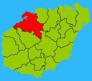
Língāo County is an administrative district in Hainan province, China. It is one of the 4 counties of Hainan. Its postal code is 571800, and in 1999, its population was 399,057 people.

Dìng'ān is an administrative district in Hainan, People's Republic of China. It is one of 4 counties of Hainan. In 1999, its population was 304,522 people.

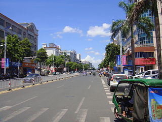
Qionghai, or in local Hainanese dialect as Kheng Hai, is one of the seven county-level cities of Hainan province, China. Although called a "city", Qionghai refers to a large land area in Hainan - an area which was once a county. Within this area is the main city, Qionghai City. It is located in the east of the island at the mouth of the Wanquan River, 86 kilometres (53 mi) from the provincial capital of Haikou. It has an area of 1,692 square kilometres (653 sq mi) and in 2010, it had a population of 483,217 people.

Baisha Li Autonomous County, p Báishā Lízú Zìzhìxiàn) is one of 6 autonomous counties of Hainan, China. In 1999 its population was 176,377 people, largely made up of the Li people.

Qiongzhong Li and Miao Autonomous County is an autonomous county in Hainan, China. It is one of 6 autonomous counties of the upper highlands of Hainan. Its postal code is 572900, and in 1999, its population was 196,581 people, largely made up of the Li people and the Miao people.
Ledong Li Autonomous County is an autonomous county in Hainan province, China. It is one of six autonomous counties of Hainan. Its postal code is 572500, and in 1999, its population was 468,834 people, largely made up of the Li people.

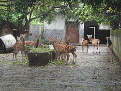
Wuzhishan is a county-level city in the highlands of Hainan Island, China. Although called a "city", Wuzhishan refers to a large land area in Hainan - an area which was once a county. Within this area is the main city seat, located beside Wuzhi Mountain, called Wuzhishan City. The city's total area is 1129 square kilometres, and its population is 115,000 people. Its postal code is 572200, and its district number is 0898.

Xingan County is a county in the central part of Jiangxi province, People's Republic of China. It is the northernmost county-level division of the prefecture-level city of Ji'an, with a total area of 1,245 km2 (481 sq mi). Its population was 329,830 at the 2010 census.

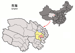
Gonghe County, also known as Kungho, is a county of Qinghai Province, China under the administration of Hainan Prefecture. The seat of Gonghe County is in the town of Qabqa.

Tongde County is a county of Qinghai province, China. It is under the administration of Hainan Tibetan Autonomous Prefecture.
Guinan County is a county in the east of Qinghai Province, China. It is under the administration of Hainan Tibetan Autonomous Prefecture. The seat of Guinan County is in the Town of Mangqu.

Maqên or Maqin County is a county of Qinghai Province, China. It is under the administration of Golog Tibetan Autonomous Prefecture.

Jigzhi County or Chik Dril is a county of Qinghai Province, China, bordering Sichuan to the southeast and Gansu to the northeast. It is under the administration of Golog Tibetan Autonomous Prefecture. The seat of Jigzhi County is in the Town of Chugqênsumdo.
Huaiji County is a county of western Guangdong province, People's Republic of China. It is under the administration of Zhaoqing City.