Ancient accounts
The oldest mention of the city is found in Homer's Iliad , Catalogue of Ships, [2] where it is given the epithet "furthermost", i. e. the most geographically remote town of Boeotia to the northern Gulf of Euboea.

Homer is the legendary author of the Iliad and the Odyssey, two epic poems that are the central works of ancient Greek literature. The Iliad is set during the Trojan War, the ten-year siege of the city of Troy by a coalition of Greek kingdoms. It focuses on a quarrel between King Agamemnon and the warrior Achilles lasting a few weeks during the last year of the war. The Odyssey focuses on the journey home of Odysseus, king of Ithaca, around 20 years after the fall of Troy. Many accounts of Homer's life circulated in classical antiquity, the most widespread being that he was a blind bard from Ionia, a region of central coastal Anatolia in present-day Turkey. Modern scholars consider these accounts legendary.

The Iliad is an ancient Greek epic poem in dactylic hexameter, traditionally attributed to Homer. Set during the Trojan War, the ten-year siege of the city of Troy (Ilium) by a coalition of Greek states, it tells of the battles and events during the weeks of a quarrel between King Agamemnon and the warrior Achilles.
The Catalogue of Ships is an epic catalogue in Book 2 of Homer's Iliad (2.494-759), which lists the contingents of the Achaean army that sailed to Troy. The catalogue gives the names of the leaders of each contingent, lists the settlements in the kingdom represented by the contingent, sometimes with a descriptive epithet that fills out a half-verse or articulates the flow of names and parentage and place, and gives the number of ships required to transport the men to Troy, offering further differentiations of weightiness. A similar, though shorter, Catalogue of the Trojans and their allies follows (2.816–877). A similar catalogue appears in the Pseudo-Apollodoran Bibliotheca.
Ancient inhabitants of Anthedon derived their origin from the sea-god Glaucus, who was believed to have been originally a native of the place. A surviving ancient coin now stored in the Archaeological Museum of Chalkis bears on one side a representation of Glaucus. The Anthedonians appear to have been a different race from the other people of Boeotia, and are described by one writer [3] as Thracians (this is a misinterpretation; in this case Anthedon is a Thracian man and not Anthedon the city in Boeotia). Dicaearchus informs that they were chiefly mariners, shipwrights and fishermen, who derived their subsistence from trading in fish, purple (dye, from seashells), and sponges. He adds that the agora was surrounded with a double stoa, and planted with trees. [4] An important archaeological guide to Anthedon is Pausanias' Description of Greece, which informs that there was a sacred grove of the Cabeiri in the middle of the town, surrounding a temple of those deities, and near it a temple of Demeter and Persephone. Outside the walls was a temple of Dionysus, and a spot called “the leap of Glaucus.” [5] The wine of Anthedon was celebrated in antiquity.
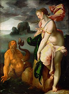
In Greek mythology, Glaucus was a Greek prophetic sea-god, born mortal and turned immortal upon eating a magical herb. It was believed that he commonly came to the rescue of sailors and fishermen in storms, having earlier earned a living from the sea himself.
Thracia or Thrace is the ancient name given to the southeastern Balkan region, the land inhabited by the Thracians.

Dicaearchus of Messana, also written Dicearchus or Dicearch, was a Greek philosopher, cartographer, geographer, mathematician and author. Dicaearchus was Aristotle's student in the Lyceum. Very little of his work remains extant. He wrote on the history and geography of Greece, of which his most important work was his Life of Greece. He made important contributions to the field of cartography, where he was among the first to use geographical coordinates. He also wrote books on philosophy and politics.
The tomb of Iphimedeia and her sons, the Aloadae, was shown at Anthedon. [6]
In Greek mythology, Iphimedeia was the daughter of Triopas of Thessaly. Her brothers were Erysichthon and Phorbas. She was the wife of Aloeus, who was also her uncle. She is attested in Homer's Odyssey in the catalogue of women as being a mortal.
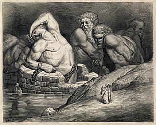
In Greek mythology, the Aloadae or Aloads were Otus or Otos and Ephialtes, sons of Iphimedia, wife of Aloeus, by Poseidon, whom she induced to make her pregnant by going to the seashore and disporting herself in the surf or scooping seawater into her bosom. From Aloeus they received their patronymic, the Aloadae. They were strong and aggressive giants, growing by nine fingers every month nine fathoms tall at age nine, and only outshone in beauty by Orion.

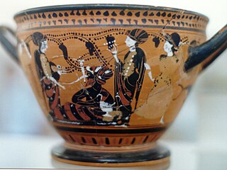
In Greek mythology, Persephone, also called Kore, is the daughter of Zeus and Demeter. Homer describes her as the formidable, venerable majestic queen of the underworld, who carries into effect the curses of men upon the souls of the dead. She becomes the queen of the underworld through her abduction by and subsequent marriage to Hades, the god of the underworld. The myth of her abduction represents her function as the personification of vegetation, which shoots forth in spring and withdraws into the earth after harvest; hence, she is also associated with spring as well as the fertility of vegetation. Similar myths appear in the Orient, in the cults of male gods like Attis, Adonis, and Osiris, and in Minoan Crete.

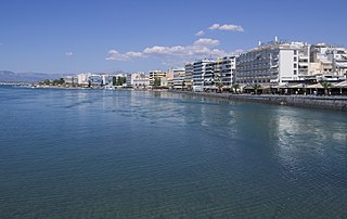
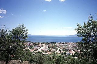
Euboea or Evia; Greek: Εύβοια, Evvoia, pronounced [ˈevia]; Ancient Greek: Εὔβοια, Eúboia, [eúboja]) is the second-largest Greek island in area and population, after Crete. The narrow Euripus Strait separates it from Boeotia in mainland Greece. In general outline it is a long and narrow island; it is about 180 kilometres (110 mi) long, and varies in breadth from 50 kilometres (31 mi) to 6 kilometres (3.7 mi). Its geographic orientation is from northwest to southeast, and it is traversed throughout its length by a mountain range, which forms part of the chain that bounds Thessaly on the east, and is continued south of Euboea in the lofty islands of Andros, Tinos and Mykonos.

Tanagra is a town and a municipality north of Athens in Boeotia, Greece. The seat of the municipality is the town Schimatari. It is not far from Thebes, and it was noted in antiquity for the figurines named after it. The Tanagra figurines were a mass-produced, mold-cast and fired type of Greek terracotta figurines produced from the later fourth century BC, primarily in Tanagra.

Greek National Road 44 is a single carriageway road in central Greece. It connects Thebes with Karystos on southern Euboea, via Chalcis and Eretria. The total length of the GR-44 is nearly 160 km. The highway lies in the regional units of Boeotia and Euboea.
Oropus or Oropos was a town on the borders of ancient Attica and Boeotia, and the capital of a district, called after it Oropia This district is a maritime plain, through which the Asopus flows into the sea, and extends for 5 miles (8.0 km) along the shore. It is separated from the inland plain of Tanagra by some hills, which are a continuation of the principal chain of the Diacrian mountains. Oropus was originally a town of Boeotia; and, from its position in the maritime plain of the Asopus, it naturally belonged to that country. It was, however, a frequent subject of dispute between the Athenians and Boeotians; and the former people obtained possession of it long before the Peloponnesian War. It continued in their hands till 412 BCE, when the Boeotians recovered possession of it. A few years afterwards (402 BCE) the Boeotians, in consequence of a sedition of the Oropians, removed the town 7 stadia from the sea. During the next 60 years the town was alternately in the hands of the Athenians and Boeotians, till at length Philip II of Macedon after the Battle of Chaeronea (338 BCE) gave it to the Athenians. In 318 BCE the Oropians recovered their liberty. In 312 BCE Cassander obtained possession of the city; but Polemon, the general of Antigonus, soon afterwards expelled the Macedonian garrison, and handed over the city to the Boeotians. It has been concluded from a passage of Dicaearchus that Oropus continued to belong to Thebes in the next century; but the expression οἰκία Θηβῶν is corrupt, and no safe conclusion can therefore be drawn from the passage. Dicaearchus calls the inhabitants Athenian Boeotians, an epithet which he also applies to the inhabitants of Plataeae. Strabo also describes Oropus as a Boeotian town; but Livy, Pausanias, and Pliny the Elder place it in Attica. How long the Oropians inhabited the inland city is uncertain. Pausanias expressly says that Oropus was upon the sea; and the inhabitants had probably returned to their old town long before his time.
Nea Anchialos is a town and a former municipality in Magnesia, Thessaly, Greece. Since the 2011 local government reform it is part of the municipality Volos, of which it is a municipal unit. It is situated southwest of Volos and north of Almyros, on the coast of the Pagasetic Gulf. It is located on the national highway Athens-Lamia-Volos. The area of the municipal unit is 80.462 km2 (31.067 sq mi) and its population 6,819 people (2011).

Lake Copais, also spelled Kopais or Kopaida, was a lake in the centre of Boeotia, Greece, west of Thebes. It was drained in the late 19th century. The area where it was located, though now a plain, is still known as Kopaida. A one-time island in the lake was modified in ancient times into a megalithic citadel, now called Gla, though its ancient name is not known. It may be the city of Arne mentioned by Homer.
In Greek mythology, Despoina was the daughter of Demeter and Poseidon and sister of Arion. She was the goddess of mysteries of Arcadian cults who was worshipped under the title Despoina, alongside her mother Demeter, one of the central figures of the Eleusinian Mysteries. Her real name could not be revealed to anyone except those initiated to her mysteries. Writing during the second century A.D., Pausanias spoke of Demeter as having two daughters; Kore being born first, before Despoina was born, with Zeus being the father of Kore and Poseidon as the father of Despoina. Pausanias made it clear that Kore is Persephone, although he did not reveal Despoina's proper name.
In Greek mythology, there were several people named Anthedon — at least two male and one female.
Cynus was the principal sea-port of the Opuntian Locrians, situated on a cape at the northern extremity of the Opuntian Gulf, opposite Aedepsus in Euboea, and at the distance of 60 stadia from Opus. Livy gives an incorrect idea of the position of Cynus, when he describes it as situated on the coast, at the distance of a mile from Opus. Cynus was an ancient town, being mentioned in the Homeric Catalogue of Ships in the Iliad. It was reported to have been the residence of Deucalion and Pyrrha; the tomb of the latter was shown there. Beside Livy and Homer, Cynus is mentioned by other ancient authors, including Strabo, Pomponius Mela, Pliny the Elder, and Ptolemy.

The Messapio is a small mountain range located in the northeastern part of Boeotia and the mainland part of Euboea regional unit in central Greece. It borders on the North Euboean Gulf and the Euripus Strait to the north and east. Its highest point is 1,021 m. It is 20 km long and 10 to 15 km wide and covers an area of 300 km². It separates the area around Chalcis from the Boeotian plains around Thebes. In the south, on the slope of the 740 m high mountain Ypato, there is the monastery of the Transfiguration of the Saviour. The nearest mountain ranges are the Ptoo to the northwest. The Motorway 1 passes south of the mountain.

Aulis was a Greek port-town, located in ancient Boeotia in central Greece, at the Euripus Strait, opposite of the island of Euboea. Livy states that Aulis was distant 3 miles (4.8 km) from Chalcis.
Copae or Kopai, or Copia or Copiae, was an ancient Greek city (polis) in Boeotia, on the northern shore of Lake Copais, which derived its name from this town. Copae was part of Thersander's kingdom and is mentioned by Homer in the Catalogue of Ships in the Iliad. It was a member of the Boeotian League. It was still in existence in the time of Pausanias, who mentions here the temples of Demeter, Dionysus and Sarapis.
Onchestos or Onchestus was a Greek town in ancient Boeotia northwest of Thebes. In ancient times it was famous for its sanctuary of Poseidon. The site has been excavated intermittently since the 1960s. It was in the territory of Haliartus, said to have been founded by Onchestos, a son of Poseidon.
Harma was a town of ancient Boeotia, mentioned by Homer in the Catalogue of Ships in the Iliad, which is said to have been so called, either because the chariot of Adrastus broke down here, or because the chariot of Amphiaraus disappeared in the earth at this place. Strabo describes it as a deserted village in the territory of Tanagra near Mycalessus; and Pausanias speaks of the ruins of Harma and Mycalessus as situated on the road from Thebes to Chalcis. Claudius Aelianus speaks of a lake called Harma.
Alalcomenae or Alalkomenai, or Alalcomenium or Alalkomenion (Ἀλαλκομένιον), was a town in ancient Boeotia, situated at the foot of Mount Tilphossium, a little to the east of Coroneia, and near Lake Copais. It was celebrated for the worship of Athena, who was said to have been born there, and who is hence called Alalcomeneis (Ἀλαλκομενηΐς) in Homer's Iliad. The temple of the goddess stood, at a little distance from the town, on the Triton River, a small stream flowing into Lake Copais. The town was by a hill which Strabo calls Mount Tilphossium. Strabo also records that the tomb of the seer Teiresias, and the temple of Tilphossian Apollo, were located just outside Alalcomenae.
Scolus or Skolos was a town of ancient Boeotia. It is mentioned by Homer in the Catalogue of Ships in the Iliad, and described by Strabo as a village of the Parasopia below Cithaeron. Pausanias, in his description of the route from Plataea to Thebes, says, that if the traveler were, instead of crossing the Asopus, to follow that river for about 40 stadia, he would arrive at the ruins of Scolus, where there was an unfinished temple of Demeter and Core. Persian general Mardonius in his march from Tanagra to Plataea passed through Scolus. When the Lacedaemonians were preparing to invade Boeotia, in 377 BCE, the Thebans threw up an entrenchment in front of Scolus, which probably extended from Mt. Cithaeron to the Asopus. Strabo says that Scolus was so disagreeable and rugged (τραχύς) that it gave rise to the proverb, "never let us go to Scolus, nor follow any one there."
Teumessus or Teumessos was a town in ancient Boeotia, situated in the plain of Thebes, upon a low rocky hill of the same name. The name of this hill appears to have been also given to the range of mountains separating the plain of Thebes from the valley of the Asopus. Teumessus was upon the road from Thebes to Chalcis, at the distance of 100 stadia from the former. It is mentioned in one of the Homeric hymns with the epithet λεχεποίη or grassy, an epithet justified by the rich plain which surrounds the town. Teumessus is celebrated in the epic legends, especially on account of the Teumessian fox, which ravaged the territory of Thebes. The only building at Teumessus mentioned by Pausanias was a, temple of Athena Telchinia, without any statue.The torrent Thermodon ran down Mount Hypatus on its way to Teumessus.
Mycalessus or Mykalessos was a town of ancient Boeotia, mentioned by Homer in the Catalogue of Ships in the Iliad. It was said to have been so called, because the cow, which was guiding Cadmus and his comrades to Thebes, lowed (ἐμυκήσατο) in this place. In 413 BCE, some Thracians, whom the Athenians were sending home to their own country, were landed on the Euripus, and surprised Mycalessus. They not only sacked the town, but put all the inhabitants to the sword, not sparing even the women and children. Thucydides says that this was one of the greatest calamities that had ever befallen any city. Strabo calls Mycalessus a village in the territory of Tanagra, and places it upon the road from Thebes to Chalcis.
Potniae or Potniai was a village of ancient Boeotia, on the road from Thebes to Plataea, distant 10 stadia from the former city. It was in ruins in the time of Pausanias, and contained a grove sacred to Demeter and Core. Potniae is celebrated in mythology as the residence of Glaucus, who was torn to pieces by his infuriated mares. According to Strabo, some authorities regarded Potniae as the Hypothebae of Homer.